
Steel home · OK
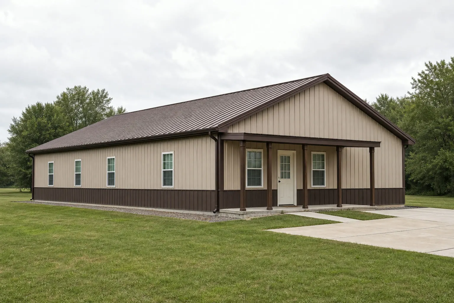
Steel Homes in Oklahoma
A steel home foundation plan drawn for a flat parcel on Oklahoma's western plains does not transfer to a lot in the Ozark Plateau or the Ouachita Mountains, and Oklahoma happens to contain both. The Oklahoma Climatological Survey describes the Ouachita Mountains dominating the southeast with peaks rising up to 2,000 feet above their base, while USGS physiographic work places western Oklahoma within the Great Plains province — a flatter interior-plains landscape distinguished from the Central Lowland to the east. That split, not a single statewide answer, is where an Oklahoma steel home project actually begins, and it is layered with a state-level code adoption body whose scope buyers frequently misread as a design authority rather than an adoption framework.
Site conditions
Two Oklahomas, one steel frame
The frame of a steel home does not change much from west to east. What sits underneath it does.
West of roughly the state's center, USGS physiographic mapping (Fenneman, Bulletin 730-D) places Oklahoma within the Great Plains province — flatter interior terrain that generally simplifies grading and gives a builder a predictable pad to work from. That is not the whole state, though. The Oklahoma Climatological Survey describes the Ouachita Mountains dominating the southeast with peaks up to 2,000 feet above their base, and the Ozark Plateau marking the extreme northeast corner. A steel home sited in either of those areas is a hillside or bench-cut project, not a flat-pad project, and the two should never be quoted the same way.
The Arkansas River Valley running through the middle of the state adds a third condition again: bottomland proximity to a major waterway, where drainage around the slab and flood elevation are the practical questions rather than slope. None of this is a structural rule this page can state — soil bearing, cut depth and drainage design are engineer-and-site questions — but knowing which of the three conditions your parcel sits in is the fact that should shape the first conversation with a builder.
Permitting runs on its own separate track. The Oklahoma Uniform Building Code Commission, created under 59 O.S. §§1000.20-1000.30, issues rules addressing how local jurisdictions and other political subdivisions adopt codes. That is an adoption framework, not a design authority: the Commission sets how adoption works, while which edition is actually enforced on your project, and what a permit review will ask for, remains a question for your specific city or county building department.
Site planning
What changes by Oklahoma region
The same steel-home shell resolves into a different site plan depending on which of these three conditions the parcel matches.
| Region | Ground condition | First site question |
|---|---|---|
| Western/central plains (Great Plains province) | Flatter interior terrain | Confirm soil bearing and drainage slope away from the pad |
| Arkansas River Valley (central belt) | Bottomland near a major waterway | Check flood elevation and drainage before finalizing pad height |
| Ouachita Mountains / Ozark Plateau (southeast/northeast) | Elevated, sloped terrain with peaks up to roughly 2,000 feet above their base | Budget for cut-and-fill grading and confirm access grade for delivery |
Western/central plains (Great Plains province)
- Ground condition
- Flatter interior terrain
- First site question
- Confirm soil bearing and drainage slope away from the pad
Arkansas River Valley (central belt)
- Ground condition
- Bottomland near a major waterway
- First site question
- Check flood elevation and drainage before finalizing pad height
Ouachita Mountains / Ozark Plateau (southeast/northeast)
- Ground condition
- Elevated, sloped terrain with peaks up to roughly 2,000 feet above their base
- First site question
- Budget for cut-and-fill grading and confirm access grade for delivery
Terrain
Oklahoma's landscape in four working pieces
Buyers rarely need a full physiographic map, but knowing which of these four pieces your site sits in changes the site-prep conversation.
Great Plains province (west)
Flatter ground; site prep tends to center on drainage and soil bearing rather than grading.
Central Lowland transition (central)
The eastward edge of the plains, where terrain begins to roll before the highland regions begin.
Arkansas River Valley
Waterway-adjacent bottomland running through the middle of the state, where flood elevation is worth checking early.
Ouachita Mountains and Ozark Plateau (southeast/northeast)
Elevated, folded terrain with named peaks and ridges, where grading and access grade dominate the site budget.
Get Oklahoma steel home quotes
Tell us which part of the state your site is in — plains, river valley, or highland — and we pass that context through with the enquiry.
Sequence
Order of decisions for an Oklahoma steel home
Sequencing these correctly avoids paying twice for site work.
Step 1
Identify which of the three terrain conditions your parcel matches
Plains, river valley, or highland — each points to a different foundation and drainage conversation.
Step 2
Get a local soil and grading assessment before finalizing the pad
A statewide assumption about soil behavior is not reliable given the terrain range described above.
Step 3
Confirm your enforced code edition with the local jurisdiction
The state commission governs how codes are adopted, not which edition your specific city or county enforces.
Step 4
Check moisture detailing against your nearest station record
NWS Tulsa's published climatology is a useful northeastern reference, not a statewide rainfall or snowfall figure.
Step 5
Plan access grade for delivery on hillside sites
A steep approach road changes what a delivery crew can bring in and how the schedule is sequenced.
Footprint
Footprints suited to Oklahoma's site range
Single-level plans dominate requests from both flat-plains and highland sites, for different reasons: ease of grading on the plains, and minimizing cut-and-fill on slopes.
30′ × 40′
1,200 sq ft
A compact single-level plan that keeps grading modest on a sloped highland lot.
30′ × 50′
1,500 sq ft
Added length while keeping the footprint narrow enough for a constrained hillside pad.
40′ × 60′
2,400 sq ft
A wider open-plan layout that suits a flatter western or river-valley site.
30′ × 60′
1,800 sq ft
A long, narrow plan that works well when access is limited to one side of the lot.
Example Configuration — for planning purposes only.
Each footprint page carries layout detail; this page explains only why Oklahoma sites tend toward this range.
Questions
Oklahoma steel home questions
State-level answers, with site-specific and local-authority questions routed to where they belong.
Oklahoma has a state body, the Oklahoma Uniform Building Code Commission, that issues rules governing how local jurisdictions adopt codes. That is an adoption framework rather than a single enforced design standard, so the edition and requirements applied to your project are set by your local building department.
The ground itself changes enough that it should. Western and central Oklahoma sit largely within the flatter Great Plains province, while the Ouachita Mountains and Ozark Plateau in the southeast and northeast are elevated, sloped terrain. A local geotechnical assessment, not a statewide assumption, is the right basis for a foundation plan.
NWS Tulsa keeps published rainfall and snowfall climatology for its own station, which is a genuine reference point for the northeast but not a substitute for checking conditions near your specific site. Wall and roof moisture detailing are specification questions for your builder.
That depends on your plan and local lot-coverage or setback rules, which are set by your city or county. Oklahoma's overall land area of 68,594.2 square miles spans multiple terrain types, so there is no single statewide site-size answer.
If the brief is a residence alone, a steel home page is the right starting point. If it combines living space with a workshop or equipment bay under one roof, the barndominium guide for Oklahoma covers that acreage-focused combination in more depth.
We do not publish state-level home prices here, since specification and site work drive cost far more than the state does. Our cost pages explain the drivers; a builder quote reflects your actual plan and site.
Sources for the Oklahoma facts on this page
This page states no code requirement, wind speed, snow load, permit rule, price or supplier claim. The state-specific facts it does use are listed with their publisher below.
USGS historical survey work (Fenneman, USGS Bulletin 730-D) classifies western Oklahoma within the Great Plains physiographic province, part of the larger interior plains distinguished from the Central Lowland province to the east.
U.S. Geological Survey (USGS Bulletin 730-D, Nevin M. Fenneman) · Originally published 1923; USGS reference · Tier 1
https://pubs.usgs.gov/bul/0730d/report.pdfThe Oklahoma Geological Survey describes Oklahoma's landscape as defined by mountains (e.g., the Ouachita Mountains) and streams, with resistant folded/faulted/thrust rock masses forming the state's mountain ranges.
Oklahoma Geological Survey · June 1998 · Tier 2
http://www.ogs.ou.edu/pubsscanned/InfSeries/infseries1.pdfNWS Tulsa maintains published monthly/yearly rainfall and snowfall climatology pages for the Tulsa station.
National Weather Service (NOAA), Tulsa OK office · Ongoing NWS climatology records · Tier 1
https://www.weather.gov/tsa/climo_tulyearrainOklahoma's total land area was measured at 68,594.2 square miles as of the 2010 Census.
U.S. Census Bureau · 2010 Census · Tier 1
https://www.census.gov/geographies/reference-files/2010/geo/state-local-geo-guides-2010/oklahoma.htmlThe Oklahoma Uniform Building Code Commission (OUBCC) is the state body established by the Oklahoma Uniform Building Code Commission Act (59 O.S. §§ 1000.20-1000.30) that governs code matters and issues rules addressing code adoption by local jurisdictions and other political subdivisions.
State of Oklahoma (oklahoma.gov/oubcc) · Current statute/administrative rules · Tier 2
https://oklahoma.gov/oubcc/faqs.html