
Pole barn · OK
Pole Barns in Oklahoma
Oklahoma gives a pole barn buyer one consistent code reference — the Oklahoma Uniform Building Code Commission, created by the Oklahoma Uniform Building Code Commission Act to govern how local jurisdictions adopt codes — even though the land itself refuses to stay consistent. USGS classifies the western part of the state within the Great Plains physiographic province, while the Oklahoma Geological Survey describes the Ouachita Mountains and the Ozark Plateau edge as resistant, folded and faulted rock in the east. That split matters because Oklahoma's farm count fell from 78,531 in 2017 to 70,378 in 2022, yet the average operation still runs to 467 acres across nearly 33 million acres in farms — meaning the buildings going up are large-scale even as the number of farms consolidates.
The intersection
One code commission, two very different building sites
Oklahoma's pole barn planning story is a mismatch: a single named state code body, paired with terrain that splits sharply between open plains and folded mountain rock.
The Oklahoma Uniform Building Code Commission Act (59 O.S. §§ 1000.20-1000.29) created the OUBCC specifically to issue rules on how local jurisdictions and other political subdivisions adopt building codes. For a pole barn buyer, that is a genuine advantage over states with no equivalent body: there is one commission's FAQs and rulemaking to check before calling a specific county. It does not mean every jurisdiction enforces identical requirements — it means there is one consistent place to start that conversation.
The ground itself does not offer the same consistency. USGS's historical physiographic survey work places western Oklahoma inside the Great Plains province, distinguished from the Central Lowland province further east. Meanwhile the Oklahoma Geological Survey describes the state's mountain ranges — chiefly the Ouachitas — as resistant, folded, faulted and thrust rock masses. A post-frame foundation crew working near Woodward is solving an open-ground, wind-exposure problem; a crew working near the Ouachita foothills is solving a rock-encountered-at-shallow-depth problem. Both fall under the same OUBCC reach, but neither faces the same jobsite.
Program
Fewer farms, same large average scale
USDA's 2022 Census of Agriculture shows Oklahoma's farm count declining while the average farm size held near the top of the region, a pattern that shapes what a pole barn is actually asked to hold.
Oklahoma counted 78,531 farms in 2017 and 70,378 in 2022 — a real decline in the number of operations. At the same time, the state held 32,897,563 acres of land in farms, for an average farm size of 467 acres. Read together, those two figures describe consolidation: land is not leaving agricultural use, but it is concentrating into fewer, larger operations. For a pole barn buyer, that usually means equipment fleets sized for a bigger operating footprint than the same building type would need on a smaller Southeastern farm, and a stronger case for one consolidated clear-span structure over several small sheds scattered across the property.
That consolidation logic changes the siting conversation too. On a 467-acre average parcel, there is room to place the barn away from existing structures, but there is rarely an existing windbreak nearby unless the site sits east toward the timbered Ouachita or Ozark edge. On the open plains, treating the narrower gable end as the side that meets the prevailing wind, rather than the broad eave wall, is a no-cost siting decision available before a foundation is ever poured.
- Consolidated storage logic
- One larger clear-span bay is often more efficient than several small buildings on a 467-acre-average operation.
- Plains siting
- Where no windbreak exists, orient the gable end, not the eave wall, into the prevailing wind.
- Eastern rock check
- Near the Ouachita or Ozark edge, confirm soil depth before finalizing a standard post-hole foundation plan.
Data point
Oklahoma farm and land snapshot for pole barn planning
These figures describe the scale and terrain a pole barn must perform against in Oklahoma.
| Factor | Value | Source |
|---|---|---|
| Farm count, 2022 (down from 78,531 in 2017) | 70,378 farms | USDA NASS, 2022 Census of Agriculture |
| Average farm size | 467 acres | USDA NASS, 2022 |
| Land in farms | 32,897,563 acres | USDA NASS, 2022 |
| Total state land area | 68,594.2 sq mi | U.S. Census Bureau, 2010 |
| Western terrain classification | Great Plains physiographic province | USGS Bulletin 730-D |
| Code adoption authority | Oklahoma Uniform Building Code Commission | State of Oklahoma, oklahoma.gov/oubcc |
Farm count, 2022 (down from 78,531 in 2017)
- Value
- 70,378 farms
- Source
- USDA NASS, 2022 Census of Agriculture
Average farm size
- Value
- 467 acres
- Source
- USDA NASS, 2022
Land in farms
- Value
- 32,897,563 acres
- Source
- USDA NASS, 2022
Total state land area
- Value
- 68,594.2 sq mi
- Source
- U.S. Census Bureau, 2010
Western terrain classification
- Value
- Great Plains physiographic province
- Source
- USGS Bulletin 730-D
Code adoption authority
- Value
- Oklahoma Uniform Building Code Commission
- Source
- State of Oklahoma, oklahoma.gov/oubcc
Get Oklahoma pole barn quotes
Tell us which part of the state you're building in and roughly how many acres you're working with. We route your request with the Oklahoma terrain and scale context already attached.
Buyer decision
Ventilation and moisture control shift with terrain, not a single state average
NOAA NCEI's descriptive climate narrative for Oklahoma covers the southern Great Plains and the mountainous northeast in the same document, and a pole barn's moisture handling should follow that same regional split rather than a single statewide rule.
NWS Tulsa maintains its own published rainfall and snowfall climatology at the station level, distinct from any single statewide figure — and Tulsa sits near the timbered, more humid eastern edge of the state, closer to the Ozark Plateau than to the plains. A pole barn used for equipment storage in that part of the state is more likely to need condensation control on the underside of the roof steel than an equivalent building further west, where NOAA's narrative describes a drier, more open plains exposure.
This page does not assert a specific statewide precipitation normal, because a single official statewide (not station-level) NOAA figure for Oklahoma was not confirmed during this review — that gap is declared rather than guessed. What is verifiable is the regional pattern itself: build near Tulsa or the Ouachita/Ozark edge with humidity and roof condensation in mind, and build on the western plains with wind exposure and dust as the more relevant planning questions.
Application
Common Oklahoma pole barn uses
The plains-to-Ouachita split and the consolidating farm base point to a few recurring Oklahoma pole barn programs.
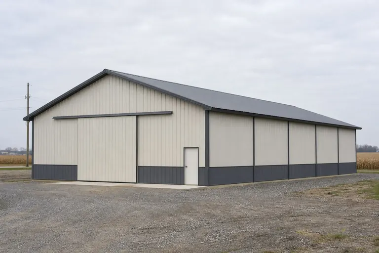 Consolidated equipment storageOne larger clear-span bay replacing several smaller structures on a 467-acre-average operation.Hay and feed storageOpen-sided or partially enclosed bays sited with wind exposure as the primary siting variable on the western plains.Working shop with attached bayA conditioned shop bay paired with open equipment storage, more common near the humid eastern edge where condensation control matters.
Example Configuration — for planning purposes only.
Dimensions
Footprints common on Oklahoma acreage
Sizes trend toward the consolidated end of the range, reflecting the state's 467-acre average farm rather than a small-lot brief.
30′ × 40′
1,200 sq ft
An entry-level footprint for a smaller or secondary operation.
40′ × 60′
2,400 sq ft
A frequent choice for consolidating equipment that previously sat in several smaller sheds.
60′ × 120′
7,200 sq ft
A large-scale option suited to operations at or above the state's 467-acre average.
Example Configuration — for planning purposes only.
Foundation method, not just footprint, should be confirmed against your specific site's terrain before ordering.
Questions
Oklahoma pole barn questions
Answered at the state level; code and hazard specifics route to the OUBCC or your local jurisdiction.
There is one named state body, the Oklahoma Uniform Building Code Commission, that governs how local jurisdictions adopt codes. That gives you a consistent starting point, but it does not mean every county or city applies identical rules — confirm specifics with your local jurisdiction.
Yes. USGS classifies western Oklahoma within the Great Plains province, while the Oklahoma Geological Survey describes folded, faulted rock forming the Ouachita Mountains in the southeast. Foundation approach and wind exposure planning differ meaningfully between those regions.
USDA's 2022 Census shows Oklahoma farm count falling from 78,531 to 70,378 while average farm size held at 467 acres, meaning land is consolidating into larger operations. That context is useful for sizing a clear-span bay meant to serve a bigger equipment fleet over time, not just today's needs.
We do not publish specific wind or snow design values on this page, since those figures depend on your exact site and the adopted code edition your jurisdiction enforces. Confirm design values with your local building department or a licensed engineer.
The state's climate narrative, as described by NOAA NCEI, spans a humid, mountainous northeast and a more open southern Great Plains character. A pole barn near the humid eastern edge is more likely to need condensation control than one on the drier western plains, though your local station data is the better reference than a single statewide description.
Possibly, but that determination is made locally, not by the state. The Oklahoma Uniform Building Code Commission governs code adoption, not individual permit exemptions, so ask your county or city building department directly.
Sources for the Oklahoma facts on this page
This page states no code requirement, wind speed, snow load, permit rule, price or supplier claim. The state-specific facts it does use are listed with their publisher below.
The Oklahoma Uniform Building Code Commission (OUBCC) is the state body established by the Oklahoma Uniform Building Code Commission Act (59 O.S. §§ 1000.20-1000.30) that governs code matters and issues rules addressing code adoption by local jurisdictions and other political subdivisions.
State of Oklahoma (oklahoma.gov/oubcc) · Current statute/administrative rules · Tier 2
https://oklahoma.gov/oubcc/faqs.htmlUSGS historical survey work (Fenneman, USGS Bulletin 730-D) classifies western Oklahoma within the Great Plains physiographic province, part of the larger interior plains distinguished from the Central Lowland province to the east.
U.S. Geological Survey (USGS Bulletin 730-D, Nevin M. Fenneman) · Originally published 1923; USGS reference · Tier 1
https://pubs.usgs.gov/bul/0730d/report.pdfThe Oklahoma Geological Survey describes Oklahoma's landscape as defined by mountains (e.g., the Ouachita Mountains) and streams, with resistant folded/faulted/thrust rock masses forming the state's mountain ranges.
Oklahoma Geological Survey · June 1998 · Tier 2
http://www.ogs.ou.edu/pubsscanned/InfSeries/infseries1.pdfOklahoma had 70,378 farms in 2022, down from 78,531 in 2017.
USDA NASS · 2022 (with 2017 comparison) · Tier 1
https://www.nass.usda.gov/Publications/AgCensus/2022/Full_Report/Volume_1,_Chapter_1_State_Level/Oklahoma/st40_1_001_001.pdfOklahoma had 32,897,563 acres of land in farms in 2022, an average farm size of 467 acres.
USDA NASS · 2022 · Tier 1
https://www.nass.usda.gov/Publications/AgCensus/2022/Full_Report/Volume_1,_Chapter_1_State_Level/Oklahoma/st40_1_001_001.pdfNOAA NCEI publishes a narrative 'Climate of Oklahoma' noting the state's southern Great Plains location and topographic features including the Ouachita Mountains, the Arkansas River Valley, and the Ozark Plateau in the northeast.
NOAA National Centers for Environmental Information (NCEI) · Historical narrative (NCEI climate normals series) · Tier 1
https://www.ncei.noaa.gov/data/climate-normals-deprecated/access/clim60/states/Clim_OK_01.pdf