
Barndominium · NE
Barndominiums in Nebraska
A Nebraska barndominium sits on a stretch of ground defined less by a single statewide rulebook than by which quarter of the state it occupies. A shop-house planned on the stabilized dunes of the Sand Hills answers to different soil and grazing-land realities than one going up on a working farm parcel east of Grand Island, and the permit conversation that follows depends on which county line you're inside. This guide works from Nebraska's own land, climate and hazard evidence to lay out what actually changes region to region, rather than repeating generic barndominium advice with the state name swapped in.
Siting
Two different Nebraskas, two different builds
Where in Nebraska you site a barndominium changes the ground conditions and the neighboring land use you're planning around.
Roughly a quarter of Nebraska's land area, the Sand Hills, is a stabilized grass-covered dune region that USDA classifies as its own Major Land Resource Area. A barndominium on or near this terrain is not sitting on the dense, silt-heavy prairie soils common in eastern counties; it's sitting on sand that only holds its shape because of an intact grass cover. Disturb that cover carelessly during site prep and you can trigger localized erosion that a standard eastern Nebraska foundation plan never has to account for. This is a conversation to have with a geotechnical engineer before committing to a slab design, not after grading has started.
East of the Sand Hills lies the more familiar farmland belt, encompassing Nebraska's 43,975,693 acres of farmland across 44,479 individual farm operations, averaging 989 acres per farm. A barndominium here is often going up beside grain bins, livestock buildings, or an existing farmstead, which means the practical questions are less about soil stability and more about integrating a new residential structure's septic, well and driveway access with decades of existing farm infrastructure without disrupting equipment traffic patterns.
That statewide farm count dropped 4% between the 2017 and 2022 agricultural censuses, alongside a 2% decline in total farmland acreage. Consolidation of that kind puts former single-operator farmsteads into new ownership more often, which is part of why a barndominium conversion on formerly ag-zoned land is a recurring scenario in Nebraska rather than an edge case; buyers considering this route should confirm with the county planning office whether the parcel's zoning still reflects agricultural use or has already been split for residential purposes.
Climate & Hazard
What the climate and hazard data actually tells you
Nebraska's available climate data is strongest around Omaha, and hazard exposure is tracked at the county level, so a barndominium plan should treat both as regional inputs rather than single statewide numbers.
The most complete Tier 1 climate normal available covers the Omaha Eppley Airfield station: 31.86 inches of annual precipitation and 27.1 inches of snowfall over the 1991-2020 period, drawn from a period-of-record dataset that stretches back to 1871 at the National Weather Service's Omaha/Valley office. That's a useful benchmark for eastern Nebraska, but it is not a substitute for site-specific data if your barndominium is going up in the drier Panhandle or the more variable Sand Hills; ask your local NWS office or a licensed engineer for the normal that applies to your actual county before finalizing roof pitch, gutter capacity or snow-load assumptions.
On the hazard side, FEMA's National Risk Index scores Nebraska's 93 counties at a mean composite of 25.8 on its 0-100 scale, with Douglas County, home to Omaha, ranked the state's highest-risk county. That composite blends multiple hazard types rather than naming one dominant threat, so it functions best as a prompt to pull your own county's NRI report rather than as a finished answer. Nebraska's State Hazard Mitigation Plan, approved by FEMA in January 2021, is the document NEMA maintains to track these risks in more detail, and its county annexes are a reasonable starting point for understanding what your local emergency management office is already tracking for your parcel.
None of this replaces a permit-office conversation. Your county building department and your engineer set the structural design criteria for this Nebraska site — confirm them before you finalize the frame, whether you're near the Sand Hills or out on the eastern farm belt.
Geography
Nebraska's building regions, briefly
Nebraska's 77,358 square miles cover more topographic variety than the flat-plains reputation suggests.
Sand Hills
Stabilized dune grassland covering close to a quarter of the state. Grading disturbs the sand-anchoring grass cover, so foundation and erosion-control planning need a geotechnical read before construction.
Eastern farm belt
Where most of Nebraska's farm acreage and operations sit, often at scales near the statewide 989-acre average. Barndominiums here typically integrate with existing farmstead access, wells and septic rather than starting from an empty lot.
Omaha metro corridor
The state's highest-ranked county on FEMA's hazard index and the source of the only complete NWS climate normal, meaning both the most hazard scrutiny and the best climate data density are concentrated here.
Start Your Nebraska Barndominium
Connect with builders who understand Nebraska's farmland, terrain and hazard-planning context.
Configuration
How Nebraska buyers tend to configure the layout
Land use patterns push Nebraska barndominium buyers toward a few recurring configurations.
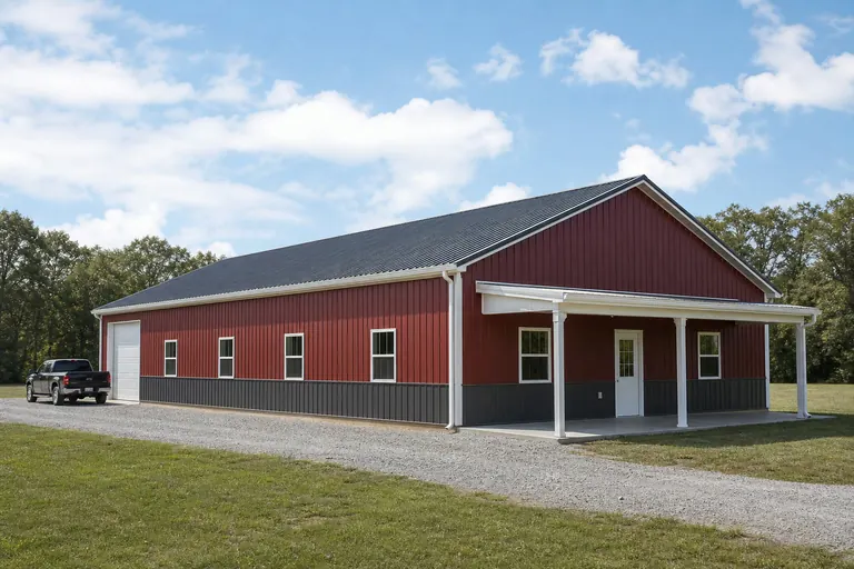 The Farmstead-Adjacent HomeA residential wing paired with a shop bay, sited next to existing grain or livestock infrastructure on a working farm parcel rather than replacing it.The Sand Hills Ranch BuildA lower-profile footprint with foundation work scoped for stabilized dune soil, often paired with grazing-land access roads instead of row-crop driveways.The Post-Consolidation ConversionA build on land recently split from a larger farm operation, where zoning and septic capacity need re-confirmation before the shop-house is designed.
Example Configuration — for planning purposes only.
Footprints
Barndominium footprints that fit Nebraska parcels
Footprint choice tends to track whether the parcel is a working farm acreage or a smaller post-consolidation lot.
30′ × 50′
1,500 sq ft
A compact footprint suited to a smaller acreage parcel split from a larger farm, balancing living space against a modest shop bay.
40′ × 60′
2,400 sq ft
A common middle-ground size for a farmstead-adjacent residence with room for one shop bay alongside the living wing.
50′ × 100′
5,000 sq ft
A larger-format build for buyers combining a full residence with substantial equipment storage; confirm septic lateral-field sizing scales with the added square footage.
Example Configuration — for planning purposes only.
Confirm septic, well and setback requirements with your county before finalizing a footprint; requirements differ between eastern farm-belt counties and Sand Hills counties.
Before You Order
A decision checklist for a Nebraska barndominium
Because Nebraska's terrain and hazard exposure vary sharply by region, a few confirmations early save the most rework later.
Step 1
Get a geotechnical read if you're near the Sand Hills
Sand-anchoring grass cover behaves differently than eastern Nebraska loam once disturbed; confirm foundation approach before grading.
Step 2
Confirm the parcel's current zoning, not its historic use
Land recently split from a consolidated farm may carry outdated zoning designations that need updating before a residence can be permitted.
Step 3
Pull your county's FEMA National Risk Index report
The 25.8 statewide mean composite score masks real county-to-county variation; your county's own report is the more useful planning input.
Step 4
Ask for a site-specific climate normal if you're outside Omaha
The only complete Tier 1 precipitation and snow normal available is for the Omaha Eppley Airfield station; other regions need their own data.
Questions
Nebraska Barndominium FAQ
Honest answers for Nebraska's residential steel building market.
Yes, but expect the foundation and site-prep plan to differ from an eastern Nebraska build because the region's stabilized dune soil behaves differently once disturbed. A geotechnical assessment is worth getting before finalizing the design.
You need to confirm zoning with your county planning office, especially on land recently split from a larger farm operation; the parcel's zoning designation may not yet reflect residential use.
The most complete Tier 1 normal available is for the Omaha Eppley Airfield station. If you're building elsewhere in the state, ask the National Weather Service or a local engineer for data specific to your county rather than assuming Omaha's figures apply statewide.
FEMA's National Risk Index gives Nebraska's 93 counties a mean composite score of 25.8 out of 100, with Douglas County ranked highest. Pull your specific county's report from FEMA's tool rather than relying on the statewide average.
Your county building department or a licensed structural engineer assigns those figures for your specific site; they are not values that can be responsibly generalized across the whole state.
The number of Nebraska farms fell 4% between 2017 and 2022, a consolidation trend that has put more formerly agricultural parcels into new ownership, including for residential conversions.
Sources for the Nebraska facts on this page
This page states no code requirement, wind speed, snow load, permit rule, price or supplier claim. The state-specific facts it does use are listed with their publisher below.
The Nebraska Sand Hills, a stabilized grass-covered sand-dune region in north-central Nebraska, cover roughly 19,300 to 19,600 square miles of the state — about a quarter of Nebraska's land area — and are classified by USDA as Major Land Resource Area 65.
USDA Natural Resources Conservation Service (Ecological Site Description program) · USDA-NRCS reference material · Tier 1
https://edit.sc.egov.usda.gov/services/descriptions/esd/065X/R065XY022NE.pdfNebraska had 44,479 farms in 2022, a 4% decrease since 2017.
USDA National Agricultural Statistics Service (NASS) · 2022 · Tier 1
https://www.nass.usda.gov/Publications/AgCensus/2022/Online_Resources/County_Profiles/Nebraska/cp99031.pdfNebraska had 43,975,693 acres of land in farms in 2022, a 2% decrease since 2017, with an average farm size of 989 acres.
USDA NASS · 2022 · Tier 1
https://www.nass.usda.gov/Publications/AgCensus/2022/Online_Resources/County_Profiles/Nebraska/cp99031.pdfThe Omaha Eppley Airfield station's 1991-2020 annual normal precipitation is 31.86 inches with 27.1 inches of annual snowfall.
NOAA National Centers for Environmental Information (NCEI) · 1991-2020 · Tier 1
https://www.ncei.noaa.gov/access/services/data/v1?dataset=normals-annualseasonal-1991-2020&stations=USW00014942&format=json&dataTypes=ANN-PRCP-NORMAL,ANN-SNOW-NORMALFEMA's National Risk Index reports Nebraska's 93 counties with a mean composite NRI risk score of 25.8 on FEMA's 0-100 relative scale (v1.20 release), with Douglas County (Omaha) ranked the state's highest-risk county.
Federal Emergency Management Agency (FEMA) · NRI v1.20 dataset · Tier 1
https://www.fema.gov/flood-maps/products-tools/national-risk-indexNebraska's State Hazard Mitigation Plan, approved by FEMA in January 2021, establishes the state's official policies and hazard-risk assessment for natural hazard mitigation planning.
Nebraska Emergency Management Agency (NEMA) · Approved January 27, 2021 · Tier 2
https://nema.nebraska.gov/assets/files/hazard-mitigation/hazmitplan2021.pdfBuilding permit offices in Nebraska authorized construction of 8,877 new privately-owned housing units in 2023 (4,666 single-family buildings plus multi-unit structures).
U.S. Census Bureau · 2023 (final annual) · Tier 1
https://www2.census.gov/econ/bps/State/st2023a.txt