
Barndominium · WA
Barndominiums in Washington
A barndominium in Washington is a residential building sited in a state defined by the Cascade Range — home to Mount Rainier, a dormant stratovolcano rising 14,408 feet, the tallest point in the state — and by a hard climate divide between the wet Puget Sound side and the arid Columbia Basin. Layer in a statewide trend of new-housing permits sliding from 49,030 units in 2022 to 37,778 in 2024, and the state-level story for a barndominium buyer here is about choosing and confirming a site in genuinely varied, sometimes hazard-relevant terrain, and about building envelope decisions for a wetter climate than many barndominium buyers assume from national marketing.
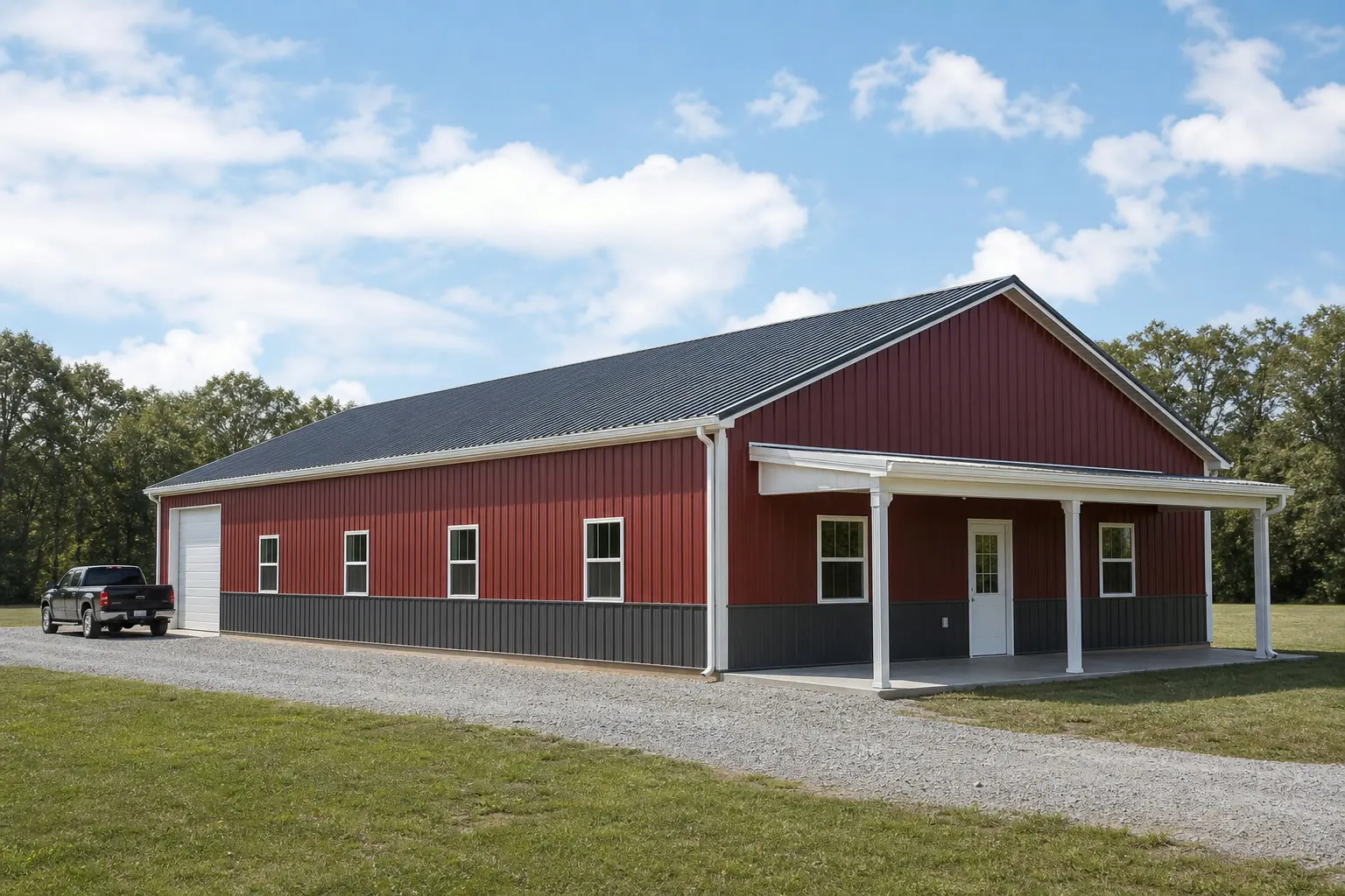
The intersection
What a Washington site actually changes about a barndominium
A barndominium is a home first, and in Washington that home is being planned against genuinely dramatic terrain and a construction climate that has cooled since 2022.
Washington's Cascade Range includes Mount Rainier, which Washington's Department of Natural Resources documents as a dormant stratovolcano standing 14,408 feet above sea level — the tallest point in the state. For a residential buyer, the practical relevance is not the summit itself but what proximity to Cascade terrain generally means for a parcel: slope, drainage paths, tree cover and access. Rural residential land near the Cascades or in their foothills is often chosen precisely for the view and the setting that this terrain provides, which is exactly why it deserves a specific site conversation rather than a generic one.
At the same time, U.S. Census Bureau building-permit data show Washington authorizing fewer new housing units than it did a few years ago: 49,030 total units in 2022, down to 37,097 in 2023, and 37,778 in 2024. A barndominium buyer is not building in a boom year statewide, which is worth knowing context-wise even though it says nothing about your specific county or builder's schedule — permit volume is a statewide indicator, not a local guarantee.
Layered on top of both is the state's climate divide. NOAA's 1991-2020 normal for Sea-Tac lists 39.34 inches of annual precipitation with 6.3 inches of snow, representative of the wetter west side, while the Washington Geological Survey's Columbia Basin province describes an arid lowland across the entire southeastern portion of the state. A barndominium's envelope, roof design and moisture detailing are reasonably different projects depending on which of those two climates the home sits in, even before any code or engineering question is asked.
Siting
Siting a residence near Cascade terrain
Rural residential land in and around the Cascades is chosen for setting as much as for square footage, which makes the site conversation as important as the floor plan.
A parcel near the Cascade Range foothills or with a Mount Rainier viewshed carries the same general site questions any sloped or forested parcel does: how the building pad is graded, where water is directed away from the foundation, and what access a delivery truck and future service vehicles will have. None of this is a Washington-specific engineering rule; it is simply more likely to matter on Cascade-adjacent land than on a flat interior lot.
Hazard awareness belongs in the same conversation, handled honestly rather than guessed at. FEMA's National Risk Index provides county- and tract-level hazard scoring for all 39 Washington counties across 18 hazard types, including wildfire and volcanic hazard categories relevant to Cascade-proximate land. This page does not rank Washington's hazards or name a single top risk for the state — that specific narrative could not be independently confirmed from FEMA's own materials in this research pass — but the NRI tool itself is a legitimate, citable starting point for a buyer to research their own parcel.
- Grade and drainage
- Confirm how the pad relates to surrounding grade before finalizing a floor plan, especially on sloped Cascade-adjacent land.
- Access and delivery
- Rural, hillier parcels sometimes need road or driveway work before a barndominium shell can even be delivered.
- County hazard research
- Use FEMA's National Risk Index to research your specific county before committing to a parcel; do not rely on statewide generalizations.
Climate
Building envelope choices differ west and east
The same barndominium floor plan is a different envelope project on the wet west side than in the arid Columbia Basin.
On the west side, the Sea-Tac normal of 39.34 inches of annual precipitation (with the National Weather Service's Seattle office maintaining ongoing climatology showing this as representative of the broader wetter, Cascades-influenced west) means a barndominium's roof design, gutter strategy and exterior moisture detailing carry real weight in daily livability, not just at the building-code level. Buyers moving from drier states sometimes underestimate how much a barndominium's covered porch, entry sequencing and drainage plan matter here.
On the east side, in and around the Columbia Basin, the concern shifts toward heat, dust and a drier building envelope, with less emphasis on constant moisture management. Neither side is harder to build in than the other; they are simply different projects, and a barndominium plan designed around one side's assumptions should be reviewed rather than copied if the parcel is on the other.
Get Washington barndominium quotes
Tell us which side of the Cascades your parcel is on, its terrain, and your living-space-to-shop split. We route it with the Washington and barndominium context already attached.
Configuration
How Washington barndominium buyers configure the building
The living-space-to-shop ratio in Washington often reflects the same rural-residential-plus-workspace logic seen nationally, adjusted for site and climate.
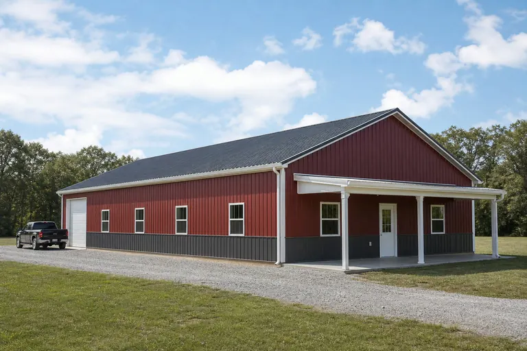 Residence with attached shopA living-space wing paired with a shop or garage bay, common on acreage parcels where the buyer wants both a home and workspace under one roof.
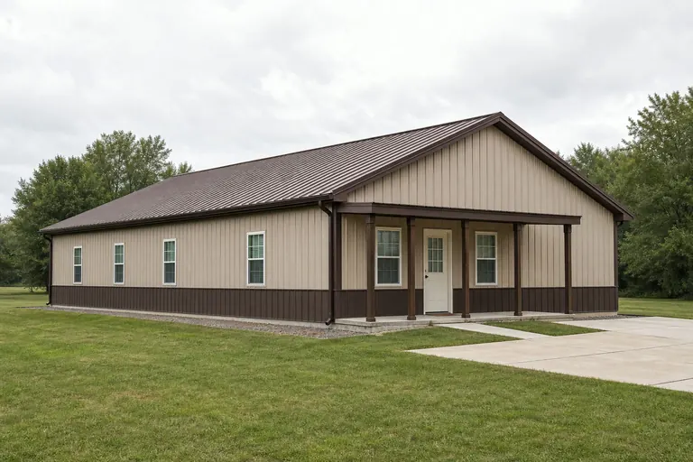 Full residential conversionA build weighted almost entirely toward living space, treated architecturally more like a house than a post-frame shop.View-oriented sitingLayouts that prioritize orientation toward Cascade or valley views, which changes window placement and covered-porch decisions more than square footage.
Example Configuration — for planning purposes only.
Preparation
Before you request a Washington barndominium quote
These points resolve most of the back-and-forth on a Washington residential post-frame project.
- Contact your local building departmentZoning and residential-use rules for a barndominium vary by county and city; confirm before finalizing a floor plan.
- Name your climate sideState whether the parcel is west-side (wetter) or east-side/interior (drier) so envelope decisions are made for the right climate.
- Research your county's hazard profileUse FEMA's National Risk Index for your specific county rather than assuming a statewide hazard picture.
- Confirm site access and grading needsSloped or forested Cascade-adjacent parcels often need more site work than a flat interior lot.
Questions
Washington barndominium questions
State-level answers we can support with evidence, and the parcel-specific questions routed to whoever actually owns them.
Zoning and residential-use rules vary by county and city, and some jurisdictions restrict residential post-frame construction differently than agricultural buildings. Your local building or planning department is the only reliable source for what your specific parcel allows.
Proximity to Cascade terrain often means more site grading, drainage planning and access work than a flat lot, and it is worth researching your county's hazard profile through FEMA's National Risk Index. It does not change the barndominium concept itself, only the site preparation around it.
It depends which side of the state you're on. West-side sites, represented by Sea-Tac's 39.34-inch annual precipitation normal, need real attention to roof and moisture detailing; the Columbia Basin's arid interior climate is a drier, different project. Neither is harder, but they are not interchangeable.
Census data show statewide new-housing-unit authorizations falling from 49,030 in 2022 to 37,778 in 2024. That is a statewide indicator, not a guarantee about your county's builder availability or timeline, which your local building department and chosen builder can speak to directly.
We do not publish state-level prices, because a credible number depends on your specification, finish level and current material pricing. Our cost pages cover what drives the number; a quote covers your building.
Sources for the Washington facts on this page
This page states no code requirement, wind speed, snow load, permit rule, price or supplier claim. The state-specific facts it does use are listed with their publisher below.
Mount Rainier, a dormant stratovolcano in Washington's Cascade Range, stands 14,408 feet above sea level, the tallest mountain in the state, per a WA DNR geologic reference publication.
Washington State Department of Natural Resources, Division of Geology and Earth Resources · Originally published 1969; DNR reference archive · Tier 2
https://dnr.wa.gov/sites/default/files/2025-04/ger_ic45_geol_hist_rocks_min.pdfSeattle-Tacoma International Airport's 1991-2020 annual climate normal precipitation is 39.34 inches with an annual normal snowfall of 6.3 inches.
NOAA National Centers for Environmental Information (NCEI) · 1991-2020 · Tier 1
https://www.ncei.noaa.gov/access/services/data/v1?dataset=normals-annualseasonal-1991-2020&dataTypes=ANN-PRCP-NORMAL,ANN-SNOW-NORMAL&stations=USW00024233&format=jsonNWS Seattle publishes climate information pages for western Washington, including precipitation plots distinguishing the wetter coastal/Cascades-influenced west side from the drier interior.
National Weather Service (NOAA), Seattle WA office · Ongoing NWS climatology records · Tier 1
https://www.weather.gov/sew/CliPlotWashington builders and developers were authorized (by building permit) to build 37,778 total new privately-owned housing units in 2024, down from 49,030 units in 2022 and 37,097 units in 2023.
U.S. Census Bureau · 2022-2024 · Tier 1
https://www2.census.gov/econ/bps/State/st2024a.txtThe Washington Geological Survey (part of the state Department of Natural Resources) names and maps distinct geologic/physiographic provinces across the state, including the Cascade Range and the Columbia Basin, the latter a wide, arid lowland occupying the entire southeastern portion of Washington.
Washington State Department of Natural Resources, Washington Geological Survey · Reference material, current · Tier 2
https://dnr.wa.gov/washington-geological-survey/explore-popular-geology/geologic-provinces-washington/columbia-basin