
Barndominium · RI
Barndominiums in Rhode Island
In the nation's smallest state, the barndominium represents a high-efficiency alternative to traditional residential construction. With a total land area of just 1,033.8 square miles and an average farm size of 56 acres, Rhode Island projects must maximize every inch of their footprint. Siting a metal home in the Ocean State means engineering for a coastal New England climate that is growing wetter and warmer, with precipitation increasing since 1895 and temperatures having risen nearly 4°F over the last century.
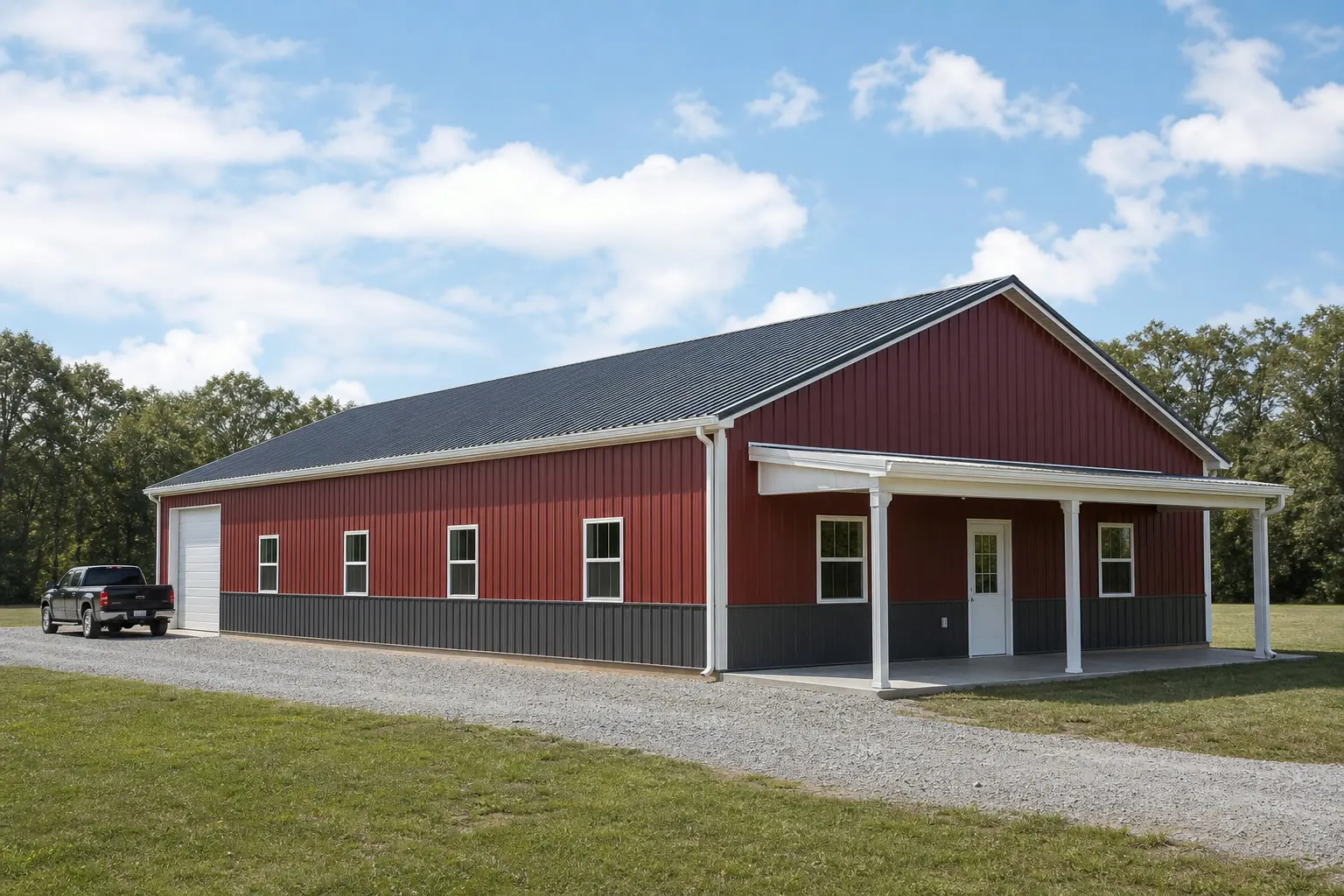
Compact Living
Barndominium Design in the Nation's Smallest State
Building a residential metal home in Rhode Island is an exercise in efficiency and climatic adaptation.
Rhode Island may be the smallest state by land area—just 1,033.8 square miles—but its residential standards are among the most rigorous in the Northeast. A barndominium project here isn't just a barn with a kitchen; it's a high-performance steel residence that must meet the Rhode Island State Building Code. With 1,054 farms averaging only 56 acres, the luxury of 'sprawl' is non-existent. Rhode Island barndominiums are often designed to consolidate living space, workshop needs, and equipment storage into a single, compact footprint that respects strict local lot coverage regulations.
The coastal influence of Narragansett Bay and the Atlantic Ocean is the primary environmental factor. Rhode Island has the third-highest water-to-land ratio in the U.S., which means that even 'inland' sites are subject to high humidity and salt-air exposure. This environmental profile has become more challenging over time: annual precipitation has increased since 1895, and temperatures have risen almost 4°F since the beginning of the 20th century. A barndominium in the Ocean State must be engineered to handle these shifts, with a focus on airtight envelopes and robust moisture management.
For the 1,054 farm owners in the state, the barndominium offers a way to modernize their operations. On a 56-acre parcel, having a residence that shares a wall with a high-clearance workshop or equipment bay allows for better land stewardship and simplified maintenance. However, the key to success in Rhode Island is early engagement with local building and zoning boards, as the state's density means that residential conversions of metal shells are viewed with a high degree of scrutiny.
Engineering for Change
Building for a Warming Coastal Climate
Rhode Island's shifting climate trends require a forward-looking approach to barndominium insulation and finishing.
The documented 4°F rise in Rhode Island temperatures since 1900 isn't just a statistic; it changes how a metal home performs. Metal is a highly efficient conductor of heat, meaning that without a high-performance thermal break, a barndominium can become uncomfortably hot in the increasingly warm New England summers. Conversely, the rising precipitation trends since 1895 increase the risk of condensation and dampness within the wall cavities.
The most effective response for a Rhode Island barndominium is the use of closed-cell spray foam insulation. This material provides both the high R-value needed to combat rising temperatures and the airtight seal necessary to keep humid coastal air away from the steel framing. When combined with a high-efficiency HVAC system and dehumidification, the metal home becomes one of the most resilient residential options in the state.
- Vertical Design
- Maximise living space on a small 56-acre farm footprint by utilizing second-story lofts or full mezzanine levels.
- Marine-Grade Coatings
- Given the high water ratio, specify Kynar 500 or equivalent coatings to protect the residential shell from salt-air corrosion.
- Lot Coverage Compliance
- Rhode Island's density makes impervious surface limits a critical design factor; consider permeable driveways and compact footprints.
Configurations
Rhode Island Barndominium Use Cases
Adapting the barndominium model to the Ocean State's unique parcels.
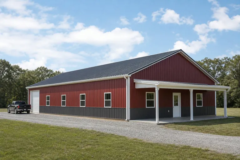 The Coastal EstateA primary residence with a large integrated boat garage, designed for Washington or Newport County shoreline sites.The Farmstead HubA 40x60 footprint that serves as both a 2-bedroom home and the headquarters for a 56-acre specialist farm.The ADU AlternativeA smaller residential metal building (30x40) used as a guest house or rental unit on an existing residential lot.
Example Configuration — for planning purposes only.
Plan Your Rhode Island Barndominium
Ready to build a resilient, efficient metal home in the Ocean State? Get quotes from specialists who understand Rhode Island's coastal and regulatory landscape.
Dimensions
Sizing Your Rhode Island Barndominium
Footprints that balance residential needs with Rhode Island land constraints.
30′ × 40′
1,200 sq ft
The 'Efficiency Barndo'—provides 1,200 sq ft, often used for open-concept living on small parcels.
40′ × 60′
2,400 sq ft
The 'Standard Residence'—2,400 sq ft, typically split between living space and a two-car garage.
40′ × 80′
3,200 sq ft
The 'Legacy Farmhouse'—allows for a 2,000 sq ft home and a large 1,200 sq ft workshop on a 56-acre farm.
Example Configuration — for planning purposes only.
Remember that multi-story designs can double these square footages without increasing the ground footprint.
Preparation
Before You Start a Rhode Island Barndominium Project
Four checks resolve most of the surprises that slow down a Rhode Island metal-home project.
- Confirm CRMC jurisdictionSites near tidal water or within Narragansett Bay's influence may require Coastal Resources Management Council review before local permitting even begins.
- Ask about historic district or aesthetic reviewMany Rhode Island towns apply design review to residential structures, including metal-shell homes, in ways that vary block to block.
- Verify septic capacity on your parcelA 56-acre average farm size still leaves many Rhode Island lots tight for leach field siting once a residence and workshop share one footprint.
- Check your FEMA flood zone statusGiven the state's high water-to-land ratio, confirm whether a raised foundation or additional freeboard is required before finalizing your slab design.
Site Types
How Site Type Changes a Rhode Island Barndominium Build
Where in Rhode Island the parcel sits changes the permitting path more than the building itself does.
| Site type | Typical constraint | Rhode Island-specific consideration |
|---|---|---|
| Coastal Washington or Newport County lot | CRMC review, flood zone elevation | Marine-grade coatings and a raised or engineered foundation are frequently non-negotiable this close to the Bay. |
| Inland Providence or Kent County farm parcel | Standard local zoning and septic sizing | Fewer coastal-specific reviews, but the state's still-limited land area keeps lot coverage limits strict. |
| Existing residential infill lot | Local aesthetic or historic district review | A metal-shell home reads differently to a design review board than a traditional New England farmhouse profile, so early renderings help. |
Coastal Washington or Newport County lot
- Typical constraint
- CRMC review, flood zone elevation
- Rhode Island-specific consideration
- Marine-grade coatings and a raised or engineered foundation are frequently non-negotiable this close to the Bay.
Inland Providence or Kent County farm parcel
- Typical constraint
- Standard local zoning and septic sizing
- Rhode Island-specific consideration
- Fewer coastal-specific reviews, but the state's still-limited land area keeps lot coverage limits strict.
Existing residential infill lot
- Typical constraint
- Local aesthetic or historic district review
- Rhode Island-specific consideration
- A metal-shell home reads differently to a design review board than a traditional New England farmhouse profile, so early renderings help.
Questions
Rhode Island Barndominium FAQ
Direct answers for Rhode Island metal home projects.
While the state building code allows for metal residences, local zoning ordinances vary. Some towns may have aesthetic requirements or restrictions on accessory residential structures. Always check with your local zoning office first.
The need for high-spec insulation (to manage the 4°F temp rise) and marine-grade coatings (due to the high water-to-land ratio) can add to the initial material cost, but these investments pay off in durability and energy efficiency.
Depending on your proximity to the water, you may need an engineered slab or even a raised foundation to meet FEMA flood zone requirements. A geotechnical survey is highly recommended.
Financing a metal home can be more complex than a traditional build. Working with lenders who specialize in custom construction and providing detailed plans that meet the RI State Building Code is essential.
It can. FEMA's National Risk Index flags hurricane, coastal flooding, and winter weather exposure at the county and tract level, and with 457 of Rhode Island's 1,531 total square miles being water, a meaningful share of sites sit within that influence. Confirm your specific flood zone with your town before finalizing a slab-on-grade versus raised foundation decision.
Sources for the Rhode Island facts on this page
This page states no code requirement, wind speed, snow load, permit rule, price or supplier claim. The state-specific facts it does use are listed with their publisher below.
The U.S. Census Bureau's 2010 Census geography reference lists Rhode Island's land area as 1,033.8 square miles, the smallest of any U.S. state.
U.S. Census Bureau · 2010 Census · Tier 1
https://www.census.gov/geographies/reference-files/2010/geo/state-local-geo-guides-2010/rhode-island.htmlRhode Island had 1,054 farms in 2022 with 59,076 acres of land in farms and an average farm size of 56 acres.
USDA National Agricultural Statistics Service (NASS) · 2022 · Tier 1
https://www.nass.usda.gov/Publications/AgCensus/2022/Online_Resources/Typology/typology_ri.pdfRhode Island had 1,054 farms in 2022 with 59,076 acres of land in farms and an average farm size of 56 acres.
USDA National Agricultural Statistics Service (NASS) · 2022 · Tier 1
https://www.nass.usda.gov/Publications/AgCensus/2022/Online_Resources/Typology/typology_ri.pdfThe Rhode Island Department of Environmental Management describes Rhode Island as the smallest U.S. state, occupying a total of 1,531 square miles (1,074 square miles of land and 457 square miles of water), with the third-highest ratio of water area to total area of any state due to the shoreline of Narragansett Bay.
Rhode Island Department of Environmental Management (DEM) · Current DEM reference page · Tier 2
https://dem.ri.gov/environmental-protection-bureau/air-resources/climatology/climate-rhode-islandNOAA's 2022 State Climate Summary reports that annual precipitation in Rhode Island has increased since 1895 and that temperatures have risen almost 4°F since the beginning of the 20th century.
NOAA National Centers for Environmental Information (NCEI) · 2022 summary, trend since 1895/1900 · Tier 1
https://statesummaries.ncics.org/downloads/RhodeIsland-StateClimateSummary2022.pdfNOAA's 2022 State Climate Summary reports that annual precipitation in Rhode Island has increased since 1895 and that temperatures have risen almost 4°F since the beginning of the 20th century.
NOAA National Centers for Environmental Information (NCEI) · 2022 summary, trend since 1895/1900 · Tier 1
https://statesummaries.ncics.org/downloads/RhodeIsland-StateClimateSummary2022.pdfThe Rhode Island Department of Environmental Management describes Rhode Island as the smallest U.S. state, occupying a total of 1,531 square miles (1,074 square miles of land and 457 square miles of water), with the third-highest ratio of water area to total area of any state due to the shoreline of Narragansett Bay.
Rhode Island Department of Environmental Management (DEM) · Current DEM reference page · Tier 2
https://dem.ri.gov/environmental-protection-bureau/air-resources/climatology/climate-rhode-islandThe Rhode Island Department of Environmental Management describes Rhode Island as the smallest U.S. state, occupying a total of 1,531 square miles (1,074 square miles of land and 457 square miles of water), with the third-highest ratio of water area to total area of any state due to the shoreline of Narragansett Bay.
Rhode Island Department of Environmental Management (DEM) · Current DEM reference page · Tier 2
https://dem.ri.gov/environmental-protection-bureau/air-resources/climatology/climate-rhode-islandFEMA's National Risk Index is the federal tool providing county- and tract-level natural hazard risk data (including hurricane, coastal flooding, and winter weather categories relevant to New England) for Rhode Island; a state-specific narrative summary was not retrieved directly from fema.gov in this session.
Federal Emergency Management Agency (FEMA) · Current NRI release · Tier 1
https://www.fema.gov/flood-maps/products-tools/national-risk-index