
RV carport · AR
RV Carports in Arkansas
Arkansas doesn't have one RV carport siting story — it has two. Eastern Arkansas sits in the Mississippi Alluvial Plain, a low, flat, historically flood-prone floodplain according to USGS physiographic reference material, while the Ozark Plateau and Ouachita Mountains to the west and north put a carport pad on genuinely different ground: sloped, rockier, and less prone to standing water but harder to level. An RV carport is tall and narrow-footed, so whichever half of the state a parcel sits in changes the drainage and grading conversation before a single post is set. Layer in Arkansas's 75 FEMA-scored counties and a farm base that shrank to 37,756 operations in 2022 (down 11% since 2017) while growing to an average 363 acres each, and the honest starting point for an Arkansas RV carport is the parcel's physiography, not the vehicle.
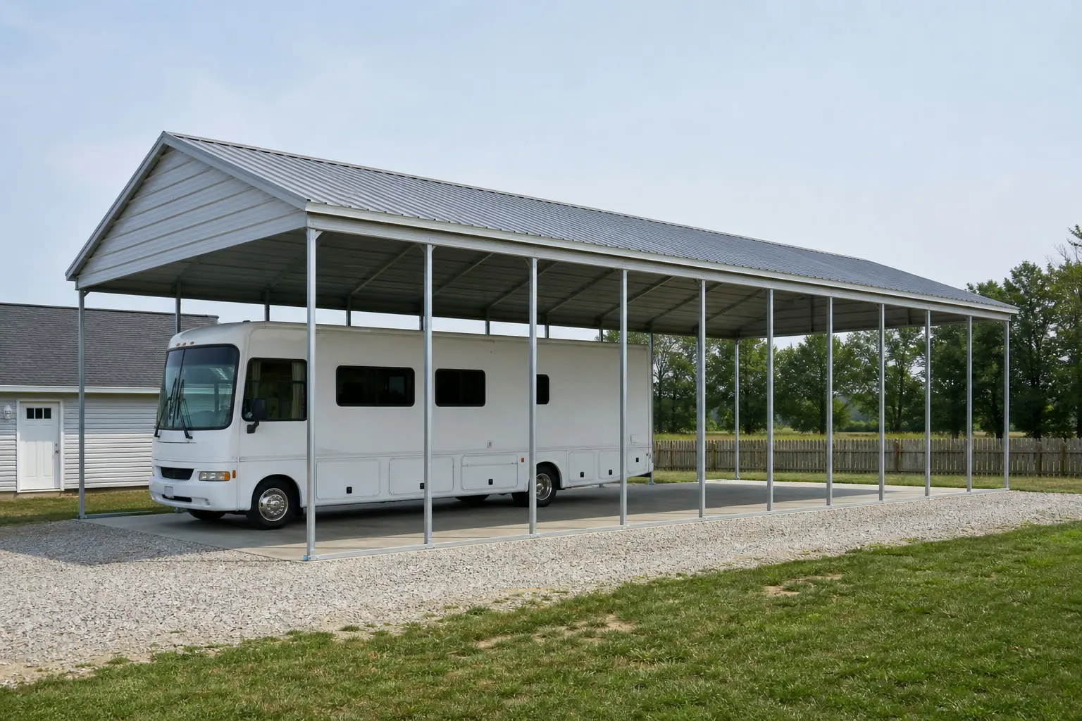
Two Physiographic Halves, Two Different Pads
Arkansas splits geologically down the middle. USGS physiographic reference material describes the eastern Delta as part of the Mississippi Alluvial Plain — low, flat, and historically flood-prone — while the Ozark Plateau and Ouachita Mountains occupy the western and northern reaches on higher, more broken ground. An RV carport's tall roof plane and small footprint of posts make it sensitive to whichever of these two conditions a parcel actually sits in: a Delta pad has to manage standing water and soft alluvial soil, while a highland pad often needs cut-and-fill grading before the frame can go level.
Siting
Delta Siting Versus Highland Siting
The two halves of the state pose different site-prep problems for the same RV carport frame.
| Region | Ground condition | What it means for the carport |
|---|---|---|
| Mississippi Alluvial Plain (east) | Low, flat, historically flood-prone floodplain per USGS reference material | Grade the pad above surrounding ground and route runoff away from the footings before posts go in. |
| Ozark Plateau / Ouachita Mountains (west, north) | Higher, sloped, more broken terrain | Expect cut-and-fill grading to get a level pad; confirm slope tolerance with your installer before ordering. |
Mississippi Alluvial Plain (east)
- Ground condition
- Low, flat, historically flood-prone floodplain per USGS reference material
- What it means for the carport
- Grade the pad above surrounding ground and route runoff away from the footings before posts go in.
Ozark Plateau / Ouachita Mountains (west, north)
- Ground condition
- Higher, sloped, more broken terrain
- What it means for the carport
- Expect cut-and-fill grading to get a level pad; confirm slope tolerance with your installer before ordering.
Preparation
What to Confirm Before an Arkansas RV Carport Quote
These four checks head off a second round of quoting once site work starts.
- Identify your physiographic regionAsk whether your parcel sits in the Delta's Alluvial Plain or in Ozark/Ouachita highland terrain — the answer changes whether drainage or grading is the first site-prep task.
- Pull your county's FEMA hazard scoreWith 75 separately-scored Arkansas counties, check your own county's National Risk Index profile rather than assuming a statewide figure applies.
- Measure your RV including roof-mounted equipmentClearance planning needs the tallest point of the vehicle, not just body height, to set post height correctly.
- Ask your local building department about flood-zone rulesDelta parcels near the Mississippi Alluvial Plain may carry floodplain requirements that a highland parcel would not; confirm before finalizing footing depth.
- Discuss a wind-break wall if the site is exposedA partial side enclosure on the prevailing-wind side is easier to specify up front than to retrofit onto finished posts later.
Get Arkansas RV carport quotes
Tell us your region — Delta or highland — your RV height, and your acreage, and we route it with the Arkansas siting context already attached.
Configuration
How Arkansas RV Carports Get Configured
Configuration follows the vehicle and whatever else the structure needs to shelter alongside it.
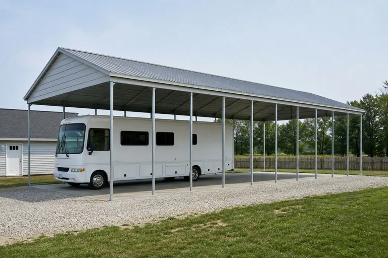 Single RV bayAn open bay sized to one motorhome or travel trailer, common on both Delta acreage and highland home sites.
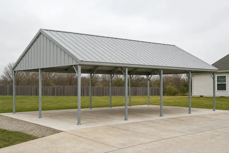 RV plus farm equipment bayA combined structure covering an RV and equipment, suited to the state's larger average 363-acre farm parcels.
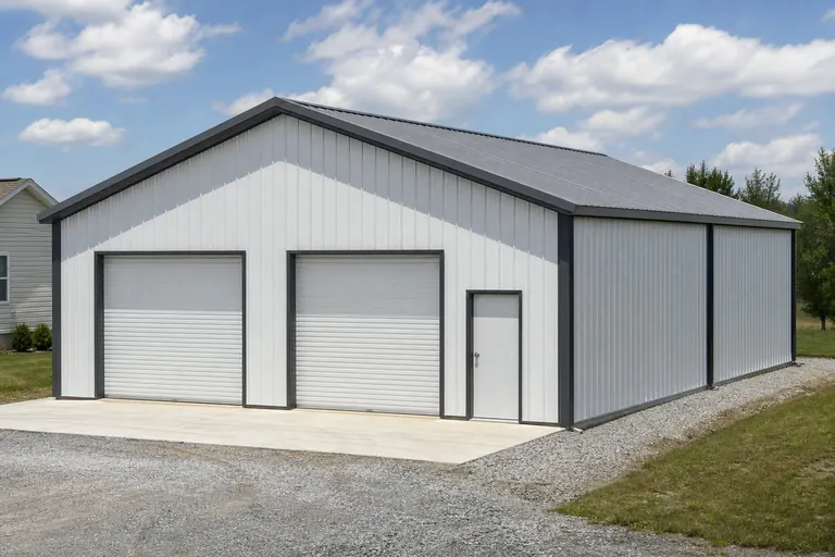 Partially enclosed RV coverSide enclosure added to an open bay for more weather protection during Arkansas's humid, storm-prone months.
Example Configuration — for planning purposes only.
Footprint
Footprints That Fit an Arkansas RV Carport
Vehicle length and clearance set the footprint; the region still governs how that footprint gets sited on the ground.
14′ × 36′
504 sq ft
A single-bay footprint sized for one motorhome or long travel trailer.
14′ × 40′
560 sq ft
Added length for a longer Class A motorhome or a trailer with a full-length awning.
24′ × 40′
960 sq ft
A two-bay footprint for an RV alongside a second vehicle or farm equipment.
Example Configuration — for planning purposes only.
Footprint pages carry post spacing and clearance detail for each size; this page explains only the Arkansas siting context.
Climate
What Little Rock's Climate Record Means for a Covered RV
NOAA's 1991-2020 normals for the Little Rock station are a citable central-Arkansas reference, and they point to conditions worth planning around for a vehicle stored under an open bay rather than inside a garage.
An RV parked under an open-sided carport is still exposed to wind-driven rain and to the state's humid air, even with a roof overhead. The Little Rock station's period-of-record normals reflect a warm, humid climate typical of central Arkansas, conditions that can accelerate mildew growth on an RV's exterior seals and awnings if the vehicle sits uncovered by walls for long stretches between trips.
That's a reasonable argument for the partially enclosed configuration described above on either side of the state, not just in one region: a wind-break wall on the prevailing-wind side cuts down on driven rain reaching the vehicle without fully enclosing the structure. This page cites the Little Rock normals as a representative regional reference rather than a statewide figure, since a single station cannot describe both Delta humidity and Ozark highland conditions with the same precision.
It's worth raising with your installer at the same time as post height and bay width, since retrofitting a wind-break wall onto finished posts is a harder job than specifying it in the original order.
Questions
Arkansas RV Carport Questions, Answered Honestly
Region-specific answers, with anchoring, permitting and pricing questions routed to whoever actually owns them.
Yes. USGS physiographic reference material places the Delta within the low, flood-prone Mississippi Alluvial Plain, while the Ozark Plateau and Ouachita Mountains to the west and north sit on higher, more sloped ground. That difference changes whether drainage or grading is your first site-prep task.
FEMA's National Risk Index scores hazards county by county across all 75 Arkansas counties, so risk is not uniform. Pull your specific county's profile rather than relying on a single statewide figure.
Clearance depends on your specific vehicle's height including roof-mounted equipment, plus any local rules. Measure your RV and confirm requirements with your local building department and builder.
Many are. The 2022 Census of Agriculture recorded 37,756 Arkansas farms averaging 363 acres, and that scale of open land makes a semi-permanent RV carport near the home or barn a common, low-friction placement, though suburban placements exist too.
We do not publish state-level prices, since cost depends on size, height, specification and site work, including any grading or drainage your region requires. Our cost pages explain what drives the number; a builder quote covers your specific project.
They can, particularly near the Mississippi Alluvial Plain's low-lying ground. Check with your local building department about floodplain requirements before finalizing footing depth or pad elevation.
Sources for the Arkansas facts on this page
This page states no code requirement, wind speed, snow load, permit rule, price or supplier claim. The state-specific facts it does use are listed with their publisher below.
The Arkansas Delta in the eastern part of the state lies within the Mississippi Alluvial Plain, a low, flat, historically flood-prone floodplain region distinct from the higher Ozark Plateau and Ouachita Mountains to the west.
U.S. Geological Survey (USGS) · Originally published 1923; USGS reference · Tier 1
https://pubs.usgs.gov/bul/0730d/report.pdfFEMA's National Risk Index is an interactive county/tract-level tool covering 18 natural hazards, including tornado, riverine flooding, and earthquake, that can be queried for Arkansas's 75 counties.
Federal Emergency Management Agency (FEMA) · Current NRI release · Tier 1
https://www.fema.gov/flood-maps/products-tools/national-risk-indexArkansas had 37,756 farms in 2022, down 11% from 2017.
USDA National Agricultural Statistics Service (NASS) · 2022 · Tier 1
https://www.nass.usda.gov/Publications/AgCensus/2022/Online_Resources/County_Profiles/Arkansas/cp99005.pdfArkansas had 13,722,525 acres of land in farms in 2022, an average farm size of 363 acres, up 12% from 2017.
USDA NASS · 2022 · Tier 1
https://www.nass.usda.gov/Publications/AgCensus/2022/Online_Resources/County_Profiles/Arkansas/cp99005.pdfArkansas's total land area was measured at 52,035.5 square miles as of the 2010 Census.
U.S. Census Bureau · 2010 Census · Tier 1
https://www.census.gov/geographies/reference-files/2010/geo/state-local-geo-guides-2010/arkansas.htmlNOAA NCEI's 1991-2020 climate normals for Little Rock Adams Field list station-level monthly and annual temperature, precipitation, and degree-day data for the Little Rock area.
NOAA National Centers for Environmental Information (NCEI) · 1991-2020 · Tier 1
https://www.ncei.noaa.gov/access/services/data/v1?dataset=normals-monthly-1991-2020&endDate=9996-12-31&format=pdf&startDate=0001-01-01&stations=USW00013963