
Hobby shop · AR
Hobby Shops in Arkansas
An Arkansas hobby shop is often a secondary workspace on a larger farm parcel — the state's farms averaged 363 acres in 2022, up 12% from 2017 even as the total count of operations fell 11% to 37,756. Where that parcel sits changes the site-prep conversation before the shop's use ever comes up: USGS physiographic reference material places the eastern Delta within the Mississippi Alluvial Plain, a low, flat, historically flood-prone floodplain, while the Ozark Plateau and Ouachita Mountains to the west and north sit on higher, more broken ground. A hobby shop's slab has to answer to whichever of those two conditions it sits on, and Arkansas's 75 individually FEMA-scored counties mean the hazard picture is genuinely local rather than uniform. This page starts from the ground the shop sits on, not the woodworking or fabrication use inside it.
Siting
The Ground Decides the Slab, Not the Hobby
A hobby shop's foundation plan in Arkansas depends on which of the state's two physiographic halves the parcel sits in.
USGS physiographic reference material splits Arkansas into a low, flat, historically flood-prone Mississippi Alluvial Plain in the east and a higher, more broken Ozark Plateau and Ouachita Mountains in the west and north. A hobby shop is usually a modest single-story slab, but that slab still has to answer to whichever region it sits in: a Delta parcel calls for raising the pad and directing runoff away from the building, while a highland parcel more often needs grading or a retaining approach to get a level, buildable pad in the first place.
Neither condition is a reason to avoid building in either region — Arkansas hobby shops exist across the state — but it is a reason to have the site-prep conversation before finalizing a floor plan, since the fix is far cheaper before the slab is poured than after.
Preparation
Four Checks Before Siting an Arkansas Hobby Shop
A hobby shop is small enough to become an afterthought in site planning, which is exactly why these get skipped.
Step 1
Confirm your physiographic region
Ask whether the parcel sits in the Delta's Alluvial Plain or the Ozark/Ouachita highlands before setting pad elevation.
Step 2
Pull your county's FEMA hazard score
Arkansas has 75 separately-scored counties; check yours rather than assuming a statewide hazard picture.
Step 3
Price the power run across your acreage
With average farm size up to 363 acres statewide, a shop sited well away from the house can mean a meaningfully longer trenched electrical run.
Step 4
Ask your local building department about floodplain rules
Delta-region parcels near the Alluvial Plain may carry floodplain requirements a highland parcel would not.
Application
How Arkansas Hobby Shops Get Used
Use tends to follow the parcel: acreage-scale fabrication versus a smaller in-town workshop.
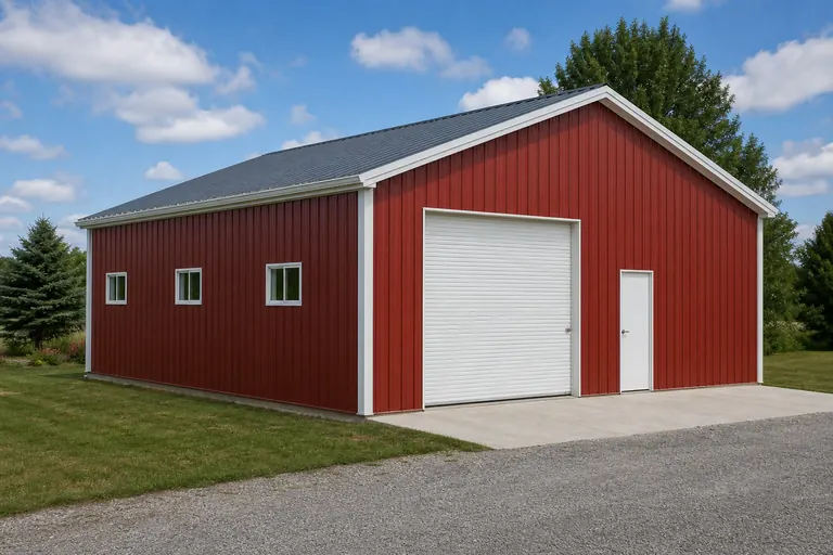 Farm fabrication and repair shopA secondary workspace for equipment maintenance on larger acreage, suited to the state's rising average farm size.Woodworking or restoration shopA climate-controlled space for detail work, benefiting from a well-drained, elevated pad in Delta counties.In-town workshopA compact shop on a smaller residential-scale lot, more common in Ozark and Ouachita foothill towns.
Example Configuration — for planning purposes only.
Get Arkansas hobby shop quotes
Tell us your region — Delta or highland — and rough acreage, and we route it with the Arkansas siting context already attached.
Footprint
Sizing an Arkansas Hobby Shop
Footprint follows planned use; grading and drainage needs still depend on the region.
24′ × 30′
720 sq ft
A compact single-use shop for woodworking or light maintenance.
30′ × 40′
1,200 sq ft
A multi-use hobby space with room for a vehicle or larger workbench layout.
40′ × 60′
2,400 sq ft
A larger fabrication or restoration shop suited to a bigger acreage parcel.
Example Configuration — for planning purposes only.
Footprint pages carry post spacing and layout detail for each size; this page covers only Arkansas siting context.
Comparison
Delta Siting Versus Highland Siting for a Hobby Shop
The same shop design needs a different site-prep approach depending on which half of Arkansas it's built in.
| Region | Ground condition | Shop-specific implication |
|---|---|---|
| Mississippi Alluvial Plain (east) | Low, flat, historically flood-prone per USGS reference | Raise and grade the pad; plan runoff routing away from the slab edge. |
| Ozark Plateau / Ouachita Mountains (west, north) | Higher, more broken terrain | Expect grading or cut-and-fill work to reach a level, buildable pad. |
Mississippi Alluvial Plain (east)
- Ground condition
- Low, flat, historically flood-prone per USGS reference
- Shop-specific implication
- Raise and grade the pad; plan runoff routing away from the slab edge.
Ozark Plateau / Ouachita Mountains (west, north)
- Ground condition
- Higher, more broken terrain
- Shop-specific implication
- Expect grading or cut-and-fill work to reach a level, buildable pad.
Climate
Planning Ventilation Around a Humid, Four-Season Climate
NWS Little Rock's published climatological summary describes a humid, four-season climate that should shape a hobby shop's ventilation plan as much as its foundation.
The National Weather Service maintains a period-of-record climatological summary for Little Rock covering temperature, precipitation and other statistics for the station. That record reflects the kind of warm, humid summer conditions common across central and eastern Arkansas, which matters inside an enclosed hobby shop where dust collection, finishing chemicals or engine exhaust from equipment repair can build up without adequate air movement.
A shop used for woodworking or fabrication typically needs both intake and exhaust ventilation sized to the room's volume, not just a single wall vent, and a humid climate adds a case for a dehumidifier or HVAC dehumidification cycle to protect tools, lumber and finished projects from moisture during the wettest months. This review did not locate a single statewide humidity or rainfall figure covering Arkansas as a whole, so the Little Rock station record is cited here as a representative regional reference rather than a statewide claim, and a shop elsewhere in the state should check conditions against its own nearest station.
None of this changes the Delta-versus-highland foundation question covered above — ventilation and moisture control apply to a hobby shop in either region, since both sides of the state see the same humid growing-season air mass move through during summer.
- Size ventilation to shop volume
- A single wall vent rarely moves enough air for dust collection or finishing work; plan intake and exhaust together.
- Consider dehumidification for stored materials
- Lumber, tools and finished projects are vulnerable to humidity swings during Arkansas's wettest months.
- Check your own nearest station
- The Little Rock climate record is a useful regional reference, not a substitute for local conditions elsewhere in the state.
Questions
Arkansas Hobby Shop FAQ
Region-specific answers, with pricing and code questions routed to whoever actually owns them.
Yes. USGS physiographic reference material places the eastern Delta in the low, flood-prone Mississippi Alluvial Plain, while the Ozark Plateau and Ouachita Mountains to the west and north sit on higher, more broken ground, changing whether pad elevation or grading is your first site-prep task.
No. FEMA's National Risk Index scores each of Arkansas's 75 counties individually; check your specific county rather than assuming a single statewide flood or hazard picture.
Often. The 2022 Census of Agriculture recorded 37,756 Arkansas farms averaging 363 acres, and a hobby shop is a common secondary building on that scale of parcel, though in-town workshops exist too.
We do not publish state-level prices; cost depends on size, finish level and site work, including any pad grading your region requires. Our cost pages explain the drivers, and a builder quote covers your specific project.
Possibly, particularly on Delta parcels near the Mississippi Alluvial Plain. Confirm with your local building department before finalizing slab elevation.
Sources for the Arkansas facts on this page
This page states no code requirement, wind speed, snow load, permit rule, price or supplier claim. The state-specific facts it does use are listed with their publisher below.
The Arkansas Delta in the eastern part of the state lies within the Mississippi Alluvial Plain, a low, flat, historically flood-prone floodplain region distinct from the higher Ozark Plateau and Ouachita Mountains to the west.
U.S. Geological Survey (USGS) · Originally published 1923; USGS reference · Tier 1
https://pubs.usgs.gov/bul/0730d/report.pdfArkansas had 37,756 farms in 2022, down 11% from 2017.
USDA National Agricultural Statistics Service (NASS) · 2022 · Tier 1
https://www.nass.usda.gov/Publications/AgCensus/2022/Online_Resources/County_Profiles/Arkansas/cp99005.pdfArkansas had 13,722,525 acres of land in farms in 2022, an average farm size of 363 acres, up 12% from 2017.
USDA NASS · 2022 · Tier 1
https://www.nass.usda.gov/Publications/AgCensus/2022/Online_Resources/County_Profiles/Arkansas/cp99005.pdfFEMA's National Risk Index is an interactive county/tract-level tool covering 18 natural hazards, including tornado, riverine flooding, and earthquake, that can be queried for Arkansas's 75 counties.
Federal Emergency Management Agency (FEMA) · Current NRI release · Tier 1
https://www.fema.gov/flood-maps/products-tools/national-risk-indexNWS Little Rock maintains a published climatological summary document with period-of-record averages, statistics, and records for the Little Rock station.
National Weather Service (NOAA), Little Rock AR office · Period of record through most recent update · Tier 1
https://preview.weather.gov/media/lzk/clilit.pdf