
Horse barn · AR
Horse Barns in Arkansas
Arkansas horse barn siting runs through the same fault line as the rest of the state's land: a low, flat, historically flood-prone Mississippi Alluvial Plain in the east, and a higher, more broken Ozark Plateau and Ouachita Mountains landscape to the west and north, per USGS physiographic reference material. For a horse barn, that split changes the first site question. In the Delta, it's drainage — keeping stalls, aisles and paddocks dry on ground that floods historically. In the highlands, it's grading — getting a level barn pad and workable paddock slope on genuinely uneven terrain. Both regions sit within Arkansas's 2022 farm count of 37,756 operations averaging 363 acres, and both fall inside one of the state's 75 individually FEMA-scored counties, so the hazard conversation has to be local, not statewide.
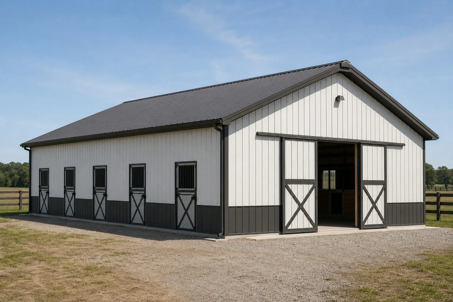
Site Planning
One State, Two Site-Prep Problems
An Arkansas horse barn's first design question depends on whether the parcel sits in the Delta or the highlands.
USGS physiographic reference material splits Arkansas roughly in two: the eastern Mississippi Alluvial Plain is low, flat, and historically flood-prone, while the Ozark Plateau and Ouachita Mountains to the west and north sit on higher, more broken ground. For a horse barn, that split matters more than for most building types, because standing water under stalls is a genuine hoof and soundness concern, not just a maintenance nuisance.
On Delta ground, the practical response is to prioritize aisle and stall drainage from the start — sloped floors, perimeter drains, and a pad raised above the surrounding grade. In the highlands, the more common problem is the opposite: getting a level barn pad and workable paddock grade on sloped terrain, which often means cut-and-fill earthwork before the barn frame arrives. Neither region rules out horse-keeping; both simply front-load a different kind of site work.
Site Selection
Siting a Horse Barn by Arkansas Region
Arkansas's physiographic split, per USGS reference material, shapes the site-prep task for a horse barn differently in each region.
Mississippi Alluvial Plain (Delta)
Low, flat ground with a documented history of flooding. Prioritize a raised, well-drained pad and perimeter drainage around the barn footprint before finalizing stall layout.
Ozark Plateau (north/northwest)
Higher, sloped terrain. Expect grading work to level the barn pad and paddock area; confirm slope tolerance for turnout areas with your site contractor.
Ouachita Mountains (west/central)
Similarly broken terrain to the Ozarks. A center-aisle barn generally needs more earthwork here than on flatter Delta or central Arkansas ground.
Preparation
Before Siting an Arkansas Horse Barn
These checks head off drainage or grading surprises once construction starts.
- Confirm your physiographic regionAsk whether the parcel sits in the Delta's Alluvial Plain or Ozark/Ouachita highland terrain before finalizing pad elevation and grading plans.
- Pull your county's FEMA hazard scoreArkansas has 75 separately-scored counties; check your specific county's flood and severe-weather profile rather than a statewide assumption.
- Plan aisle and stall drainage on Delta groundA raised, sloped floor and perimeter drainage matter more on historically flood-prone Alluvial Plain ground than on higher terrain.
- Budget grading on highland groundOzark and Ouachita sites more often need cut-and-fill earthwork to reach a level barn pad and workable paddock slope.
- Plan ridge and gable ventilation earlyHumid conditions reflected in the Little Rock climatological record make ammonia and moisture control a real design input, not an afterthought, in either region.
Get Arkansas horse barn quotes
Tell us your region — Delta or highland — stall count and acreage, and we route it with the Arkansas siting context already attached.
Footprint
Sizing an Arkansas Horse Barn
Footprint follows stall count and use; the region still governs how the pad gets prepared.
36′ × 48′
1,728 sq ft
A four-stall barn with a center aisle and small tack area, workable on either Delta or highland ground once graded.
40′ × 60′
2,400 sq ft
Adds wash-bay and hay storage space for a more active riding operation.
60′ × 120′
7,200 sq ft
A larger boarding or training layout, best suited to flatter ground or a fully graded highland pad.
Example Configuration — for planning purposes only.
Footprint pages carry stall layout and aisle detail for each size; this page covers only Arkansas siting context.
Layout
Barn Styles for Arkansas Operations
Layout choice interacts with region: a center-aisle barn asks more of highland grading than a shed-row does.
| Style | Best for | Arkansas-specific note |
|---|---|---|
| Center-aisle barn | Boarding, training, larger herds | Needs a longer level pad, which is more of an earthwork commitment on Ozark/Ouachita ground than on Delta flatland. |
| Shed-row barn | Smaller hobby herds | Individual exterior stall doors and a shorter footprint make this easier to site on sloped highland ground. |
| Run-in shed | Pasture-kept horses on larger acreage | Works well on the state's larger average 363-acre parcels; still needs a raised pad if sited on Delta ground. |
Center-aisle barn
- Best for
- Boarding, training, larger herds
- Arkansas-specific note
- Needs a longer level pad, which is more of an earthwork commitment on Ozark/Ouachita ground than on Delta flatland.
Shed-row barn
- Best for
- Smaller hobby herds
- Arkansas-specific note
- Individual exterior stall doors and a shorter footprint make this easier to site on sloped highland ground.
Run-in shed
- Best for
- Pasture-kept horses on larger acreage
- Arkansas-specific note
- Works well on the state's larger average 363-acre parcels; still needs a raised pad if sited on Delta ground.
Air Quality
Ventilation Matters More in a Humid Barn Than a Dry One
NWS Little Rock's climatological record points to humid, four-season conditions that make stall and aisle ventilation a real design decision, not an afterthought.
A center-aisle barn traps ammonia from manure and urine, along with moisture from washing, sweat and simple humidity, inside a relatively enclosed volume. In a drier climate that moisture leaves faster on its own; in Arkansas's more humid air, especially across the Delta and central part of the state where the Little Rock station sits, it tends to linger unless the barn is designed to move air through continuously.
Ridge vents, gable vents and stall windows sized to the barn's volume are the standard tools for keeping ammonia and moisture from building up, and a shed-row design with individual exterior stall doors has a natural advantage here over a fully enclosed center-aisle layout. This isn't a statewide humidity figure — this page could not confirm one — but the Little Rock record is a reasonable basis for treating ventilation as a first-order design question in either the Delta or the highlands.
Questions
Arkansas Horse Barn FAQ
Region-specific answers, with engineering, permitting and pricing questions routed to whoever actually owns them.
Yes. USGS physiographic reference material describes the Delta as low, flat, historically flood-prone ground, which pushes drainage to the top of the site-prep list, while the Ozark Plateau and Ouachita Mountains are higher and more broken, which pushes grading and pad leveling to the top instead.
No. FEMA's National Risk Index scores each of Arkansas's 75 counties separately, so check your county's specific profile rather than assuming one statewide risk level.
There's no fixed statewide rule; it depends on herd size, paddock plans and local zoning. Arkansas's average farm size was 363 acres in 2022, but many horse operations are sited on far smaller parcels — check zoning with your county directly.
We do not state a specific figure here; wind and snow requirements are set by your engineer of record and confirmed through your local building department for your exact parcel.
We do not publish state-level prices; cost depends on size, stall count, finish level and site work, including any grading or drainage your region requires. Our cost pages explain the drivers, and a builder quote covers your specific project.
Sources for the Arkansas facts on this page
This page states no code requirement, wind speed, snow load, permit rule, price or supplier claim. The state-specific facts it does use are listed with their publisher below.
The Arkansas Delta in the eastern part of the state lies within the Mississippi Alluvial Plain, a low, flat, historically flood-prone floodplain region distinct from the higher Ozark Plateau and Ouachita Mountains to the west.
U.S. Geological Survey (USGS) · Originally published 1923; USGS reference · Tier 1
https://pubs.usgs.gov/bul/0730d/report.pdfArkansas had 37,756 farms in 2022, down 11% from 2017.
USDA National Agricultural Statistics Service (NASS) · 2022 · Tier 1
https://www.nass.usda.gov/Publications/AgCensus/2022/Online_Resources/County_Profiles/Arkansas/cp99005.pdfArkansas had 13,722,525 acres of land in farms in 2022, an average farm size of 363 acres, up 12% from 2017.
USDA NASS · 2022 · Tier 1
https://www.nass.usda.gov/Publications/AgCensus/2022/Online_Resources/County_Profiles/Arkansas/cp99005.pdfFEMA's National Risk Index is an interactive county/tract-level tool covering 18 natural hazards, including tornado, riverine flooding, and earthquake, that can be queried for Arkansas's 75 counties.
Federal Emergency Management Agency (FEMA) · Current NRI release · Tier 1
https://www.fema.gov/flood-maps/products-tools/national-risk-indexArkansas's total land area was measured at 52,035.5 square miles as of the 2010 Census.
U.S. Census Bureau · 2010 Census · Tier 1
https://www.census.gov/geographies/reference-files/2010/geo/state-local-geo-guides-2010/arkansas.htmlNWS Little Rock maintains a published climatological summary document with period-of-record averages, statistics, and records for the Little Rock station.
National Weather Service (NOAA), Little Rock AR office · Period of record through most recent update · Tier 1
https://preview.weather.gov/media/lzk/clilit.pdf