
Pole barn · CO
Pole Barns in Colorado
Colorado does not have one pole barn climate; it has four physiographic regions and a code system that answers to whichever county or municipality you happen to be building in. The Colorado Geological Survey maps the Southern Rocky Mountains, the Great Plains, the Wyoming Basin and the Colorado Plateau as separate terrain provinces, and the state's Office of the State Architect confirms it has no general authority outside state-owned buildings — everything else defaults to local adoption. A pole barn brief on the eastern High Plains and one in a mountain valley are not the same project just because both say 'Colorado' on the permit application.
The intersection
There is no single 'Colorado pole barn'
Colorado's physiographic map names four separate terrain provinces, and its code system has no single statewide authority — so the honest first question is which Colorado a buyer is actually building in.
The Colorado Geological Survey's physiographic map splits the state into the Southern Rocky Mountains, the Great Plains — itself broken into High Plains, Colorado Piedmont and Raton Basin subprovinces — the Wyoming Basin, and the Colorado Plateau. That is not a scenic description; it is a working map of where soil, slope, drainage and access differ enough to change how a post-frame foundation should be laid out. A pole barn footing plan drafted for flat High Plains ground does not automatically suit a Raton Basin bench or a Rocky Mountain valley floor.
Layer elevation on top of terrain. Colorado's highest point, Mount Elbert, reaches 14,440 feet, while roughly the eastern two-fifths of the state is flat plains and the state as a whole carries the highest mean elevation of any state in the country. That range is precisely why a single wind or snow figure for 'Colorado' would be close to meaningless: conditions at 5,000 feet on the plains and conditions at 9,000 feet in a mountain valley are not comparable, and neither should be assumed for the other without site-specific confirmation.
Then there is code authority. Colorado's Office of the State Architect states plainly that its remit covers only state-owned or state-lease-purchased buildings, not private construction generally. The Department of Local Affairs' Division of Housing issues resolutions that apply only where a local jurisdiction has not already adopted its own standard — meaning the practical rule is: whatever your county or municipality has adopted governs your pole barn, and that has to be confirmed locally rather than assumed from a statewide reference.
Site context
Reading terrain by physiographic province before you fix a footprint
The Colorado Geological Survey's four-province map is a practical starting point for scoping site prep before a pole barn design is finalized.
Great Plains (including High Plains and Colorado Piedmont)
Generally flatter terrain across the eastern portion of the state, where the Colorado Geological Survey identifies subprovinces including the High Plains, the Colorado Piedmont and the Raton Basin; grading and drainage still deserve a site-specific check even where the land reads as flat.
Southern Rocky Mountains
Slope, rock and access are the recurring site-prep variables named for Colorado's mountain terrain in the state's physiographic mapping; a pole barn here should expect more site-prep planning before the frame goes up.
Colorado Plateau and Wyoming Basin
These western and northwestern provinces round out the Colorado Geological Survey's four-part map; a buyer siting a pole barn in either should ask their local building department about terrain-specific access and drainage expectations rather than assume plains-style conditions.
Get Colorado pole barn quotes
Tell suppliers your county, your parcel's terrain province and your rough footprint. We route it with the Colorado and pole barn context already attached.
Configuration
What Colorado pole barns are commonly asked to do
Terrain province tends to shape the brief as much as the buyer's stated use, since access and grading constraints differ so much across the state.
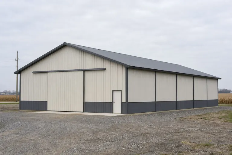 Plains equipment and hay storageFlatter Great Plains sites often prioritize clear span and door height for large implements over complex site prep.
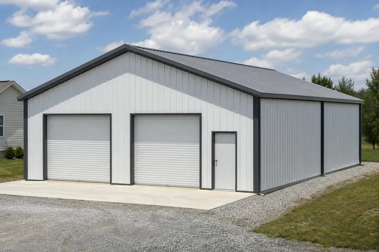 Foothill and mountain equipment coverSouthern Rocky Mountains sites more often need a grading and drainage plan resolved before the frame is even quoted.
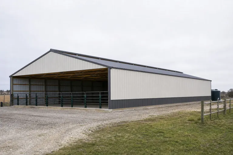 Working livestock shelterOpen or partially enclosed configurations respond differently to plains wind exposure than to mountain-valley wind patterns.
Example Configuration — for planning purposes only.
Footprint
Sizes that suit a Colorado pole barn brief
Footprint choice in Colorado tracks the parcel's terrain province and intended use more than any single statewide default.
40′ × 60′
2,400 sq ft
A workable single-purpose equipment or storage building on a smaller parcel in either the plains or foothills.
40′ × 80′
3,200 sq ft
Common where a property needs both equipment cover and feed or hay storage under one roof.
60′ × 100′
6,000 sq ft
Sized for larger equipment lines or combined livestock and equipment use on a bigger operation.
Example Configuration — for planning purposes only.
Footprint pages carry layout and door detail for each of these; this page only explains why the Colorado brief lands in this range.
Preparation
Before you request a Colorado pole barn quote
Four things resolved in advance make a Colorado quote comparable rather than a guess.
Step 1
Identify your actual permitting authority
Confirm whether your county or municipality is the office of record; Colorado has no single statewide authority for private construction.
Step 2
Get site-specific elevation and exposure data
Do not rely on a statewide snow or wind assumption; ask for conditions at your actual parcel given Colorado's mountain-to-plains range.
Step 3
Confirm which physiographic province your parcel sits in
Terrain province affects grading, drainage and access planning ahead of foundation design.
Step 4
Verify parcel and access status
With a meaningful share of Colorado land under federal management, confirm private ownership and any access easements before finalizing a site plan.
Questions
Colorado pole barn questions
Questions we can answer honestly at state level, with the rest routed to whoever actually owns them.
No. Colorado's Office of the State Architect only sets minimum codes for state-owned or state-lease-purchased buildings. Private construction, including a pole barn, is governed by whichever code your county or municipality has locally adopted.
The Colorado Geological Survey's own physiographic map treats the Southern Rocky Mountains, the Great Plains, the Wyoming Basin and the Colorado Plateau as distinct terrain provinces. We do not state specific load numbers here; ask your local building department for site-specific requirements.
The Congressional Research Service's federal land ownership dataset reported roughly 23.8 million federal acres against the state's own reported total acreage in a 2013 dataset. Confirm your own parcel's ownership and any access easements directly with your county before planning a build.
Permit requirements depend on your county or municipality. Colorado's Division of Housing rules apply only where local standards do not already exist, so your local building department is the reliable source for what applies to your parcel.
No single figure applies statewide. Colorado's elevation ranges from flat eastern plains to Mount Elbert's 14,440-foot summit, and the state has the highest mean elevation of any state, so snow exposure varies sharply by site. Confirm load requirements with your local building department.
Sources for the Colorado facts on this page
This page states no code requirement, wind speed, snow load, permit rule, price or supplier claim. The state-specific facts it does use are listed with their publisher below.
The Colorado Geological Survey's physiographic map divides the state into the Southern Rocky Mountains, the Great Plains (with High Plains, Colorado Piedmont, and Raton Basin subprovinces), the Wyoming Basin, and the Colorado Plateau.
Colorado Geological Survey · current reference map · Tier 2
https://coloradogeologicalsurvey.org/wp-content/uploads/ON-010-09-04.pdfColorado's highest point, Mount Elbert, reaches 14,440 feet elevation (NAVD 88), reflecting the extreme high-mountain-to-plains elevation range relevant to mountain snow load versus valley/plains conditions.
Wikipedia (cross-referencing USGS elevation data) · current · Tier 1
https://en.wikipedia.org/wiki/Mount_ElbertColorado is described as having the highest mean elevation of any U.S. state and contains 54 peaks above 14,000 feet, with the eastern two-fifths of the state being flat plains, underscoring the mountain-vs-plains contrast for snow and wind exposure.
NETSTATE.com (general geography reference) · current reference page · Tier 2
https://www.netstate.com/states/geography/co_geography.htmColorado has no single statewide building code agency for general construction; the state's Office of the State Architect only sets minimum codes for state-owned/state-lease-purchased buildings, while other construction is subject to local adoption per the Division of Housing and Colorado's Planning for Hazards program.
Colorado Office of the State Architect; Colorado Department of Local Affairs, Division of Housing · current, accessed 2024/2025 · Tier 2
https://osa.colorado.gov/building-codesColorado has no single statewide building code agency for general construction; the state's Office of the State Architect only sets minimum codes for state-owned/state-lease-purchased buildings, while other construction is subject to local adoption per the Division of Housing and Colorado's Planning for Hazards program.
Colorado Office of the State Architect; Colorado Department of Local Affairs, Division of Housing · current, accessed 2024/2025 · Tier 2
https://osa.colorado.gov/building-codesCRS's federal land ownership dataset lists Colorado federal acreage at roughly 23.8 million acres (2013 data) against total state acreage of approximately 23.6 million acres reported in the same table (figures should be read alongside the report's narrative, as western-state totals were affected by year-to-year BLM/DOD adjustments).
Congressional Research Service · data as of FY2013, report dated March 3, 2017 · Tier 1
https://www.everycrsreport.com/files/20170303_R42346_95ce191e74ed8e08054bb5476971544bc55823f2.html