
Barndominium · WV
Barndominiums in West Virginia
A West Virginia barndominium project starts with the ground, not the floor plan. Between the Appalachian (Allegheny) Plateau and the Valley and Ridge province, level, well-drained building pads are the exception rather than the rule, and a band of counties in the east — Greenbrier, Pocahontas, Randolph, Monroe among them — sit on mapped karst terrain where subsurface voids change how a slab gets engineered. Layer on a farm base that has shrunk to 3,549,104 acres across 22,787 farms, an average of 156 acres each, and the practical question stops being 'what does a barndominium cost' and starts being 'where on this specific parcel can one actually sit.'
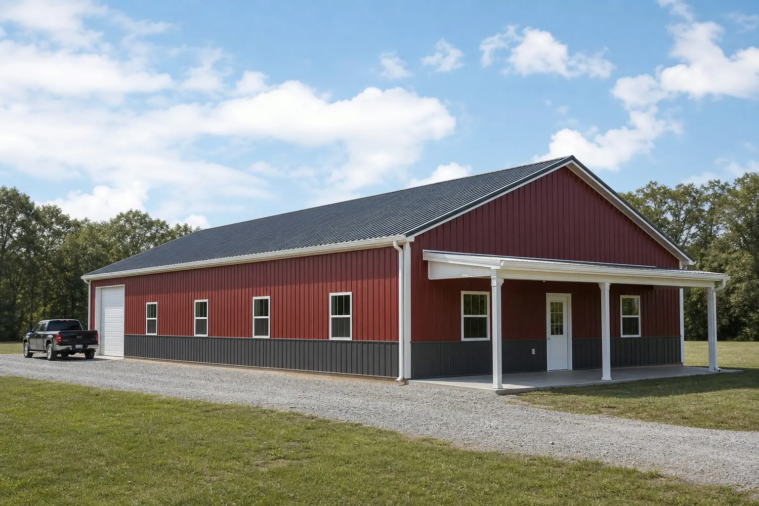
Where you can actually build
Two provinces, one hard siting question
West Virginia's Geological and Economic Survey identifies two dominant physiographic provinces plus a sliver of a third, and each behaves differently under a barndominium foundation.
The Appalachian (Allegheny) Plateau covers much of the state and is defined by steep ridges and narrow valleys, while the Valley and Ridge province to the east alternates long parallel ridgelines with flatter valley floors. WVGES also notes a very small portion of a third province, the Blue Ridge, in the state's easternmost corner. For a barndominium buyer, the practical consequence is that 'find a flat spot' is rarely the whole plan — most West Virginia parcels require some combination of cut-and-fill grading, retaining structure, or a walk-out foundation design to get a level pad under the building.
This matters more for a barndominium than for a simple ag building because residential occupancy adds egress, insulation and fire-separation requirements on top of the structural shell. A grading plan that would be acceptable for an equipment shed on a hillside often is not acceptable once people are living inside, since exit paths and accessible grading around doors become part of the review.
None of this is a reason to avoid sloped sites — many West Virginia barndominiums are built successfully on graded hillside pads with walk-out lower levels. It is a reason to walk the specific parcel with a site contractor and your county building department before committing to a floor plan sized for flat ground.
County-level risk
Karst terrain in specific eastern counties
WVGES has mapped karst terrain — landscape shaped by dissolving limestone — across a defined set of West Virginia tax districts, concentrated in specific named counties.
Greenbrier, Pocahontas, Randolph and Monroe counties
WVGES documentation identifies these among the counties containing mapped karst terrain in the limestone-rich Valley and Ridge and eastern Appalachian Plateau. A barndominium slab in these counties benefits from confirming there are no known sinkholes or subsurface voids on the specific building pad before finalizing a foundation design.
Non-karst Appalachian Plateau counties
Elsewhere on the Plateau, the primary site concern shifts from subsurface voids to slope stability and drainage — cut-and-fill grading and retaining structures are the more common budget line than a geotechnical karst survey.
Valley and Ridge lowland floors
The flatter valley floors within the Valley and Ridge province are often the most buildable ground in this province, but they can also sit closer to streams draining the surrounding ridges, which makes drainage planning worth confirming alongside grading.
Parcel scale
Designing for a 156-acre average farm
West Virginia's farm base has both shrunk and stayed relatively small compared to some neighboring Appalachian states, which shapes how a combined home-and-shop building gets programmed.
The 2022 Census of Agriculture counted 22,787 farms in West Virginia, down from 23,622 in 2017, spread across 3,549,104 acres for an average of 156 acres per farm. That is a meaningfully tighter parcel than the large multi-hundred-acre operations common in some Midwest or Southern states, which changes the barndominium brief: rather than one of several buildings on a sprawling property, the barndominium is frequently the single structure that has to hold the residence, the equipment bay, and general storage together.
On a 156-acre parcel with genuine slope, that consolidation pressure meets the terrain constraint from the sections above. The buildable footprint on many West Virginia sites is smaller than the buyer's wish list, which makes early siting — before a floor plan is finalized — the highest-leverage planning step on this specific intersection of type and state.
- Site before you design
- Confirm the buildable pad size and slope on your specific 156-acre-or-smaller parcel before committing to a footprint.
- Plan combined use deliberately
- If the barndominium is the only structure on the property, separate 'clean' living space from 'dirty' shop space with real partitions from day one.
Start Your West Virginia Barndominium Quote
Tell us your county and rough parcel slope; we route your quote request with West Virginia siting context already attached.
Scale
Footprints that fit a graded West Virginia pad
Given the state's terrain constraints, West Virginia barndominium footprints tend to skew toward buildable-pad-friendly rectangles rather than the largest available combined shells.
30′ × 50′
1,500 sq ft
A compact combined home-and-shop footprint that fits on a smaller graded pad without extensive additional cut-and-fill.
40′ × 60′
2,400 sq ft
A common mid-size split between roughly half living space and half shop or garage, workable on many Valley and Ridge valley-floor sites.
40′ × 80′
3,200 sq ft
A larger combined footprint best suited to flatter Appalachian Plateau or valley-floor parcels where grading costs are lower.
Example Configuration — for planning purposes only.
The right footprint depends on the graded pad your site can actually support, not just the acreage on the deed.
Planning
Before finalizing a West Virginia barndominium site
These steps address the terrain and permitting realities specific to West Virginia.
- Confirm your county's karst statusIf your parcel is in Greenbrier, Pocahontas, Randolph, Monroe or another WVGES-mapped karst tax district, request a subsurface check before fixing the slab location.
- Get a grading estimate earlyOn Appalachian Plateau or Valley and Ridge slopes, cut-and-fill and retaining costs can rival the shell cost; price this before finalizing the footprint.
- Pull your county's FEMA NRI scoreFEMA's National Risk Index rates all 55 West Virginia counties individually; check your specific county rather than assume a statewide hazard level.
- Verify residential permitting with your countyResidential occupancy standards and permit thresholds are set locally; confirm requirements with your county building department before ordering a shell.
Common Questions
West Virginia Barndominium FAQ
Honest answers for West Virginia metal home buyers.
Not a problem, but a planning variable. Most of the state sits on the Appalachian Plateau or Valley and Ridge provinces, both of which typically require grading, retaining structures, or a walk-out design to create a level foundation pad, so site work is a bigger part of the budget conversation than in flatter states.
Only if your county is one of the karst-mapped areas WVGES has documented, such as Greenbrier, Pocahontas, Randolph or Monroe. If so, a basic subsurface check before finalizing your slab location is a reasonable precaution; elsewhere it's a lower priority.
The 2022 Census of Agriculture put the statewide average farm size at 156 acres. Your specific parcel may be larger or smaller, but that average is a useful reference point for how much buildable, gradeable land a project typically has to work with.
We don't assert a single statewide code answer here. Permit thresholds and residential-occupancy standards are administered locally; confirm the applicable code edition and permit process with your county building department.
FEMA's National Risk Index provides county- and tract-level hazard scores across 18 hazard types for all 55 West Virginia counties. Look up your specific county rather than relying on a general statewide impression.
Sources for the West Virginia facts on this page
This page states no code requirement, wind speed, snow load, permit rule, price or supplier claim. The state-specific facts it does use are listed with their publisher below.
The West Virginia Geological and Economic Survey states that West Virginia mainly has two major physiographic provinces, the Appalachian (Allegheny) Plateau and the Valley and Ridge, plus a very small portion of a third, the Blue Ridge province.
West Virginia Geological and Economic Survey (WVGES) · Reference material, current · Tier 2
https://www.wvgs.wvnet.edu/www/maps/pprovinces.htmWVGES maps karst terrain across multiple West Virginia tax districts, concentrated in the state's limestone-rich Valley and Ridge and eastern Appalachian Plateau counties (e.g., Greenbrier, Pocahontas, Randolph, Monroe).
West Virginia Geological and Economic Survey (WVGES) · WVGES reference mapping · Tier 2
https://www.wvgs.wvnet.edu/www/geology/docs/WV_Tax_Districts_Containing_Karst_Terrain.pdfWest Virginia had 22,787 farms in 2022, down from 23,622 farms in 2017.
USDA National Agricultural Statistics Service (NASS) · 2022 (with 2017 comparison) · Tier 1
https://www.nass.usda.gov/Publications/AgCensus/2022/Full_Report/Volume_1,_Chapter_1_State_Level/West_Virginia/st54_1_001_001.pdfWest Virginia had 3,549,104 acres of land in farms in 2022, an average farm size of 156 acres.
USDA NASS · 2022 · Tier 1
https://www.nass.usda.gov/Publications/AgCensus/2022/Full_Report/Volume_1,_Chapter_1_State_Level/West_Virginia/st54_1_001_001.pdfWest Virginia builders and developers were authorized (by building permit) to build 4,192 total new privately-owned housing units in 2024 (3,515 in single-family buildings, 50 in 2-unit buildings, 44 in 3-4 unit buildings, and 583 in buildings of 5+ units), following a 17.9% year-over-year increase from 3,406 units in 2022 to 4,014 units in 2023.
U.S. Census Bureau · 2022-2024 · Tier 1
https://www2.census.gov/econ/bps/State/st2024a.txtCharleston Yeager Airport's 1991-2020 annual climate normal precipitation is 46.24 inches with an annual normal snowfall of 31.5 inches.
NOAA National Centers for Environmental Information (NCEI) · 1991-2020 · Tier 1
https://www.ncei.noaa.gov/access/services/data/v1?dataset=normals-annualseasonal-1991-2020&dataTypes=ANN-PRCP-NORMAL,ANN-SNOW-NORMAL&stations=USW00013866&format=jsonFEMA's National Risk Index tool provides county- and tract-level composite and hazard-specific risk scores for all 55 of West Virginia's counties across 18 natural hazard types.
Federal Emergency Management Agency (FEMA) · Current NRI release · Tier 1
https://www.fema.gov/flood-maps/products-tools/national-risk-index