
Storage building · TN
Storage Buildings in Tennessee
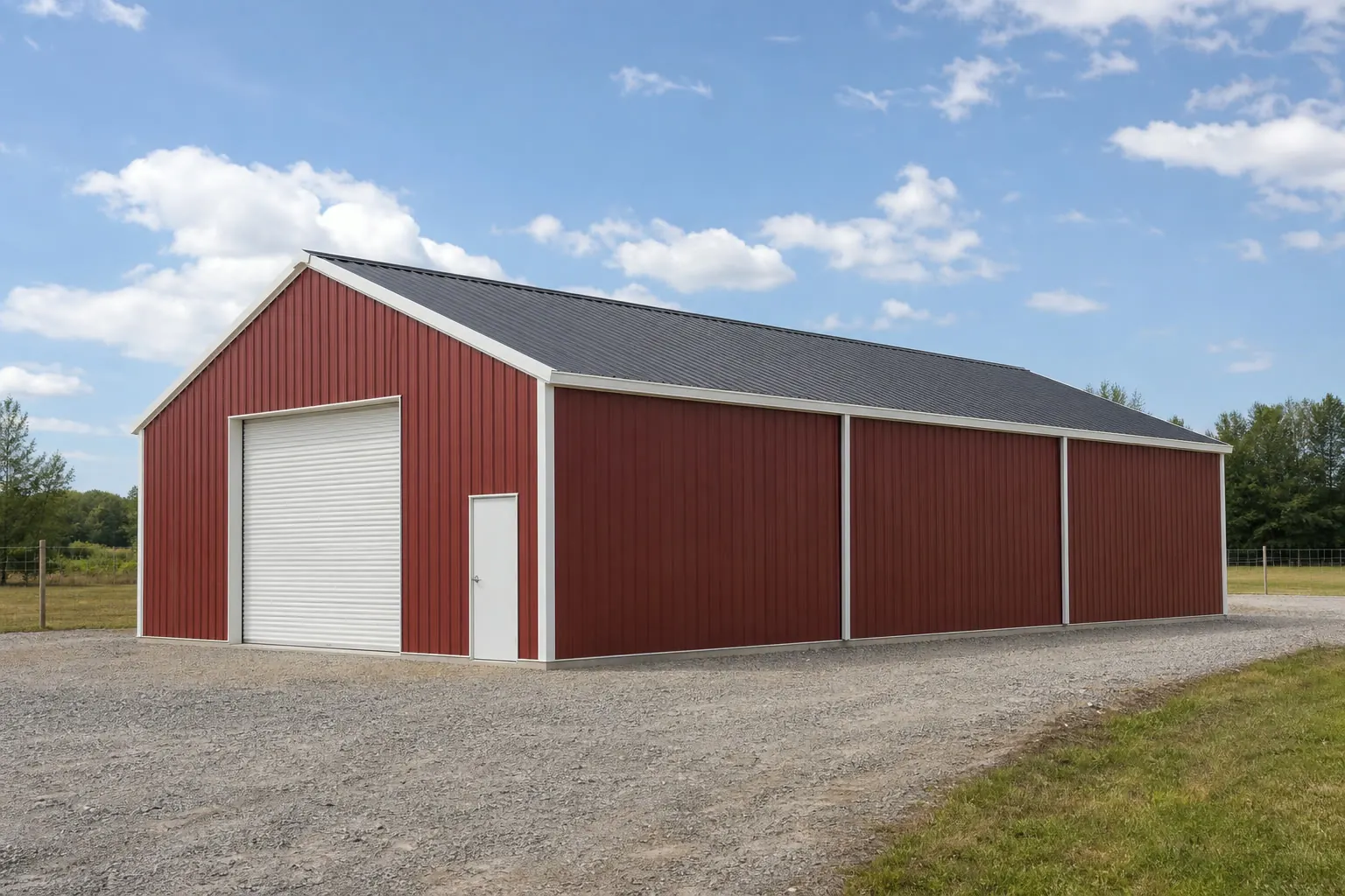
A storage building in Tennessee is shaped less by a single statewide climate profile than by where on the state's long, geologically varied axis the parcel sits and what kind of operation it needs to support. The Tennessee Encyclopedia records that the state's long east-west span crosses most of the geological provinces found in the east-central United States, and the state's own Division of Geology has documented the Cumberland Plateau overthrust in enough detail to make site-specific ground checks a real planning step in that region. At the same time, UT Extension's Center for Profitable Agriculture has been tracking a shift toward value-added and specialty crop production statewide, which changes what a storage building is actually asked to hold. This page works through both factors as they apply to a storage building project in Tennessee.
Ground Conditions
Why the ground under a Tennessee storage building varies so much
Tennessee's long east-west axis means a storage building's foundation question is a location question first.
The Tennessee Encyclopedia's Geologic Zones entry describes the state as a narrow band stretching more than 500 miles east-west, with that axis crossing the underlying geological grain rather than running along it, so most of the geological provinces found across the east-central United States appear somewhere within Tennessee. For a storage building, this means the same 30x50 footprint can sit on genuinely different ground depending on where in the state the lot falls, and a single default foundation spec is a poor fit for a state this geologically varied.
The clearest documented example is the Cumberland Plateau. The Tennessee Division of Geology, now the Tennessee Geological Survey, has published detailed studies of the Cumberland Plateau overthrust and the Crab Orchard Mountains area, describing the region's overthrust geologic structure. A storage building sited in or near this formation is a reasonable candidate for a site-specific geotechnical check before the foundation type is finalized, since a gravel pad or slab spec that works on flatter, more uniform ground elsewhere in the state may not perform the same way here.
None of this replaces a local soil test. It is instead a reason to ask for one: confirm which of the state's geological provinces your parcel sits in, and treat that answer as an input to the foundation decision rather than an afterthought.
Use Case
What Tennessee storage buildings are increasingly asked to hold
UT Extension's own tracking of the state's agricultural shift changes what a storage building is designed around.
Value-added agriculture
The University of Tennessee Institute of Agriculture's Center for Profitable Agriculture published an analysis of 2022 Census of Agriculture data specifically covering value-added agriculture trends in Tennessee, indicating this is an active and tracked part of the state's farm economy.
Specialty crop production
That same UT Extension analysis covers specialty crop production trends, which often calls for a storage building configured for shorter-term, higher-turnover use rather than long-term bulk equipment storage.
Confirming your county's farm profile
USDA NASS's Tennessee 2022 Census by State landing page is the official source for a specific county's farm count, land-in-farms, and average size; use it, or a local UT Extension office, to size a storage building against your actual county rather than a statewide assumption.
Hazard Awareness
Checking hazard exposure before you site the building
FEMA's National Risk Index is the right tool for county-level hazard exposure, and it is one this page routes to rather than summarizes with a single statewide number.
FEMA's National Risk Index provides county- and tract-level scoring for natural hazards, including categories such as tornado, severe storm, and riverine flooding that are relevant to Tennessee. A state-specific narrative naming Tennessee's leading hazards directly from FEMA was not retrieved for this pack, so this page does not assert a single statewide hazard ranking. What it does recommend is using the NRI's interactive tool to check your specific county and tract before finalizing a storage building's site and anchoring method.
This matters because a storage building's exposure risk is a site decision, not a brand or product decision: two identical buildings placed in different counties can face materially different tornado or flood exposure according to the NRI's own scoring. Pulling that county-level data before construction is a low-cost step relative to the cost of relocating or reinforcing a structure after the fact.
- Pull your county's NRI score
- Use FEMA's National Risk Index tool directly rather than assuming a single statewide hazard level.
- Match anchoring to the site, not the region
- A gravel pad that performs well on flatter western ground may need a different anchoring approach on a Cumberland Plateau site.
- Ask your local department about wind and snow design values
- This pack could not confirm statewide adopted wind or snow figures, so those values should come from your local building department.
Get your Tennessee storage building quote
Talk to suppliers who can size a storage building for your county's soil, hazard exposure, and farm-use needs.
Dimensions
Common Tennessee storage building footprints
Footprints that fit typical Tennessee agricultural and residential storage needs.
12′ × 24′
288 sq ft
A compact residential shed footprint for tools and seasonal equipment.
24′ × 30′
720 sq ft
A common two-bay footprint sized for a tractor plus general equipment storage.
30′ × 50′
1,500 sq ft
A larger footprint suited to combining bulk storage with a value-added processing or packing bay.
Example Configuration — for planning purposes only.
Measure the widest equipment or the largest batch of processed product you expect to store before fixing a final width.
Foundation Planning
Matching the foundation to Tennessee's regional ground
The right foundation for a Tennessee storage building depends on which of the state's geological zones the parcel sits in.
| Foundation type | Best suited for | Tennessee-specific consideration |
|---|---|---|
| Compacted gravel pad | Light equipment and seasonal storage on stable, flatter ground | A reasonable choice on the western lowlands, but still needs a crowned surface and edge drainage for regional rain events. |
| Reinforced concrete slab | Heavier machinery or value-added processing equipment needing a clean, level surface | Worth pairing with a site-specific geotechnical check near documented Cumberland Plateau overthrust ground. |
| Post-frame on treated skids | Elevated bulk or specialty crop storage kept off damp ground | Useful where keeping stored product above grade matters more than year-round heavy vehicle access. |
Compacted gravel pad
- Best suited for
- Light equipment and seasonal storage on stable, flatter ground
- Tennessee-specific consideration
- A reasonable choice on the western lowlands, but still needs a crowned surface and edge drainage for regional rain events.
Reinforced concrete slab
- Best suited for
- Heavier machinery or value-added processing equipment needing a clean, level surface
- Tennessee-specific consideration
- Worth pairing with a site-specific geotechnical check near documented Cumberland Plateau overthrust ground.
Post-frame on treated skids
- Best suited for
- Elevated bulk or specialty crop storage kept off damp ground
- Tennessee-specific consideration
- Useful where keeping stored product above grade matters more than year-round heavy vehicle access.
Questions
Tennessee Storage Building FAQ
Direct answers for Tennessee storage building projects.
Given the Tennessee Division of Geology's documentation of the overthrust structure in that region, a site-specific geotechnical check is a reasonable precaution before finalizing a foundation type there, even though it is not required in every case.
We don't assert a single statewide hazard ranking; FEMA's National Risk Index scores hazards like tornado, severe storm, and riverine flooding by county and tract, so checking your specific county is the accurate way to answer this.
A meaningful share of demand here is tied to UT Extension's tracked growth in value-added agriculture and specialty crop production, which pulls processing-adjacent storage needs into the design in addition to standard equipment storage.
Permit thresholds vary by county and city; there is no single statewide figure confirmed here. Your local building department is the correct source for the size and use thresholds that trigger a permit in your jurisdiction.
A reinforced concrete slab is generally preferred for heavier processing equipment needing a clean, level surface, though the right choice still depends on your county's soil conditions and hazard exposure.
Yes. The state's long east-west span crosses most of the east-central United States' geological provinces, so a foundation and siting approach appropriate on the western lowlands is not a safe assumption for a Cumberland Plateau or eastern-highlands parcel.
Sources for the Tennessee facts on this page
This page states no code requirement, wind speed, snow load, permit rule, price or supplier claim. The state-specific facts it does use are listed with their publisher below.
The Tennessee Division of Geology (State of Tennessee, Department of Conservation) has published detailed geologic studies of the Cumberland Plateau overthrust and the Crab Orchard Mountains area, documenting the geologic structure of the Cumberland Plateau region in the state.
Tennessee Department of Conservation, Division of Geology (now Tennessee Geological Survey) · Originally published 1954; state agency archival document · Tier 2
https://www.tn.gov/content/dam/tn/environment/geology/documents/geology_bulletin-60txt.pdfThe Tennessee Encyclopedia's Geologic Zones entry notes Tennessee is a narrow state over 500 miles long, with its long east-west axis crossing the grain of the underlying geology, so that most of the geological provinces of the east-central United States are represented somewhere within the state.
Tennessee Historical Society / Tennessee Encyclopedia · Reference entry · Tier 2
https://tennesseeencyclopedia.net/entries/geologic-zones/The University of Tennessee Institute of Agriculture's Center for Profitable Agriculture published an analysis of 2022 Census of Agriculture data covering value-added agriculture and specialty crop production trends in Tennessee.
University of Tennessee Institute of Agriculture, Center for Profitable Agriculture · 2022 Census, published June 2024 · Tier 2
https://cpa.tennessee.edu/wp-content/uploads/sites/106/2024/07/CPA436.pdfUSDA NASS's 2022 Census by State page provides direct access to Tennessee's state-level farm count, land-in-farms, and average farm size tables as part of the 2022 Census of Agriculture.
USDA National Agricultural Statistics Service (NASS) · 2022 · Tier 1
https://www.nass.usda.gov/Census_by_State/Tennessee/FEMA's National Risk Index is the federal tool providing county- and tract-level natural hazard risk scoring (including tornado, severe storm, and riverine flooding categories relevant to Tennessee) for all Tennessee counties; a state-specific hazard narrative directly from FEMA was not retrieved in this session.
Federal Emergency Management Agency (FEMA) · Current NRI release · Tier 1
https://www.fema.gov/flood-maps/products-tools/national-risk-index