
Pole barn · IL
Pole Barns in Illinois
Illinois carried 71,123 farms in the 2022 Census of Agriculture, averaging 370 acres each across more than 26 million acres of farmland — a large, genuinely active working-farm base and the core audience for equipment and grain storage pole barns. What's easy to miss is that Illinois does not have one uniform site-risk profile to plan around. FEMA does not publish a single statewide severe-weather ranking for Illinois; instead, its National Risk Index scores 18 named hazards at the county and census-tract level, which is the honest, citable way to compare relative exposure between, say, a pole barn site near the Mississippi River bottomlands and one on the state's central till plain. Add in the Illinois State Geological Survey's twelve named physiographic divisions, and a pole barn buyer in this state has two separate, real reasons to ask locally specific questions rather than plan from a single statewide assumption.
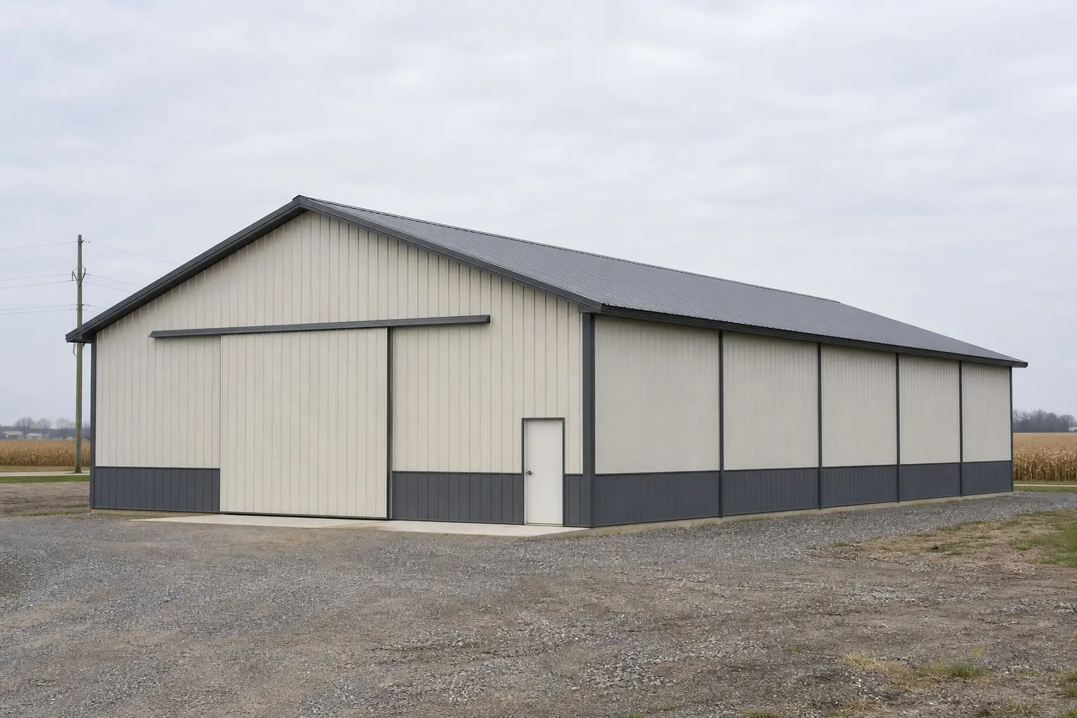
Agricultural base
A working-farm state at real scale
71,123 farms averaging 370 acres each is the audience a pole barn is built for, and Illinois has that base at genuine scale.
The 2022 Census of Agriculture counted 71,123 farms in Illinois across more than 26 million acres of farmland, a decline of 2% in farm count since 2017 but still a large, active agricultural base. At an average of 370 acres per farm, a meaningful share of that acreage is being actively worked, which is the direct market for equipment storage, grain handling and machinery-shelter pole barns rather than smaller hobby-farm structures.
That scale matters for sizing conversations. A working operation on several hundred acres is generally planning storage around specific equipment — a combine, grain cart, sprayer, or a full tillage lineup — rather than a single vehicle, which is why pole barn clear-span width and door height tend to be driven by the largest piece of equipment on the operation, not by a generic size guide.
Sourced figures
Illinois agriculture and land at a glance
These sourced figures anchor the farm-scale claims made on this page.
| Metric | Value | Source |
|---|---|---|
| Total farms, 2022 | 71,123 (down 2% since 2017) | USDA NASS |
| Land in farms, 2022 | 26,292,041 acres | USDA NASS |
| Average farm size | 370 acres | USDA NASS |
| Total land area | 55,518.9 sq mi | U.S. Census Bureau |
| Named physiographic divisions | 12 sections (ISGS reference map) | Illinois State Geological Survey |
Total farms, 2022
- Value
- 71,123 (down 2% since 2017)
- Source
- USDA NASS
Land in farms, 2022
- Value
- 26,292,041 acres
- Source
- USDA NASS
Average farm size
- Value
- 370 acres
- Source
- USDA NASS
Total land area
- Value
- 55,518.9 sq mi
- Source
- U.S. Census Bureau
Named physiographic divisions
- Value
- 12 sections (ISGS reference map)
- Source
- Illinois State Geological Survey
Site risk
Why there's no single 'Illinois hazard' to design around
FEMA does not publish one statewide severe-weather ranking for Illinois; its National Risk Index instead compares county and tract-level exposure across 18 named hazards.
It would be convenient to point to a single Illinois hazard — tornado risk, say, or riverine flooding — and design every pole barn around it. FEMA does not support that shortcut for this state. Its National Risk Index is an interactive tool that scores 18 natural hazards, including tornado, hail, riverine flooding and severe winter weather, at the county and census-tract level rather than publishing a single statewide ranking narrative. For a buyer comparing two candidate sites, the honest approach is to pull each county's or tract's relative NRI scores directly from FEMA's tool rather than rely on a generalized statewide claim.
This is a relative comparison tool, not a source of structural design values. A county with a higher relative tornado or wind score on the NRI does not translate into a specific wind speed for your pole barn's engineering; that number comes from your local building department and the adopted code edition in force there. What the NRI is useful for is deciding where on a larger parcel to site a pole barn that will shelter livestock, and whether a safe-room or reinforced corner is worth discussing with your builder given the county's relative exposure.
Illinois's terrain variety compounds this. A pole barn site in the Green River Lowland has different drainage behavior than one on the Springfield Plain or in the Shawnee Hills Section further south, and a pad-prep plan should reflect the named physiographic division the site sits in rather than a single statewide assumption about soil and grading.
The Chicago Midway station's published climate normal, for example, shows lake-effect-influenced snowfall specific to that location near Lake Michigan — a real, sourced figure for that station, but not one that should be extrapolated to a pole barn site in central or southern Illinois, hundreds of miles from the lake's moderating and snow-enhancing effect.
Planning a pole barn build in Illinois
Tell us your target footprint, primary use and general area of the state. We route it with the Illinois and pole-barn context already attached.
Site context
Illinois terrain, grouped for pole-barn siting
The ISGS's twelve named divisions group into a few practical bands worth discussing with a site contractor.
Northeast lowland and lake plain
Lake-influenced ground near Chicago, where drainage and the station-specific lake-effect snowfall pattern deserve early attention.
Northern hill and driftless country
More varied, rolling terrain in the Rock River Hill Country and Wisconsin Driftless Section, where excavation needs can exceed a flat-plain estimate.
Central plains
The state's most extensive flat-to-gently-rolling ground, generally the more straightforward pad-prep condition among Illinois's named sections and home to much of the state's working farmland.
Southern hill country
The Mt. Vernon Hill Country, Shawnee Hills Section and Lincoln Hills toward the state's southern tip, where slope and site-specific grading are worth budgeting for.
Configuration
How Illinois pole barns tend to get used
With farms averaging 370 acres, most Illinois pole barn programs are sized around active equipment and storage needs rather than hobby use.
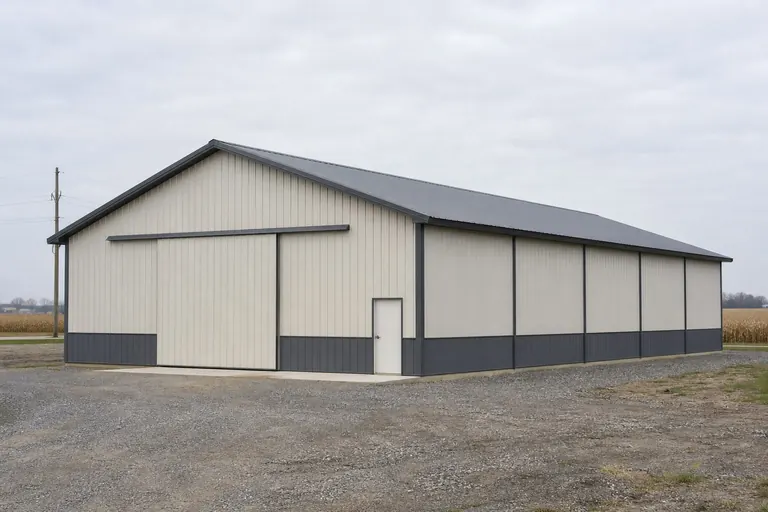 Equipment and machinery storageClear-span width and door height sized to the operation's largest implement, common across Illinois's row-crop counties.Grain and input storageA dedicated structure for bagged inputs, parts and seasonal equipment rotation alongside grain-handling infrastructure.Livestock shelterA structure where the county's relative hazard exposure, checked via FEMA's National Risk Index, informs siting and any added shelter features.
Example Configuration — for planning purposes only.
Footprint
Sizes common for an Illinois farm pole barn
Sizing should follow the specific equipment or storage need on your operation rather than a generic statewide figure.
30′ × 50′
1,500 sq ft
A starting size for a smaller operation's equipment and general storage.
40′ × 60′
2,400 sq ft
A frequent size where a single large implement plus general storage share the space.
60′ × 100′
6,000 sq ft
Larger clear-span option for a full equipment lineup on a bigger operation.
60′ × 120′
7,200 sq ft
An upper-end footprint for combined equipment, grain-adjacent and general farm storage.
Example Configuration — for planning purposes only.
Confirm door height and clear-span against your tallest or widest equipment, not just floor footprint.
Questions
Illinois pole barn questions
Answered directly, with structural and permit numbers routed to the local building department.
Illinois's scale supports it: 71,123 farms averaging 370 acres each across more than 26 million acres of farmland is a genuinely active working-farm base, which is the core audience for equipment and grain storage pole barns.
There is no single statewide answer. FEMA's National Risk Index scores 18 hazards at the county and tract level rather than ranking one hazard for the whole state, so the honest approach is to check your specific county's relative scores through FEMA's tool.
It can. The Illinois State Geological Survey names twelve physiographic divisions with different terrain characteristics, from lowland ground near Chicago to hill country in the north and south and flatter central plains in between.
This page does not state a specific figure; no single statewide value applies evenly across a state this size and this varied in terrain. Your local building department will supply the design values for your exact site.
We could not confirm a single statewide frost-line depth figure from a NOAA/NWS or state extension source, so this is a question for your local building department, which sets footing depth requirements for your specific location.
We do not publish state-level prices, because the number depends on size, specification, site work and current material and labor pricing. Our cost pages cover what drives the number; a builder quote covers your specific project.
Sources for the Illinois facts on this page
This page states no code requirement, wind speed, snow load, permit rule, price or supplier claim. The state-specific facts it does use are listed with their publisher below.
Illinois had 71,123 farms in 2022, a decrease of 2% since 2017.
USDA National Agricultural Statistics Service (NASS) · 2022 · Tier 1
https://www.nass.usda.gov/Publications/AgCensus/2022/Online_Resources/County_Profiles/Illinois/cp99017.pdfIllinois had 26,292,041 acres of land in farms in 2022, an average farm size of 370 acres.
USDA NASS · 2022 · Tier 1
https://www.nass.usda.gov/Publications/AgCensus/2022/Online_Resources/County_Profiles/Illinois/cp99017.pdfFEMA's National Risk Index is an interactive county/tract-level tool covering 18 natural hazards (including tornado, hail, riverine flooding, and severe winter weather relevant to the Midwest); FEMA does not publish a single-number statewide 'top hazard' ranking narrative for Illinois on fema.gov, so county/tract-level NRI queries are the citable source.
Federal Emergency Management Agency (FEMA) · Current NRI release · Tier 1
https://www.fema.gov/flood-maps/products-tools/national-risk-indexThe Illinois State Geological Survey maps the state into named physiographic divisions including the Till Plains, Wisconsin Driftless Section, Rock River Hill Country, Green River Lowland, Great Lake Section (Chicago Lake Plain), Kankakee Plain, Springfield Plain, Galesburg Plain, Bloomington Ridged Plain, Mt. Vernon Hill Country, Shawnee Hills Section, and Lincoln Hills.
Illinois State Geological Survey, University of Illinois · ISGS reference map, 1993 (revised 1998), originally based on Leighton et al. 1948 · Tier 2
https://clearinghouse.isgs.illinois.edu/data/geology/physiographic-divisionsIllinois's total land area was measured at 55,518.9 square miles as of the 2010 Census.
U.S. Census Bureau · 2010 Census · Tier 1
https://www.census.gov/geographies/reference-files/2010/geo/state-local-geo-guides-2010/illinois.htmlChicago Midway Airport's 1991-2020 annual climate normal is roughly 36-38 inches of precipitation with substantial lake-effect-influenced snowfall totals published by NOAA NCEI for the official station.
NOAA National Centers for Environmental Information (NCEI) · 1991-2020 · Tier 1
https://www.ncei.noaa.gov/access/services/data/v1?dataset=normals-annualseasonal-1991-2020&startDate=0001-01-01&endDate=9996-12-31&stations=USW00014819&format=pdf