
Barndominium · HI
Barndominiums in Hawaii
A barndominium's core promise — full residential living plus a working shop or storage bay under one steel roof — depends on having land to put it on, and Hawaii's farmland base has been shrinking for years: USDA counted 7,000 farms in 2012, 7,328 in 2017, and 6,569 by 2022, a 10 percent drop in that latest five-year span. That land also sold ranking Hawaii 46th of 50 states in agricultural product sales in 2022, which tells a buyer the working side of a Hawaii barndominium is more likely to be a homestead, nursery plot or small diversified operation than a large commodity farm. Whatever the acreage, every parcel sits on ground that USGS classifies as volcanic in origin, and rainfall varies so sharply from one side of an island to the other that a single statewide climate figure cannot describe the roof and drainage decisions ahead.
The Hawaii Context
A barndominium on a shrinking farm base
Hawaii's working-land inventory has been contracting for a decade, which reshapes what a combined home-and-shop building is realistically paired with.
USDA's Census of Agriculture recorded 7,000 Hawaii farms in 2012, 7,328 in 2017, and 6,569 by 2022 — growth, then a 10 percent decline in the latest five-year window, alongside a 7 percent drop in total acres in farms. A barndominium buyer planning to pair a residence with a working shop, feed storage or a small growing operation should read that trend as a reason to confirm actual available acreage on their specific parcel rather than assume the large-lot norms common in bigger mainland agricultural states.
The scale of Hawaii's agricultural economy reinforces the same point: the 2022 Census ranked Hawaii 46th of 50 states in total agricultural product sales. That does not mean farming is absent — it means the typical Hawaii operation attached to a barndominium is more likely to be a smaller diversified crop, nursery, or homestead-scale setup than a commodity farm sized to justify a very large equipment bay.
None of this determines your specific site. It is a reason to have an honest conversation with your builder about how much working space the barndominium's shop side actually needs, sized to your parcel and your intended use rather than a generic mainland template.
Foundation Planning
Designing for volcanic ground, island by island
A barndominium foundation plan in Hawaii should follow the specific island and parcel's rock or soil condition, not a single statewide assumption.
Big Island (island of Hawaii)
USGS mapping puts this island at 4,030 square miles with active volcanic terrain ranging from near-sea-level lava flow to high elevation on Mauna Loa and Mauna Kea; ground condition can vary sharply within a short distance.
Leeward sites statewide
Generally drier, per reference stations like Honolulu Airport, but drainage planning should still follow a site-specific check rather than that single station's normal.
Windward and upland sites
NWS notes Hawaii rainfall varies sharply by elevation and exposure, so a barndominium here should plan roof and grading drainage for a wetter profile than a leeward reference figure would suggest.
All islands
Every site sits on ground USGS classifies as volcanic rock or derived volcanic soil, so a geotechnical check before the slab is poured is a genuinely useful step regardless of location.
Hazard Exposure
Checking hazard exposure before you finalize siting
FEMA's National Risk Index is the right tool for a Hawaii barndominium buyer to check tsunami and volcanic activity exposure at the parcel level.
Because a barndominium is a full-time residence, not an outbuilding, hazard exposure deserves the same attention as it would for any Hawaii home. FEMA's National Risk Index platform is built to be queried by county and census tract, and tsunami and volcanic activity are among the hazard categories tracked for Hawaii specifically, alongside the other 16 hazard types the tool scores nationally.
This page does not assign a hazard score to any specific parcel — that lookup belongs to the buyer and their local emergency management office — but treating it as a step before finalizing where the residence sits, rather than after, is the more sensible order of operations on a shield-volcano island chain.
- Check FEMA NRI by parcel
- Query tsunami and volcanic activity scores for your specific census tract before finalizing siting.
- Confirm ground condition locally
- Volcanic rock and derived soil vary from dense basalt to loose cinder even within one island.
- Plan drainage for the actual site
- Windward or upland sites can see materially more rainfall than a leeward reference figure.
Start your Hawaii barndominium project
Get connected with specialists who understand Hawaii's ground conditions and per-island permitting.
Application
Typical Hawaii barndominium layouts
How Hawaii owners use a combined residential steel building given the state's smaller-scale agricultural base.
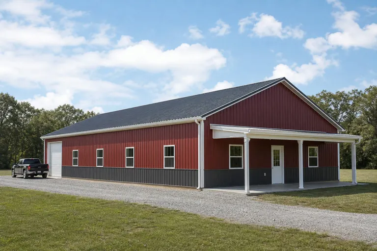 The Homestead LayoutA residence-forward design with a modest shop or storage bay, scaled to a smaller Hawaii parcel rather than a commodity-farm footprint.The Diversified Grower's BuildingLiving space paired with equipment storage for a small nursery or specialty-crop operation, reflecting Hawaii's diversified rather than commodity agricultural mix.The Upland RetreatA compact footprint with upgraded roof drainage for a windward or elevated site where rainfall runs well above the leeward statewide reference figure.
Example Configuration — for planning purposes only.
Site Readiness
Before you finalize a Hawaii barndominium plan
Steps specific to Hawaii's land, ground and hazard context, ahead of drawings.
- Confirm actual usable acreageWith farm counts and acreage down in the latest USDA census, verify your parcel's real usable footprint before sizing the shop bay.
- Get a geotechnical read on your specific groundVolcanic rock and soil conditions vary from basalt to cinder even nearby; do not assume a generic foundation spec applies.
- Check FEMA's National Risk Index for your tractTsunami and volcanic activity are scored hazard categories for Hawaii; check your specific parcel before finalizing siting.
- Use a site-specific rainfall referenceNWS Honolulu explains how to retrieve normals for individual Hawaii sites since windward and leeward rainfall differ sharply.
- Confirm county permitting requirementsEach island's county government administers its own building permit process; confirm before ordering.
Questions
Hawaii Barndominium FAQ
Practical answers for buyers planning a combined residential-and-shop steel building in Hawaii.
USDA counted 6,569 Hawaii farms in 2022, down 10% from 2017's 7,328, so land availability should be confirmed for your specific parcel rather than assumed. Many Hawaii barndominium projects scale the shop bay to a smaller homestead or diversified-crop footprint.
Yes, potentially. USGS classifies essentially all Hawaii ground as volcanic rock or derived volcanic soil, ranging from dense basalt to loose cinder, so a geotechnical check for your specific site is worth doing before the slab is poured.
FEMA's National Risk Index scores both tsunami and volcanic activity for Hawaii by census tract. Check the tool for your specific parcel before finalizing where the residence sits.
Substantially. NWS Honolulu explains that Hawaii's rainfall varies sharply by elevation and windward/leeward exposure, so a barndominium on an upland or windward site should plan for materially more rainfall than a leeward reference figure like Honolulu Airport's normal.
Many owners do, though Hawaii's 2022 agricultural sales ranked 46th nationally, reflecting a smaller-scale, diversified agricultural economy rather than large commodity operations. Confirm zoning for agricultural use with your county planning department.
Each Hawaii county administers its own building permit process. Contact your county's building department directly to confirm requirements for a combined residential-and-shop structure on your parcel.
Sources for the Hawaii facts on this page
This page states no code requirement, wind speed, snow load, permit rule, price or supplier claim. The state-specific facts it does use are listed with their publisher below.
Hawaii had 6,569 farms in 2022, down 10% from 2017, covering 1,053,302 acres of land in farms (down 7%), with an average farm size of 160 acres.
USDA National Agricultural Statistics Service (NASS) · 2022 · Tier 1
https://www.nass.usda.gov/Publications/AgCensus/2022/Online_Resources/County_Profiles/Hawaii/cp99015.pdfUSDA NASS's 2017 Census of Agriculture reported 7,328 Hawaii farms on 1,135,352 acres, up from 7,000 farms on 1,129,317 acres in 2012, before the count declined again by 2022.
USDA NASS · 2017 (with 2012 comparison) · Tier 1
https://www.nass.usda.gov/Publications/AgCensus/2017/Full_Report/Volume_1,_Chapter_1_State_Level/Hawaii/st15_1_0009_0010.pdfHawaii's 2022 Census of Agriculture market value of products sold totaled about $673.8 million, ranking Hawaii 46th of 50 states in agricultural sales.
USDA National Agricultural Statistics Service (NASS) · 2022 · Tier 1
https://www.nass.usda.gov/Publications/AgCensus/2022/Online_Resources/County_Profiles/Hawaii/cp99015.pdfUSGS's Geologic Map of the State of Hawaii documents that the islands are the exposed, subaerial parts of the Hawaiian Ridge, a large volcanic mountain range built by shield-volcano eruptions on the Pacific Ocean floor, so nearly all foundation-bearing ground in the state is volcanic rock or derived volcanic soil.
U.S. Geological Survey (USGS) · 2021 · Tier 1
https://pubs.usgs.gov/sim/3143/sim3143_pamphlet.pdfFEMA's National Risk Index platform (hazards.fema.gov) is the authoritative county/tract-level source for Hawaii natural hazard exposure scores across 18 hazard types, including hazard categories such as tsunami and volcanic activity that are tracked for Hawaii specifically.
Federal Emergency Management Agency (FEMA) · Current NRI dataset · Tier 1
https://www.fema.gov/flood-maps/products-tools/national-risk-index