
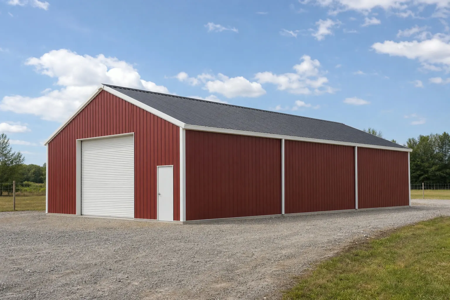
Storage building · MS
Storage Buildings in Mississippi
Mississippi's total relief — from the Gulf coastline up to Woodall Mountain near Iuka — runs 806 feet, per the Mississippi Encyclopedia's landforms entry, and the ground in between is not one uniform surface: Mississippi State University Extension separates the Delta's river-deposited alluvial soils from the loess bluffs and Coastal Plain that make up most of the rest of the state. A storage building's drainage and pad design should answer to that terrain range first, and this page works through it alongside USDA's documented drop in Mississippi farm count and FEMA's county-level hazard data before it gets to sizing.
Terrain
Mississippi's 806 feet of relief is a site question, not a footnote
The Mississippi Encyclopedia's own landforms entry places 806 feet of total relief between the Gulf coast and the state's highest point, which is enough elevation range to change how a storage building's pad should be graded.
The Mississippi Encyclopedia records the state's total relief — from the Gulf coastline up to Woodall Mountain near Iuka in the northeast — at 806 feet, and groups Mississippi's landforms into distinct physiographic regions rather than treating the state as a single flat plain. For a storage building, that range matters because a parcel near the coast faces a different starting elevation and drainage profile than one on higher inland ground, even before local soil or slope factors are considered.
The practical takeaway is not a single elevation number that applies statewide — none exists — but a reason to have the specific parcel's elevation and drainage checked before a pad is graded, particularly for any site closer to the lower end of that 806-foot range where standing water is more likely to be a real concern.
Ground conditions
Delta, loess and Coastal Plain ground each behave differently
MSU Extension's own land-resource-area classification is the reason a storage building's foundation choice should follow the parcel's region rather than a single statewide default.
Mississippi Delta (alluvial plain)
MSU Extension identifies the Delta as an alluvial-plain land-resource area with soils formed from sediments the Mississippi River deposited, distinct from the state's other regions.
Loess bluffs
The loess region sits between the Delta and the Coastal Plain in MSU Extension's classification, with soil behavior distinct from both the river-deposited Delta ground and the Coastal Plain further south.
Coastal Plain
The Coastal Plain covers much of the rest of the state in MSU Extension's regional breakdown, and a storage building sited here should be checked against this region's own soil and drainage characteristics rather than assumed to match Delta conditions.
Buyer context and hazard check
Consolidating farms and an above-average hazard profile
USDA's farm-count data and FEMA's hazard scoring both point toward the same practical step: check your specific parcel and county rather than relying on a statewide average.
USDA NASS counted 31,290 farms in Mississippi in 2022, down 11% from 2017, while land in farms dropped a much smaller 2% to 10,251,497 acres, putting the average farm at 328 acres. A double-digit drop in farm count against a near-steady acreage total points toward consolidation into fewer, larger operations, and larger operations more often want one substantial storage footprint sized for bulk equipment or harvested product rather than several smaller buildings scattered across separate parcels.
FEMA's National Risk Index reports Mississippi's 82 counties averaging a composite hazard score of 50.9 out of 100, a figure FEMA describes as among the higher state averages nationally. NWS Jackson's compiled Storm Data statistics, covering 1950 through 2021, add long-run documentation of the state's tornado history. Neither figure sets a specific wind rating or anchoring spec here — that comes from your builder's engineer and your local building department — but both are reasons to pull your specific county's data before finalizing a storage building's site and door detailing.
- Check your land-resource area
- Confirm whether the parcel sits on Delta alluvium, loess or Coastal Plain ground before choosing a foundation.
- Pull your county's NRI score
- The statewide 50.9 average masks real county-to-county variation; check the specific figure for your site.
- Size for consolidation, not the smallest operation
- Mississippi's farm-count trend favors planning for a larger, consolidated footprint over several smaller ones.
Get your Mississippi storage building quote
Talk to suppliers who can size a storage building for your parcel's elevation, soil region and hazard exposure.
Dimensions
Common Mississippi storage building footprints
Footprints that fit typical Mississippi agricultural and residential storage needs, given the state's consolidation trend.
12′ × 24′
288 sq ft
A compact residential shed footprint for tools and seasonal equipment.
24′ × 30′
720 sq ft
A two-bay footprint sized for a tractor plus general equipment storage.
30′ × 50′
1,500 sq ft
A larger footprint suited to a consolidated farm operation storing bulk equipment or harvested product.
Example Configuration — for planning purposes only.
Measure the widest equipment or the largest batch of product you expect to store before fixing a final width.
Foundation planning
Matching the foundation to Mississippi's regional ground
The right foundation for a Mississippi storage building depends on which of the state's land-resource areas the parcel sits in and where it falls on the state's 806-foot relief range.
| Foundation type | Best suited for | Mississippi-specific consideration |
|---|---|---|
| Compacted gravel pad | Light equipment and seasonal storage on stable ground | Worth pairing with careful grading on Delta alluvial or low-elevation coastal sites where drainage is a bigger concern. |
| Reinforced concrete slab | Heavier machinery or bulk product storage needing a clean, level surface | A reasonable default across all three of MSU Extension's regions, but still needs a site-specific compaction check. |
| Elevated post-frame on treated skids | Sites near the lower end of the state's elevation range where keeping stored product off wet ground matters | Worth discussing for coastal or Delta parcels rather than assuming a standard at-grade slab everywhere. |
Compacted gravel pad
- Best suited for
- Light equipment and seasonal storage on stable ground
- Mississippi-specific consideration
- Worth pairing with careful grading on Delta alluvial or low-elevation coastal sites where drainage is a bigger concern.
Reinforced concrete slab
- Best suited for
- Heavier machinery or bulk product storage needing a clean, level surface
- Mississippi-specific consideration
- A reasonable default across all three of MSU Extension's regions, but still needs a site-specific compaction check.
Elevated post-frame on treated skids
- Best suited for
- Sites near the lower end of the state's elevation range where keeping stored product off wet ground matters
- Mississippi-specific consideration
- Worth discussing for coastal or Delta parcels rather than assuming a standard at-grade slab everywhere.
Questions
Mississippi storage building FAQ
Direct answers for Mississippi storage building projects.
Yes — the Mississippi Encyclopedia documents 806 feet of total statewide relief between the Gulf coast and Woodall Mountain, so a parcel's specific elevation and drainage should be checked rather than assumed, especially closer to the coast.
MSU Extension classifies the Delta as a distinct alluvial-plain land-resource area, separate from the loess and Coastal Plain regions, so a foundation approach that works in one region is not automatically right for another.
FEMA's National Risk Index reports a mean composite score of 50.9 out of 100 across the state's 82 counties, among the higher state averages nationally, but this is a statewide mean — check your specific county's score.
Permit thresholds vary by county and municipality; there is no single statewide figure confirmed here. Your local building department is the correct source.
There is no official typical size, but USDA data shows Mississippi farms consolidating toward fewer, larger operations, which tends to favor a larger single footprint over several smaller buildings.
NWS Jackson's compiled Storm Data statistics document a long tornado history for the state from 1950-2021, which is worth reviewing with your builder for door and roof detailing, though specific wind ratings come from your local building department.
Sources for the Mississippi facts on this page
This page states no code requirement, wind speed, snow load, permit rule, price or supplier claim. The state-specific facts it does use are listed with their publisher below.
The total relief of Mississippi, from the Gulf coastline to the state's highest point at Woodall Mountain near Iuka, is 806 feet, and the state's landforms are grouped into physiographic regions.
Mississippi Humanities Council (Mississippi Encyclopedia) · Reference material · Tier 2
https://mississippiencyclopedia.org/entries/landforms/Mississippi State University Extension identifies the Mississippi Delta as an alluvial-plain land resource area with soils formed from sediments left by the Mississippi River, distinct from the state's loess and coastal-plain regions.
Mississippi State University Extension Service · Extension reference material · Tier 2
https://extension.msstate.edu/agriculture/soils/mississippi-land-resource-areasMississippi had 31,290 farms in 2022, an 11% decrease since 2017.
USDA National Agricultural Statistics Service (NASS) · 2022 · Tier 1
https://www.nass.usda.gov/Publications/AgCensus/2022/Online_Resources/County_Profiles/Mississippi/cp99028.pdfFEMA's National Risk Index reports Mississippi's 82 counties with a mean composite NRI risk score of 50.9 on FEMA's 0-100 relative scale (v1.20 release), among the higher state averages nationally.
Federal Emergency Management Agency (FEMA) · NRI v1.20 dataset · Tier 1
https://www.fema.gov/flood-maps/products-tools/national-risk-indexNWS Jackson's compiled Storm Data statistics for 1950-2021 document Mississippi's long-term tornado history for the state, sourced from the NOAA/NCEI Storm Data database.
National Weather Service (NOAA), Jackson MS office · 1950-2021 · Tier 1
https://www.weather.gov/jan/severe_statistics