
Pole barn · TN
Pole Barns in Tennessee
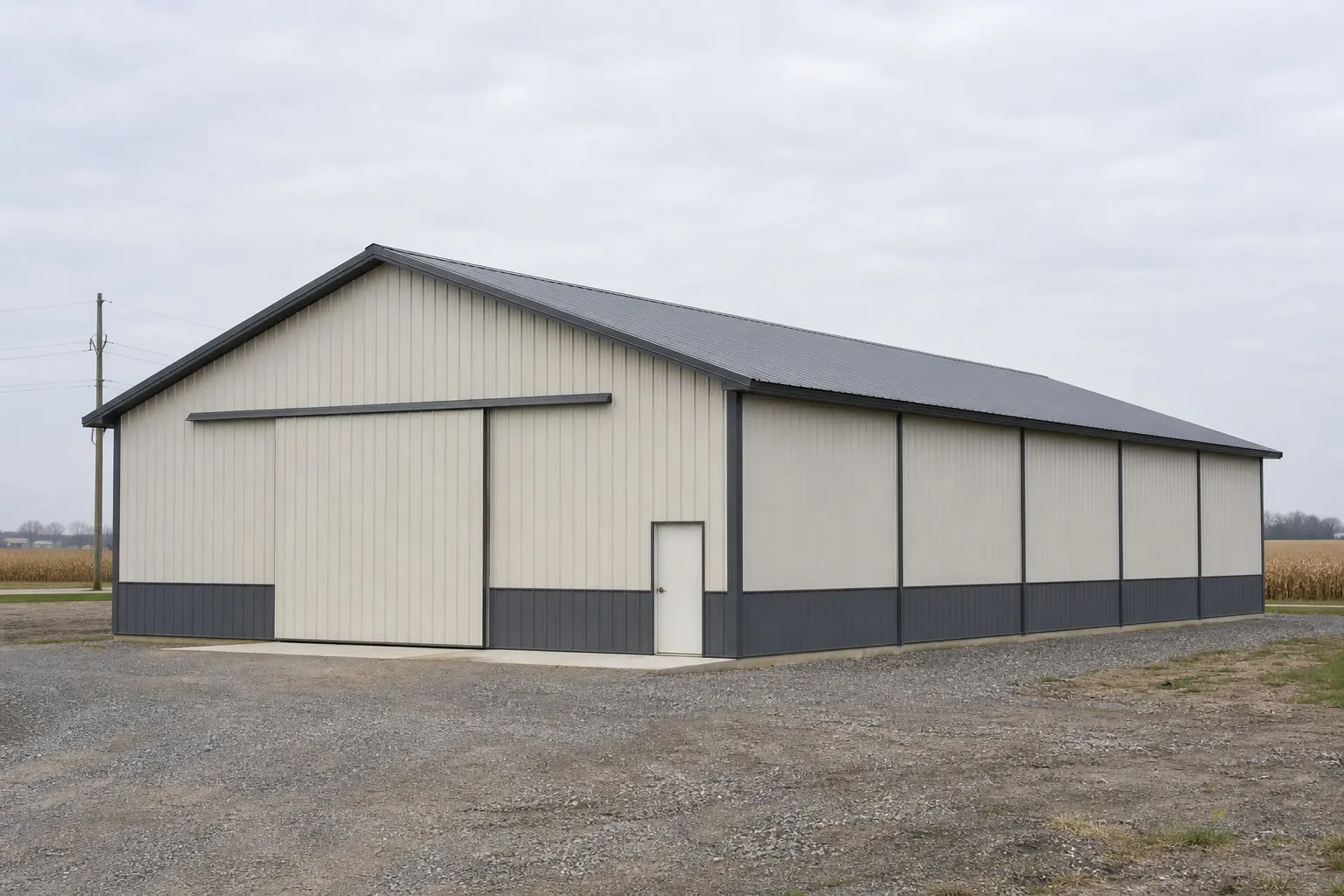
A pole barn ordered for a farm near the Mississippi River in west Tennessee is answering a different site question than the same building ordered for a lot on the Cumberland Plateau in the east. The Tennessee Encyclopedia notes the state runs over 500 miles along an axis that crosses the grain of the underlying geology, and the University of Tennessee Institute of Agriculture's Center for Profitable Agriculture tracks a working agricultural base still investing in value-added and specialty crop production statewide. Between the terrain variety and that ongoing farm activity, a Tennessee pole barn's post depth, bracing and ventilation plan should start from the specific region and soil, not from a single statewide post-frame spec.
Regional Reference
What a pole barn plan should account for, by region
Tennessee's geology and climate divisions push different priorities to the front depending on where the site sits.
| Region | State Reference | Post-Frame Priority |
|---|---|---|
| West Tennessee (Mississippi lowlands) | NOAA NCEI 'Climate of Tennessee' narrative | Flatter terrain shifts priority to site drainage and post-footing waterproofing. |
| Middle Tennessee | Crosses multiple geologic provinces per Tennessee Encyclopedia | Confirm local soil conditions rather than assuming lowland or plateau behavior. |
| East Tennessee (Cumberland Plateau) | TN Division of Geology Bulletin 60 (overthrust structure) | Site grading and a geotechnical review before setting post depth. |
West Tennessee (Mississippi lowlands)
- State Reference
- NOAA NCEI 'Climate of Tennessee' narrative
- Post-Frame Priority
- Flatter terrain shifts priority to site drainage and post-footing waterproofing.
Middle Tennessee
- State Reference
- Crosses multiple geologic provinces per Tennessee Encyclopedia
- Post-Frame Priority
- Confirm local soil conditions rather than assuming lowland or plateau behavior.
East Tennessee (Cumberland Plateau)
- State Reference
- TN Division of Geology Bulletin 60 (overthrust structure)
- Post-Frame Priority
- Site grading and a geotechnical review before setting post depth.
Foundation Strategy
Matching post depth to Tennessee's varied ground
Post-frame construction is adaptable, but the specific foundation approach should follow the region's documented geology.
Tennessee's length works against a one-size post-frame spec. The Tennessee Encyclopedia's Geologic Zones entry explains that because the state's long axis crosses the grain of the underlying geology, most of the geological provinces of the east-central United States show up somewhere within its borders. A pole barn builder working in the Mississippi River lowlands of west Tennessee is dealing with flatter, more uniform ground than one working on the folded, overthrust terrain the Tennessee Division of Geology has documented on the Cumberland Plateau in the east.
That plateau documentation, covering the overthrust structure and the Crab Orchard Mountains area specifically, is a strong signal that a pole barn sited there deserves a dedicated geotechnical look before post depth and spacing are finalized, rather than reusing a foundation plan drawn up for flatter ground elsewhere in the state.
Climate division matters just as much for what happens above the foundation. ETSU's Tennessee Climate Office identifies four distinct climate divisions running from the flatter west to the mountainous east. A pole barn used for hay or feed storage needs ridge and eave ventilation tuned to the humidity and temperature pattern of its specific division, since a design suited to one division can trap more moisture than expected in another.
None of this is an argument for over-engineering a Tennessee pole barn. It is an argument for sequencing the decisions correctly: confirm the region's documented geology and climate division first, then let post depth, bracing and ventilation follow from those answers rather than from a generic post-frame spec pulled from a different part of the country.
Dimensions
Sizing a pole barn for Tennessee's working land
Tennessee's continued specialty crop and value-added agricultural activity supports a range of post-frame footprints.
30′ × 50′
1,500 sq ft
A workable size for a single-operation storage building or an auxiliary structure.
40′ × 60′
2,400 sq ft
A common standard for combined hay, feed and equipment storage.
40′ × 80′
3,200 sq ft
Fits larger operations, including the value-added and specialty crop activity the UT Extension Center for Profitable Agriculture documents from the 2022 Census of Agriculture.
Example Configuration — for planning purposes only.
Specific Tennessee farm-count and land-in-farms totals were not captured as direct figures in this evidence pass; confirm current numbers on the USDA NASS Tennessee 2022 Census by State page before finalizing a size, and check your county's agricultural-exemption rules before assuming a smaller footprint avoids permitting review entirely.
Get your Tennessee pole barn quote
Connect with post-frame builders who account for Tennessee's regional soil and climate differences.
Hazard Awareness
Reading Tennessee's hazard categories correctly
FEMA's National Risk Index names tornado, severe storm and riverine flooding as categories relevant to Tennessee counties, which should shape a pole barn's structural detailing.
Tornado exposure
FEMA's National Risk Index tracks tornado risk at the county and tract level for Tennessee; truss-to-post connection hardware is worth reviewing against your specific county's score rather than a statewide assumption.
Severe storm exposure
The same FEMA tool covers severe storm risk categories; a pole barn used for equipment storage benefits from confirming wind-uplift anchoring against local county data.
Riverine flooding
Riverine flooding is a named FEMA NRI category relevant to Tennessee; sites near rivers, more common in the western lowlands, should check flood exposure before setting a floor elevation or slab grade. These are the specific categories FEMA's National Risk Index names as relevant to Tennessee, and a county's individual score, not a statewide assumption, is the number that should shape anchoring and connection hardware choices.
Storage & Moisture
Keeping stored feed and equipment dry across four climate divisions
Ventilation and drainage needs shift as a pole barn moves from Tennessee's flatter west to its mountainous east.
- Confirm your specific climate division before specifying ventilationETSU's Tennessee Climate Office identifies four distinct climate divisions statewide; match ridge and eave venting to the local division rather than a single statewide guess.
- Check FEMA NRI for tornado, severe storm and flooding scoresFEMA's National Risk Index names these three hazard categories as relevant to Tennessee counties; review your county's specific score before finalizing anchoring details.
- Plan drainage around west Tennessee's flatter, Mississippi-adjacent lowlandsNOAA NCEI's climate narrative places the flattest ground in the west along the Mississippi River, where grading for drainage matters more than slope control.
- Budget for a geotechnical review on Cumberland Plateau sitesThe Tennessee Division of Geology's documented overthrust structure in the plateau region is a reason to check soils before setting post depth there specifically.
Questions
Tennessee Pole Barn Questions
Direct answers for buyers planning post-frame storage across Tennessee's regions.
It can. State geology records document overthrust structure specific to the Cumberland Plateau in the east, while the western lowlands along the Mississippi River are flatter. A site-specific soils check remains the most reliable way to confirm which foundation approach applies.
ETSU's Tennessee Climate Office identifies four distinct climate divisions across the state. Matching ridge and eave ventilation to your specific division helps prevent trapped humidity from affecting stored hay, feed or equipment.
Exemptions and streamlined review for bona fide agricultural structures vary by county in Tennessee. Confirm directly with your local building department before starting construction.
FEMA's National Risk Index names tornado, severe storm and riverine flooding as categories relevant to Tennessee counties. Check your specific county's score at the FEMA NRI tool rather than assuming a uniform statewide risk.
It depends on your operation and the crops or equipment involved. The University of Tennessee's Center for Profitable Agriculture documents ongoing value-added and specialty crop activity statewide, which often supports a larger, partitioned footprint rather than a single open bay.
Sources for the Tennessee facts on this page
This page states no code requirement, wind speed, snow load, permit rule, price or supplier claim. The state-specific facts it does use are listed with their publisher below.
The Tennessee Encyclopedia's Geologic Zones entry notes Tennessee is a narrow state over 500 miles long, with its long east-west axis crossing the grain of the underlying geology, so that most of the geological provinces of the east-central United States are represented somewhere within the state.
Tennessee Historical Society / Tennessee Encyclopedia · Reference entry · Tier 2
https://tennesseeencyclopedia.net/entries/geologic-zones/The Tennessee Division of Geology (State of Tennessee, Department of Conservation) has published detailed geologic studies of the Cumberland Plateau overthrust and the Crab Orchard Mountains area, documenting the geologic structure of the Cumberland Plateau region in the state.
Tennessee Department of Conservation, Division of Geology (now Tennessee Geological Survey) · Originally published 1954; state agency archival document · Tier 2
https://www.tn.gov/content/dam/tn/environment/geology/documents/geology_bulletin-60txt.pdfEast Tennessee State University's Tennessee Climate Office describes the state as divided into four distinct climate divisions, reflecting topography that ranges from the lowlands of the Mississippi River in the west to the Appalachian mountains in the east.
East Tennessee State University (ETSU), Department of Geosciences · ETSU reference page · Tier 2
https://www.etsu.edu/cas/geosciences/tn-climate/tn-climatology.phpThe University of Tennessee Institute of Agriculture's Center for Profitable Agriculture published an analysis of 2022 Census of Agriculture data covering value-added agriculture and specialty crop production trends in Tennessee.
University of Tennessee Institute of Agriculture, Center for Profitable Agriculture · 2022 Census, published June 2024 · Tier 2
https://cpa.tennessee.edu/wp-content/uploads/sites/106/2024/07/CPA436.pdfUSDA NASS's 2022 Census by State page provides direct access to Tennessee's state-level farm count, land-in-farms, and average farm size tables as part of the 2022 Census of Agriculture.
USDA National Agricultural Statistics Service (NASS) · 2022 · Tier 1
https://www.nass.usda.gov/Census_by_State/Tennessee/FEMA's National Risk Index is the federal tool providing county- and tract-level natural hazard risk scoring (including tornado, severe storm, and riverine flooding categories relevant to Tennessee) for all Tennessee counties; a state-specific hazard narrative directly from FEMA was not retrieved in this session.
Federal Emergency Management Agency (FEMA) · Current NRI release · Tier 1
https://www.fema.gov/flood-maps/products-tools/national-risk-index