
Garden Shed · OR
Garden Sheds in Oregon
NOAA NCEI's own narrative climate summary for Oregon opens with the Cascade Range's role in dividing a wetter western half of the state from a drier eastern half, and that divide is the first thing worth settling before picking a garden shed spec. Portland's 1991-2020 water-year normal runs 36.91 inches of precipitation, a west-side reference point the National Weather Service tracks separately from the state's interior. Layer in the USDA's 2022 count of 35,547 Oregon farms, averaging 430 acres across more than 15.2 million acres in farms, and a meaningful share of Oregon garden sheds are sited on working land rather than a small residential lot. A shed answering a Willamette Valley backyard is not automatically the right answer east of the mountains.
The intersection
One state, two climates — and a shed sits in only one of them
NCEI's own narrative for Oregon leads with the Cascade Range splitting the state's climate in two, and that split is the starting point for siting a garden shed here.
NOAA's National Centers for Environmental Information publish a narrative 'Climate of Oregon' summary that opens with the Pacific Ocean's dominant influence on the state's mild, varied conditions and the Cascade Range's role in dividing wet western Oregon from drier eastern Oregon. A shed buyer in the Willamette Valley and a shed buyer east of Bend are effectively answering different climate questions, even though both are shopping the same product category.
Portland International Airport's 1991-2020 normal water-year precipitation runs 36.91 inches, a west-side reference the National Weather Service's Portland office documents on its own terms. That is representative of the wetter side of the divide, not a number that applies east of the Cascades — and this page does not have a matching official statewide figure to offer, because Oregon's precipitation swings too widely from coastal valley to high desert for one number to describe both.
Materials
Moisture on one side of the state, heat and dryness on the other
The same shed kit performs differently depending on which side of the Cascades it sits on, which is a materials and ventilation question more than a size question.
On the wetter side, a shed holding tools, seed or untreated wood is exposed to sustained damp conditions across much of the year, so ventilation and a raised or sealed floor genuinely earn their keep. Portland's temperature normals — 47.5°F average high in January climbing to about 82.3°F in August — describe a mild year-round range that keeps humidity, not heat, as the dominant concern for anything stored inside.
East of the Cascades, where NCEI's narrative describes drier conditions, the concern shifts toward dust and temperature swings rather than rot. A shed sited there benefits from attention to ventilation for heat buildup rather than moisture control, and from siting decisions that account for a more exposed, drier landscape.
Configuration
How an Oregon garden shed brief differs by property
A shed on working farmland and a shed in a Willamette Valley backyard start from different premises, even before the Cascade climate divide is factored in.
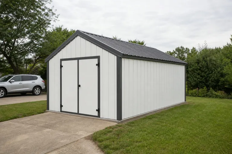 Working-acreage shedSized for irrigation fittings, hand tools and bulk seed on a farm averaging 430 acres statewide per USDA's 2022 count, often placed near existing agricultural buildings.West-side residential shedCompact tool and mower storage where ventilation and a raised floor manage the sustained damp implied by Portland's 36.91-inch water-year normal.East-side residential shedThe same compact footprint, but oriented and vented for dryness and temperature swing rather than moisture.
Example Configuration — for planning purposes only.
Get Oregon garden shed quotes
Tell us which side of the Cascades your site sits on and whether it's serving a garden bed or working acreage, and we route it with the Oregon context attached.
Site check
Checking terrain before the pad goes in
Oregon's geology agency maintains a statewide landslide database for a reason, and a shed pad is a good moment to use it.
The Oregon Department of Geology and Mineral Industries (DOGAMI) maintains the Statewide Landslide Information Database for Oregon (SLIDO), a state geologic-hazard mapping resource covering landslide susceptibility statewide, most recently updated as SLIDO-4.5 in April 2024. A garden shed is a small, light structure, but a poorly drained or unstable slope can still undermine a pad regardless of what sits on it.
Separately, DOGAMI has published coseismic landslide susceptibility, liquefaction susceptibility and soil amplification class maps for Clackamas, Columbia, Multnomah and Washington counties, feeding FEMA's HAZUS loss-estimation methodology. That level of county-specific mapping exists because Oregon's terrain is genuinely uneven, which is a reason to check a specific parcel rather than assume a flat, easy pad anywhere in the state.
Hazard data
Where to check Oregon hazard exposure by county
FEMA and DOGAMI both publish county-level tools rather than one blanket statewide rating, which matters because Oregon's 36 counties do not share identical exposure.
| Resource | What it covers | How to use it for a shed site |
|---|---|---|
| FEMA National Risk Index | County- and state-level natural hazard exposure across 18 hazard types, viewable via FEMA's report tool | Pull the report for your specific county before assuming a generic hazard picture applies. |
| DOGAMI SLIDO | Statewide landslide susceptibility mapping, most recently SLIDO-4.5 (April 2024) | Check slope stability at the parcel level, especially on hillside or forested lots. |
| DOGAMI Open-File Report O-19-09 | County-level seismic soil hazard mapping for Clackamas, Columbia, Multnomah and Washington counties | Useful if the site sits within one of those four Portland-area counties. |
FEMA National Risk Index
- What it covers
- County- and state-level natural hazard exposure across 18 hazard types, viewable via FEMA's report tool
- How to use it for a shed site
- Pull the report for your specific county before assuming a generic hazard picture applies.
DOGAMI SLIDO
- What it covers
- Statewide landslide susceptibility mapping, most recently SLIDO-4.5 (April 2024)
- How to use it for a shed site
- Check slope stability at the parcel level, especially on hillside or forested lots.
DOGAMI Open-File Report O-19-09
- What it covers
- County-level seismic soil hazard mapping for Clackamas, Columbia, Multnomah and Washington counties
- How to use it for a shed site
- Useful if the site sits within one of those four Portland-area counties.
Preparation
Before ordering a garden shed in Oregon
A short list that reflects what actually changes for this state, not a generic pre-purchase checklist.
Step 1
Identify which side of the Cascades your site sits on
It changes the ventilation and floor spec more than it changes size.
Step 2
Pull your county's FEMA National Risk Index report
County-level data is what FEMA actually publishes; there is no single statewide number to substitute.
Step 3
Check DOGAMI's SLIDO mapping if the site has any slope
A light structure still needs stable, well-drained ground.
Step 4
Confirm setback and permit thresholds with your local building department
Requirements vary by city and county across Oregon; this page does not set them.
Step 5
Decide whether the shed is serving a garden bed or a working acreage
That decision drives door width and floor material more than square footage does.
Questions
Oregon garden shed questions
Straight answers at the state level, with permitting and pricing routed to whoever actually owns them.
Permit thresholds are set locally by city and county building departments across Oregon, so confirm with your local jurisdiction before finalizing a size or placement.
It depends on the parcel. DOGAMI's statewide SLIDO database maps landslide susceptibility; checking it is worthwhile on any sloped or hillside lot, even for a light structure.
No. NOAA's own narrative for Oregon describes the Cascade Range dividing a wetter west from a drier east, so moisture-focused venting suits one side and heat/dryness-focused venting suits the other.
Yes, and it commonly does — the 2022 Census of Agriculture counted 35,547 Oregon farms averaging 430 acres, a land base where a shed frequently stores tools and irrigation fittings for acreage rather than only a backyard garden.
We do not publish state-level prices, since cost depends on size, materials and site work. Our cost pages explain what drives the number; a builder quote covers your specific project.
FEMA's National Risk Index report viewer publishes county-level data for all 36 Oregon counties, which is more useful than any single statewide hazard claim.
Sources for the Oregon facts on this page
This page states no code requirement, wind speed, snow load, permit rule, price or supplier claim. The state-specific facts it does use are listed with their publisher below.
NOAA NCEI publishes a narrative 'Climate of Oregon' noting the Pacific Ocean's dominant influence on the state's mild, varied climate and the Cascade Range's role in dividing wet western Oregon from drier eastern Oregon.
NOAA National Centers for Environmental Information (NCEI) · Historical narrative (NCEI climate normals series) · Tier 1
https://www.ncei.noaa.gov/data/climate-normals-deprecated/access/clim60/states/Clim_OR_01.pdfNWS Portland's climate book reports Portland's 1991-2020 normal water-year (Oct 1-Sept 30) total precipitation at 36.91 inches.
National Weather Service (NOAA), Portland OR office · 1991-2020 normal (record from 1872-73) · Tier 1
https://www.weather.gov/media/pqr/climate/ClimateBookPortland/pg96.pdfOregon had 35,547 farms in 2022, down 6% since 2017.
USDA National Agricultural Statistics Service (NASS) · 2022 · Tier 1
https://www.nass.usda.gov/Publications/AgCensus/2022/Online_Resources/County_Profiles/Oregon/cp99041.pdfOregon had 15,295,779 acres of land in farms in 2022, an average farm size of 430 acres.
USDA NASS · 2022 · Tier 1
https://www.nass.usda.gov/Publications/AgCensus/2022/Online_Resources/County_Profiles/Oregon/cp99041.pdfThe Oregon Department of Geology and Mineral Industries (DOGAMI) maintains the Statewide Landslide Information Database for Oregon (SLIDO), a state geologic-hazard mapping resource covering landslide susceptibility statewide.
Oregon Department of Geology and Mineral Industries (DOGAMI) · SLIDO-4.5 released April 12, 2024 · Tier 2
https://www.oregon.gov/dogami/slido/Pages/data.aspx