
Garden shed · ME
Garden Sheds in Maine
Even a small garden shed in Maine sits on ground shaped by the last ice age. The Maine Geological Survey describes the state's surface as mantled by glacial and post-glacial sediments — till, marine clay, sand and gravel — deposited as the ice sheet retreated roughly 10,000 to 16,000 years ago, which means the base under one shed pad can behave differently than the base a few hundred feet away. On top of that variability, NOAA's 1991-2020 normals for the Portland Jetport station record January and February snowfall means of about 15 to 19 inches each and roughly 51 inches of annual precipitation spread fairly evenly across the year, so a shed's gravel base and grading plan carry real, year-round drainage work even at a modest footprint.
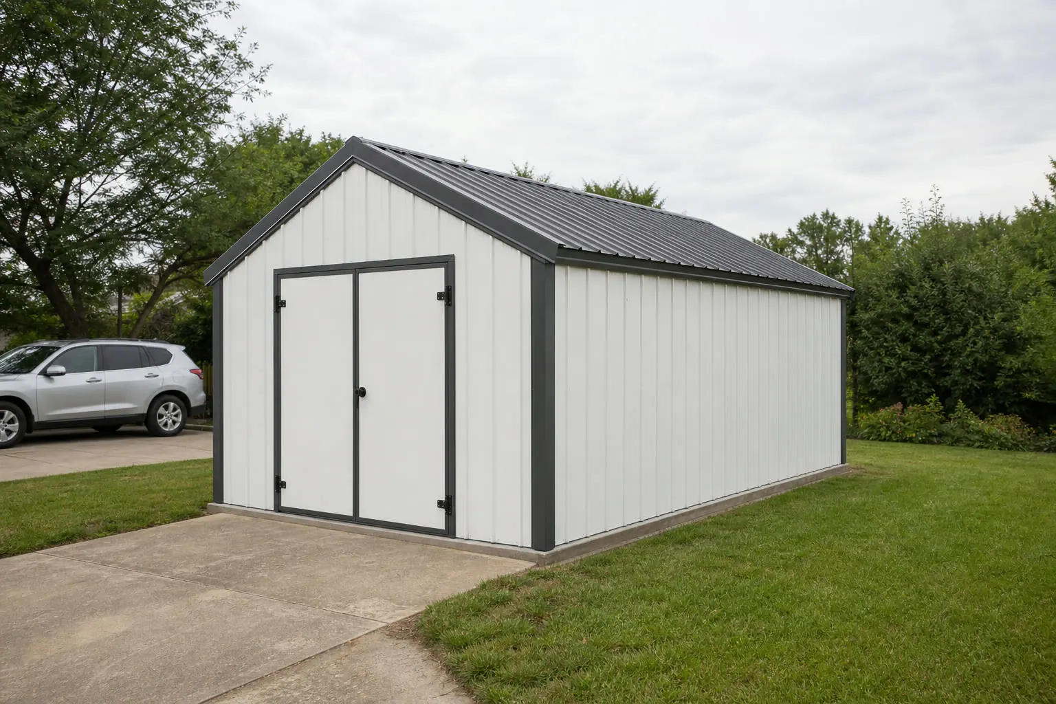
A Small Structure, a Genuinely Variable Base
A garden shed is the smallest steel structure most Maine landowners will ever site, but the ground underneath it is not simple. The Maine Geological Survey's description of statewide glacial and post-glacial deposits — till, marine clay, sand and gravel — means two shed pads in the same town can drain very differently. Add NOAA's Portland normals showing heavy winter snow and roughly 51 inches of fairly evenly distributed annual precipitation, and even a compact shed benefits from base prep decided by the actual site rather than copied from a neighbor's build.
Foundation
Why the base under a Maine shed deserves real thought
Glacially deposited soils vary enough within Maine that a gravel base sized for one yard may underperform in the next.
The Maine Geological Survey's statewide surficial geology reference describes till, marine clay, and sand-and-gravel deposits left behind as the last ice age retreated roughly 10,000 to 16,000 years ago. Till tends to compact and drain reasonably well; marine clay, found in areas that were submerged after glacial retreat, can hold water and settle unevenly under a structure. Because this variability is documented at a statewide level rather than tied to a single soil type, it is worth digging a test hole or asking a local contractor what soil is actually under your shed's footprint before ordering a gravel pad.
That check matters more in Maine than in a state with more uniform soils, because a base that performs fine on till a few properties over may hold standing water on marine clay. A compacted gravel pad with a drainage path leading water away from the structure is a reasonable default response to that variability, but the depth and grading should be sized to the specific soil condition, not to a generic instruction sheet.
Drainage
Planning Runoff Around a Maine Shed
Roughly 51 inches of annual precipitation, plus heavy winter snow, means a shed's runoff plan works in every season, not just one.
- Grade the pad above surrounding groundWith precipitation distributed fairly evenly across the year per NOAA's Portland normals, a slightly elevated, well-graded pad sheds water year-round rather than only during a single wet season.
- Route roof runoff away from the door thresholdEven a small shed roof concentrates water at its edges; direct that runoff toward a drainage path instead of letting it pool at the entrance during a Maine winter's snowmelt.
- Check for marine clay pockets before pouring or setting a padIf a test hole shows dense, sticky clay rather than sand or till, plan for a deeper gravel base or a French drain rather than a standard shallow pad.
- Confirm any permit threshold with your townAccessory structure permit rules vary by Maine municipality; a shed that seems too small to need a permit in one town may not be treated the same way in another.
- Plan for snow load on the roof, not just drainage at the baseJanuary and February in Portland average 15 to 19 inches of snowfall each per NOAA normals; confirm any roof design requirement for accessory structures with your local code office rather than assuming a shed is exempt.
Get Maine garden shed quotes
Tell suppliers your town and what you know about the site's soil and drainage. We route it with the Maine and garden shed context already attached.
Land use
Sheds on working Maine land
Maine's average farm size means many shed sites are on land with an agricultural history, which can bring hidden infrastructure into the site-prep conversation.
USDA's 2022 Census of Agriculture puts Maine's average farm at 174 acres across 7,036 farms statewide. On a property that scale, a shed site chosen for convenience near a house or driveway may still sit near buried drainage tile, an old fence line, or a field-access route from the property's working history. Asking about that history, or checking with the property's prior use records, is a reasonable step before committing to a specific shed location on a larger Maine parcel.
Footprint
Sizing a Shed to a Maine Site, Not a Catalog Default
The right garden shed footprint in Maine depends more on drainage room around the pad than on matching a generic size chart.
8′ × 10′
80 sq ft
A compact footprint that keeps the graded, well-draining pad small enough to build even where a test hole turns up marine clay rather than sand or till.
10′ × 12′
120 sq ft
Enough room for tool and lawn-equipment storage while still leaving a clear perimeter for roof runoff to drain away on a fairly evenly wet Maine site.
12′ × 16′
192 sq ft
A larger option worth reserving for sites already confirmed to sit on well-draining till or sand and gravel, where a bigger gravel pad performs predictably.
Example Configuration — for planning purposes only.
Confirm any accessory-structure permit threshold tied to footprint size with your local code office before ordering.
Access
Getting materials to the pad during Maine's wet stretches
The same glacial soils and evenly spread precipitation that shape the shed's base also shape how a delivery truck or wheelbarrow reaches it.
Because Maine's surface is a patchwork of glacial till, marine clay, and sand and gravel per the Maine Geological Survey, the route from the driveway to the shed pad can turn soft in exactly the spots where clay sits close to the surface, especially during spring thaw or after a stretch of the state's roughly 51 inches of yearly rain and snowmelt. Walking the access path in wet conditions before committing to a shed location, rather than only inspecting it on a dry day, is a small step that avoids a stuck delivery truck or a rutted lawn.
If the planned path crosses ground that stays soft, laying temporary planking or scheduling delivery for a drier stretch is cheaper than repairing a torn-up yard afterward. This is a genuinely Maine-specific concern: a state without the same glacial clay pockets and even year-round precipitation would not need the same access-timing planning for a structure this small.
Questions
Maine garden shed questions
Honest, state-specific answers, with jurisdiction-specific questions routed to the local code office.
Yes. The Maine Geological Survey describes the state's surface as a mix of glacial till, marine clay, and sand and gravel deposits, which can behave very differently under a gravel pad. Checking the actual soil at your shed's footprint is worth doing even for a small structure.
More than it looks like it needs. NOAA's Portland normals show roughly 51 inches of annual precipitation spread fairly evenly through the year, plus heavy winter snow, so a graded pad and a clear runoff path matter in every season.
That depends on your specific municipality; Maine does not set a single statewide accessory-structure permit threshold that this page can state as fact. Check with your town's code enforcement office before ordering the shed.
We do not publish a number here. Structural design values for accessory buildings are decided by the authority having jurisdiction, not by this page, so confirm the applicable requirement directly with your local code office before finalizing the shed's roof framing. NOAA's Portland normals showing January and February snowfall averaging 15 to 19 inches each are useful planning context, not a design figure to build to.
Consider the property's agricultural history. With Maine's average farm running 174 acres per USDA's 2022 Census of Agriculture, older field-access routes or drainage tile can still run through a parcel that looks unused today, so it's worth asking about the land's history before finalizing a site.
Sources for the Maine facts on this page
This page states no code requirement, wind speed, snow load, permit rule, price or supplier claim. The state-specific facts it does use are listed with their publisher below.
The Maine Geological Survey describes most of the state's surface as mantled by glacial and post-glacial sediments (till, marine clay, sand and gravel) deposited during and after the last ice age, which ended roughly 10,000-16,000 years ago.
Maine Geological Survey (Dept. of Agriculture, Conservation & Forestry) · MGS reference material · Tier 2
https://www.maine.gov/DACF/mgs/explore/surficial/facts/surficial.htmThe Portland, ME NOAA 1991-2020 normals show winter monthly snowfall means around 15-19 inches in January and February, indicative of a snow-heavy northern New England winter.
NOAA National Centers for Environmental Information (NCEI) · 1991-2020 · Tier 1
https://www.ncei.noaa.gov/access/services/data/v1?dataset=normals-monthly-1991-2020&format=pdf&stations=USW00014764Portland, ME's NOAA 1991-2020 climate normals show annual precipitation totals of about 51 inches, distributed fairly evenly through the year with over 3 inches of rain most months.
NOAA National Centers for Environmental Information (NCEI) · 1991-2020 · Tier 1
https://www.ncei.noaa.gov/access/services/data/v1?dataset=normals-monthly-1991-2020&format=pdf&stations=USW00014764Maine had 1,225,046 acres of land in farms in 2022, an average farm size of 174 acres.
USDA NASS · 2022 · Tier 1
https://www.nass.usda.gov/Publications/AgCensus/2022/Full_Report/Volume_1,_Chapter_1_State_Level/Maine/st23_1_001_001.pdf