
Detached garage · ME
Detached Garages in Maine
A detached garage in Maine is sited on ground the Maine Geological Survey describes as mostly mantled in glacial and post-glacial till, marine clay, sand, and gravel left behind roughly 10,000 to 16,000 years ago, and it has to shed a winter that NOAA's 1991-2020 Portland station normals put at 15-19 inches of mean monthly snowfall in January and February alone. A meaningful share of Maine garage projects also sit on acreage rather than a subdivision lot: USDA's 2022 Census of Agriculture counts 1,225,046 acres of Maine land in farms, an average of 174 acres per farm across 7,036 farms statewide. This page works through what that specific combination — glacial ground, heavy winter snow load conversations, and rural acreage siting — changes about planning a garage here.
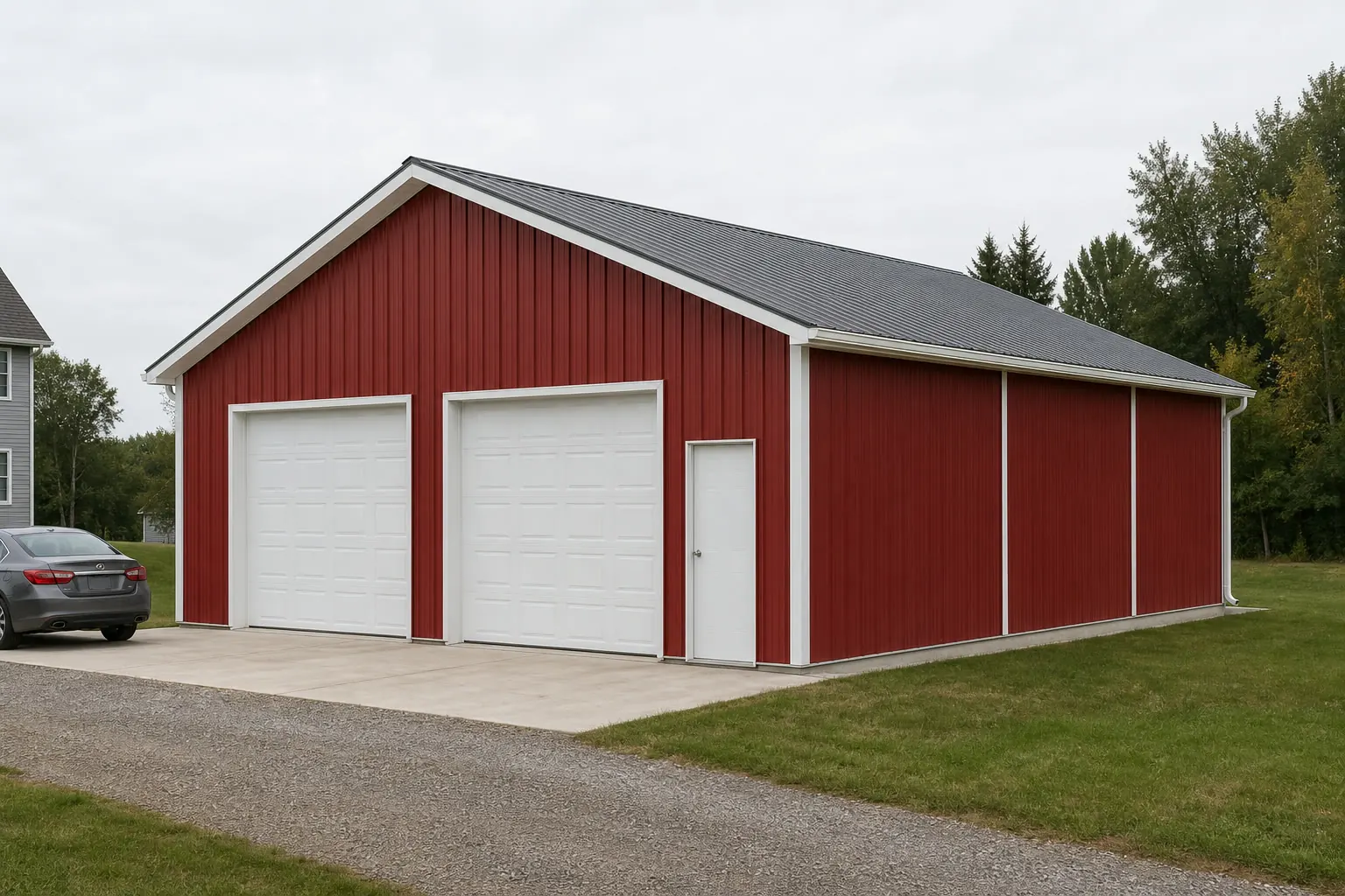
Ground conditions
Maine's Glacial Ground Is a Reason to Read the Site Before Pouring
Maine Geological Survey mapping describes statewide surficial deposits of till, marine clay, sand, and gravel from the last ice age, so foundation prep should be site-read rather than assumed.
The Maine Geological Survey's own reference material describes most of the state's surface as mantled in glacial and post-glacial sediments — till, marine clay, sand, and gravel — deposited during and after the last ice age, which the survey dates to roughly 10,000 to 16,000 years ago. That is a broad statewide description, not a single soil type, and it covers everything from dense till to soft marine clay depending on where in Maine a lot sits.
For a detached garage's slab, that range matters practically: a till-heavy site drains and bears differently than a marine-clay site near the coast. Rather than assuming a neighboring project's foundation approach applies, a site-specific soils read before the pad is finalized is the more reliable path, especially on a lot near a former shoreline or river terrace where marine clay is more likely to appear.
Climate
A Roof That Sheds a Real Maine Winter
NOAA's Portland station normals document a genuinely snow-heavy winter and an evenly distributed annual precipitation total, both relevant to roof and drainage planning.
NOAA's 1991-2020 climate normals for the Portland Jetport station record January and February mean monthly snowfall of roughly 15 to 19 inches each — a pattern the same dataset characterizes as typical of a snow-heavy northern New England winter. That is a station-level normal rather than a single statewide figure, but it is representative of the seasonal load a Maine garage roof is built to handle winter after winter.
The same station's annual precipitation normal runs about 51 inches, distributed fairly evenly through the year with over 3 inches of rain most months, per NOAA NCEI. That even distribution means gutter, downspout, and grading decisions around a garage foundation are a year-round consideration in Maine, not a rainy-season-only detail.
- Confirm your exact roof snow load with a local building department or engineer
- Portland's normals are a station-level reference, not a statewide design value.
- Plan drainage for a wet year, not just a snowy winter
- NOAA's roughly 51-inch annual normal is spread fairly evenly across the calendar.
- Get a soils read before the slab is finalized
- Statewide glacial deposits range from till to marine clay to sand and gravel.
Land use
A Lot of Maine Garage Projects Sit on Real Acreage
USDA's farm-land data shows Maine parcels averaging 174 acres, which changes the siting conversation from lot-line setbacks to driveway and access planning.
USDA's 2022 Census of Agriculture counts 1,225,046 acres of Maine land in farms, spread across 7,036 farms, for an average farm size of 174 acres — down from 7,600 farms in 2017. Those are working-farm figures, not a garage-buyer statistic, but they reflect a genuinely rural land pattern across much of the state.
On acreage that size, siting a detached garage is less about a subdivision's lot-line setback and more about driveway grading, distance from the house, and whether a former agricultural access road can support delivery and construction vehicles. A buyer converting part of a former or working farm parcel should also confirm current zoning and any easements tied to the land's agricultural history before finalizing a site.
Get Maine Detached Garage Quotes
Tell us your town or county, lot type, and vehicle or workshop needs. We route it with the Maine and detached-garage context already attached.
Configuration
What a Maine Detached Garage Is Commonly Asked to Do
Garage briefs in Maine track winter shedding needs and lot type as much as vehicle count.
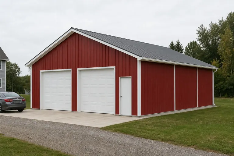 Coastal or in-town residential garageA standard one- to two-vehicle enclosed garage on a smaller in-town lot, where marine-clay ground is more likely and a soils read is worth confirming.Snow-load-focused garage buildA garage where roof pitch, overhang, and header clearance get early attention given Maine's documented heavy January-February snowfall normals.Rural or former-farm acreage garageAn enclosed garage sited on a larger rural parcel, where driveway access and prior agricultural land use matter more than lot-line setbacks.
Example Configuration — for planning purposes only.
Footprint
Common Maine Detached Garage Footprints
Size selection follows vehicle count and workspace needs; the ground and winter-load questions above apply at every size.
24′ × 24′
576 sq ft
A standard two-vehicle footprint suited to an in-town or suburban Maine lot.
24′ × 36′
864 sq ft
Two vehicles plus a workshop bay, a common step up on a larger residential lot.
30′ × 40′
1,200 sq ft
A larger footprint suited to a rural or former-farm acreage parcel.
Example Configuration — for planning purposes only.
Footprint pages carry door and layout detail; confirm frost depth, snow load, and permit requirements with your local building department and engineer.
Preparation
Before You Request a Maine Detached Garage Quote
Steps that address the parts of a Maine garage project a generic quote will not cover.
Step 1
Get a site-specific soils read
Maine's statewide surficial ground ranges from glacial till to marine clay to sand and gravel per the Maine Geological Survey.
Step 2
Confirm your roof snow load with your local building department
NOAA's Portland station normals show 15-19 inches of mean monthly snowfall in January and February alone.
Step 3
Plan year-round drainage, not just winter shedding
NOAA's roughly 51-inch annual precipitation normal is spread fairly evenly across the calendar.
Step 4
Check your county's hazard profile
FEMA's National Risk Index scores winter weather, coastal flooding, and wind exposure separately across Maine's 16 counties.
Step 5
Confirm access and zoning on rural or former-farm parcels
Maine's average farm size runs 174 acres, and prior agricultural access roads may not suit a new garage build.
Questions
Maine Detached Garage Questions
State-level answers only, with jurisdiction-specific and site-specific questions routed to the office that actually decides them.
It can. The Maine Geological Survey describes most of the state's surface as glacial and post-glacial till, marine clay, sand, and gravel. A site-specific soils read before the slab is finalized is more reliable than assuming a neighboring lot's conditions.
We do not publish a single statewide design snow load. NOAA's Portland station normals show January and February mean snowfall of roughly 15-19 inches each, a useful reference point; confirm your exact required roof design load with your local building department or a structural engineer.
Requirements are set locally. Contact your specific town or county building department to confirm permit thresholds and the adopted code edition for your project.
USDA's 2022 Census of Agriculture reports Maine farms averaging 174 acres, and a meaningful share of the state's land use is rural. On larger acreage, driveway access and site grading are typically bigger planning questions than lot-line setbacks.
There is no official typical size. 24x24 for two vehicles and 24x36 with an added workshop bay are common starting points; rural or former-farm parcels sometimes support larger footprints.
We do not publish state-level prices. Cost depends on size, materials, site work, and your local permit requirements; our cost pages explain the drivers and a builder quote covers your specific project.
Yes. FEMA's National Risk Index scores winter weather, coastal flooding, strong wind, and other hazards separately for each of Maine's 16 counties, so a coastal county's profile can differ meaningfully from an interior or northern county's.
Sources for the Maine facts on this page
This page states no code requirement, wind speed, snow load, permit rule, price or supplier claim. The state-specific facts it does use are listed with their publisher below.
Portland, ME's NOAA 1991-2020 climate normals show annual precipitation totals of about 51 inches, distributed fairly evenly through the year with over 3 inches of rain most months.
NOAA National Centers for Environmental Information (NCEI) · 1991-2020 · Tier 1
https://www.ncei.noaa.gov/access/services/data/v1?dataset=normals-monthly-1991-2020&format=pdf&stations=USW00014764The Portland, ME NOAA 1991-2020 normals show winter monthly snowfall means around 15-19 inches in January and February, indicative of a snow-heavy northern New England winter.
NOAA National Centers for Environmental Information (NCEI) · 1991-2020 · Tier 1
https://www.ncei.noaa.gov/access/services/data/v1?dataset=normals-monthly-1991-2020&format=pdf&stations=USW00014764NWS Gray, ME publishes a seasonal climate summary (PWMSeasonal.pdf) tabulating 1991-2020 temperature normals including average highs, lows, and freeze-day counts for Portland.
National Weather Service (NOAA), Gray ME office · 1991-2020 · Tier 1
https://www.weather.gov/media/gyx/climo/PWMSeasonal.pdfThe Maine Geological Survey describes most of the state's surface as mantled by glacial and post-glacial sediments (till, marine clay, sand and gravel) deposited during and after the last ice age, which ended roughly 10,000-16,000 years ago.
Maine Geological Survey (Dept. of Agriculture, Conservation & Forestry) · MGS reference material · Tier 2
https://www.maine.gov/DACF/mgs/explore/surficial/facts/surficial.htmMaine had 1,225,046 acres of land in farms in 2022, an average farm size of 174 acres.
USDA NASS · 2022 · Tier 1
https://www.nass.usda.gov/Publications/AgCensus/2022/Full_Report/Volume_1,_Chapter_1_State_Level/Maine/st23_1_001_001.pdfMaine had 7,036 farms in 2022, down from 7,600 in 2017.
USDA National Agricultural Statistics Service (NASS) · 2022 (with 2017 comparison) · Tier 1
https://www.nass.usda.gov/Publications/AgCensus/2022/Full_Report/Volume_1,_Chapter_1_State_Level/Maine/st23_1_001_001.pdfBuilders in Maine were authorized to construct 6,034 new privately-owned housing units in 2024, of which 4,650 were single-unit structures.
U.S. Census Bureau · 2024 (final annual estimates) · Tier 1
https://www.census.gov/construction/bps/stateannual.htmlFEMA's National Risk Index is the federal tool for county- and state-level natural hazard exposure data for Maine's 16 counties, covering 18 hazard types including winter weather, coastal flooding, and strong wind.
Federal Emergency Management Agency (FEMA) · Current NRI release · Tier 1
https://www.fema.gov/flood-maps/products-tools/national-risk-index