
Commercial building · CO
Commercial Steel Buildings in Colorado
Commercial construction in Colorado starts with a geographic fact most out-of-state buyers underestimate: the state's high point, Mount Elbert, reaches 14,440 feet, while NETSTATE's geography reference notes the eastern two-fifths of Colorado is flat plains — meaning a commercial parcel here could sit anywhere across a genuinely extreme elevation range. The Colorado Geological Survey's own physiographic map divides the state into four zones — the Southern Rocky Mountains, the Great Plains (with High Plains, Colorado Piedmont, and Raton Basin subprovinces), the Wyoming Basin, and the Colorado Plateau — so 'Colorado terrain' is not a single design condition. On the review side, Colorado has no single statewide building-code agency for general construction; the Office of the State Architect's authority is limited to state-owned or state-lease-purchased buildings, while everything else defaults to local adoption. This page works through what that combination means for a commercial steel building specifically.
Site Reality
One State, Two Extremes: Mountain and Plains
Colorado's own high point and its eastern plains sit at opposite ends of a range no commercial buyer should average out.
Mount Elbert's verified elevation of 14,440 feet (NAVD 88) is Colorado's highest point, and it is not an outlier in isolation — NETSTATE's geography reference notes the state has 54 peaks above 14,000 feet. At the same time, that same reference describes the eastern two-fifths of Colorado as flat plains. A commercial parcel in the mountain corridor and one on the eastern plains are not the same site in any structural or logistical sense, even though both carry a Colorado address.
The practical implication for a commercial steel building is that snow accumulation, wind exposure, and access-road grading should be assessed against the specific elevation band the parcel sits in, not a single 'Colorado climate' assumption. A structural engineer licensed to work in the specific county is the right party to set the actual design values; this page's role is only to name why that step matters more here than in a state without this range.
Terrain
Colorado's Four Physiographic Zones
The Colorado Geological Survey's own map splits the state into four zones, each with a different sitework conversation.
Southern Rocky Mountains
Steep terrain and rock composition that typically pushes foundation and access-road costs above a flat-site baseline; a geotechnical read is worth commissioning early.
Great Plains (High Plains, Colorado Piedmont, Raton Basin)
Flatter ground overall, but the survey names three distinct subprovinces within this single zone, so drainage patterns still vary parcel to parcel.
Wyoming Basin
A smaller northern zone where a commercial buyer should not assume the same soil and drainage profile as the adjacent mountain or plains zones.
Colorado Plateau
Western terrain distinct from the Rocky Mountain corridor; site access and grading scope should be confirmed against this specific zone, not the state generally.
Jurisdiction
Colorado Defaults to Local Review, Not a State Code Office
There is no single Colorado agency approving private commercial construction; the Office of the State Architect's authority stops at state-owned buildings.
Colorado's Office of the State Architect sets minimum codes only for state-owned or state-lease-purchased buildings. If a commercial steel building is privately developed rather than state-owned, it falls outside that authority and is instead reviewed under whatever code the local building department has adopted, per the Department of Local Affairs' Planning for Hazards program.
The Division of Housing's own state housing board resolutions, codified at 8 CCR 1302-8, reinforce the same pattern: those rules apply only where local standards do not already exist. That default-to-local structure means the actual adopted code edition, plan-review sequence, and inspection schedule for a commercial building are a call to the specific city or county, not a lookup against a single statewide reference.
- Confirm which physiographic zone your parcel sits in
- Foundation and grading scope differ meaningfully between the four Colorado Geological Survey zones.
- Call the local building department before finalizing plans
- Colorado has no single statewide commercial code agency outside state-owned buildings.
- Ask a structural engineer for site-specific snow and wind values
- Colorado's elevation range from plains to 14,000-foot peaks makes a single statewide design number meaningless.
Get Colorado Commercial Building Quotes
Tell us your zone, elevation, and intended use, and we'll route the right questions with your Colorado context attached.
Land Status
Check Federal Land Adjacency Before Siting Outside a Metro Core
CRS's federal land data shows a large historical federal acreage share in Colorado, worth checking for rural commercial sites.
A Congressional Research Service table lists roughly 23.8 million federal acres against approximately 23.6 million total state acreage for Colorado in the same 2013-era dataset — figures the report itself flags as subject to year-to-year BLM and DOD reporting adjustments in western states. This page does not treat that figure as a precise current percentage, but it is a reasonable prompt: a commercial parcel outside a metro core in Colorado is worth checking against federal land boundaries before a site plan is finalized, since access roads and utility easements can cross or border federal parcels in parts of the state.
This is a separate question from the physiographic-zone and local-permitting questions above; a buyer should treat land-status verification, zone-specific sitework, and local code confirmation as three distinct pre-development steps rather than one combined check.
Configuration
How Colorado Commercial Buildings Get Used
Commercial briefs in Colorado track the state's elevation and zone diversity as much as the industry served.
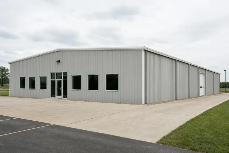 Mountain-corridor light industrialBuildings sited in the Southern Rocky Mountains zone, where access-road grading and snow-load design deserve early engineering attention.Plains distribution and storageFlatter-ground buildings in the Great Plains zone's subprovinces, generally simpler sitework but still zone-specific for drainage.Plateau or basin light-industrialWestern Colorado Plateau and northern Wyoming Basin sites, where terrain differs enough from the Front Range that a local site visit matters.
Example Configuration — for planning purposes only.
Footprint
Sizes That Suit Common Colorado Commercial Briefs
A starting range before a zone-specific site plan is drawn.
40′ × 60′
2,400 sq ft
A single working bay with a small office corner, common on flatter plains-zone parcels.
60′ × 100′
6,000 sq ft
Room for a working bay plus a retail or showroom front.
80′ × 150′
12,000 sq ft
Larger light-industrial or storage footprints, typically needing more access-road planning in mountain or plateau terrain.
Example Configuration — for planning purposes only.
Footprint pages carry layout detail; confirm code, permit, and structural-design specifics with your local building department and engineer.
Questions
Colorado Commercial Steel Building Questions
State-level answers, with jurisdiction- and site-specific items routed to the party that actually decides them.
No. The Office of the State Architect sets minimum codes only for state-owned or state-lease-purchased buildings. Privately developed commercial buildings are reviewed under whatever code the local jurisdiction has adopted.
It can be significant. Colorado's high point, Mount Elbert, reaches 14,440 feet, while the eastern two-fifths of the state is flat plains. Snow load and wind exposure should be confirmed by a structural engineer for the specific site rather than assumed from a statewide average.
The Colorado Geological Survey names four zones: Southern Rocky Mountains, Great Plains (with High Plains, Colorado Piedmont, and Raton Basin subprovinces), Wyoming Basin, and Colorado Plateau. A geotechnical engineer can confirm which zone your parcel falls into and what that means for foundation work.
It can be, particularly outside metro cores. Congressional Research Service data lists a substantial historical federal acreage share for Colorado; confirm boundary and access questions for a specific rural parcel with the relevant land-management agency.
There is no official typical size; use varies by industry and zone. Many enquiries fall between 40x60 and 80x150 depending on whether the building serves light-industrial, storage, or retail-front use.
This page could not verify a specific FEMA National Risk Index hazard enumeration for Colorado's statewide profile. Pull the NRI report for your specific county and tract at hazards.fema.gov rather than relying on a generalized statewide claim.
Sources for the Colorado facts on this page
This page states no code requirement, wind speed, snow load, permit rule, price or supplier claim. The state-specific facts it does use are listed with their publisher below.
Colorado's highest point, Mount Elbert, reaches 14,440 feet elevation (NAVD 88), reflecting the extreme high-mountain-to-plains elevation range relevant to mountain snow load versus valley/plains conditions.
Wikipedia (cross-referencing USGS elevation data) · current · Tier 1
https://en.wikipedia.org/wiki/Mount_ElbertColorado is described as having the highest mean elevation of any U.S. state and contains 54 peaks above 14,000 feet, with the eastern two-fifths of the state being flat plains, underscoring the mountain-vs-plains contrast for snow and wind exposure.
NETSTATE.com (general geography reference) · current reference page · Tier 2
https://www.netstate.com/states/geography/co_geography.htmThe Colorado Geological Survey's physiographic map divides the state into the Southern Rocky Mountains, the Great Plains (with High Plains, Colorado Piedmont, and Raton Basin subprovinces), the Wyoming Basin, and the Colorado Plateau.
Colorado Geological Survey · current reference map · Tier 2
https://coloradogeologicalsurvey.org/wp-content/uploads/ON-010-09-04.pdfColorado has no single statewide building code agency for general construction; the state's Office of the State Architect only sets minimum codes for state-owned/state-lease-purchased buildings, while other construction is subject to local adoption per the Division of Housing and Colorado's Planning for Hazards program.
Colorado Office of the State Architect; Colorado Department of Local Affairs, Division of Housing · current, accessed 2024/2025 · Tier 2
https://osa.colorado.gov/building-codesColorado's Division of Housing (Department of Local Affairs) issues state housing board resolutions (e.g., on-site construction/safety codes for manufactured and multi-family housing) that apply only where local standards do not otherwise exist, illustrating the state's default-to-local code structure.
Colorado Secretary of State / Department of Local Affairs, Division of Housing · current codified rule · Tier 2
https://www.sos.state.co.us/CCR/GenerateRulePdf.do?fileName=8+CCR+1302-8&ruleVersionId=7589CRS's federal land ownership dataset lists Colorado federal acreage at roughly 23.8 million acres (2013 data) against total state acreage of approximately 23.6 million acres reported in the same table (figures should be read alongside the report's narrative, as western-state totals were affected by year-to-year BLM/DOD adjustments).
Congressional Research Service · data as of FY2013, report dated March 3, 2017 · Tier 1
https://www.everycrsreport.com/files/20170303_R42346_95ce191e74ed8e08054bb5476971544bc55823f2.html