
Commercial building · ID
Commercial Steel Buildings in Idaho
Idaho's agricultural sales rank 19th nationally despite the state's relatively small population, and that mid-tier but substantial agricultural base supports a steady stream of commercial and light-industrial steel construction tied to processing, storage, and distribution. But the state itself is not one uniform site to build on. Idaho Geological Survey mapping shows southern Basin and Range structure, the volcanic Snake River Plain, and the mountainous central batholith all inside 82,643 square miles of land area, and FEMA's National Risk Index scores hazard exposure county by county rather than assigning Idaho a single statewide label. A commercial buyer here plans around the region their parcel sits in, not a generic Idaho profile.
Economic Backdrop
A Commercial Market Built on Agriculture
Idaho's commercial building demand is closely tied to a substantial, mid-tier-ranked agricultural economy, not a large urban commercial base.
USDA's 2022 Census of Agriculture ranks Idaho's market value of products sold 19th of 50 nationally. The Idaho State Department of Agriculture separately ranks the state #1 in the country for barley, potatoes, and peppermint oil, and #1 for alfalfa hay by share of U.S. output. That production base drives real demand for commercial steel buildings — grain storage, potato cold storage, processing facilities, and distribution buildings — that differs from a metro area's mix of retail and office space.
For a buyer planning a commercial building tied to any of these commodities, the practical implication is that layout decisions (bay depth, door height, climate control) should be driven by the specific crop or product handled, not a generic commercial template. A potato storage building and a general light-industrial warehouse share a steel frame but very little else in terms of interior specification.
Idaho's #1 national ranking for alfalfa hay by share of U.S. output points to another category worth naming directly: bulk hay and forage storage buildings, which need wide-bay clear spans and ventilation profiles distinct from a potato cold-storage building or a general light-industrial shell. A buyer scoping any of these should treat the commodity as the design brief's starting point, since a barley elevator, a potato cellar and a hay barn share little beyond a steel frame.
Site Selection
How Idaho's Terrain Changes the Site Plan
The Idaho Geological Survey's statewide geologic map identifies three terrain types, each with a different commercial sitework story.
Snake River Plain (South)
A broad volcanic terrain tied to the Yellowstone hotspot track; basalt-influenced soils across southern Idaho are worth a geotechnical look before a slab-on-grade commercial pad is finalized.
Southern Basin and Range
Alternating valley and range structure; drainage design should account for the local topography rather than assume flat, uniform ground.
Central Idaho Batholith (North/Central)
Granite mountain terrain where access roads and grading often set the site-prep budget more than building footprint does.
Exposure and Utilities
County-Level Hazard Data and Low-Density Siting
Idaho's hazard exposure is scored locally, and its low population density changes what infrastructure a commercial buyer should budget for.
FEMA's National Risk Index (hazards.fema.gov) is the authoritative county- and tract-level source for Idaho hazard exposure across 18 hazard types, including wildfire, landslide, and earthquake. This page does not assign a hazard score to any Idaho region; that number depends on the specific county and tract the parcel sits in, and pulling the NRI report for that parcel is a more useful step than reading a generalized statewide hazard narrative.
Idaho's population density of about 19 persons per square mile across 82,643.12 square miles of land also matters for commercial site planning outside the state's handful of metro areas. Many commercial parcels sit well beyond municipal water and sewer service, which can shift budget toward on-site well and septic systems and toward confirming utility extension costs with the local utility provider before a design is finalized.
That same rural pattern shows up in freight access: a commercial building serving ag storage or processing often needs a truck court and turning radius sized for grain or produce trailers rather than standard delivery vans, which is worth confirming with a site engineer alongside the utility and hazard questions above.
- Pull Your County's NRI Report
- Hazard exposure varies enough within Idaho that a statewide claim would misrepresent most parcels.
- Confirm Utility Access Early
- Rural Idaho commercial sites often need on-site water/septic solutions, not municipal hookups.
- Match Layout to Commodity
- Ag-processing and storage buildings need commodity-specific interior specs, not a generic warehouse plan.
Get Idaho Commercial Building Quotes
Tell us your region, intended use, and site utility status, and we'll route the right questions with your Idaho context attached.
Climate Reference
Why a Single Idaho Climate Number Doesn't Travel Far
NOAA's climate normals show why a Boise-area weather station cannot stand in for the whole state when a commercial building is being planned.
NOAA's National Centers for Environmental Information publish 1991-2020 climate normals for the Boise Air Terminal station showing about 11.5 inches of annual precipitation and roughly 17.6 inches of annual snowfall — figures that describe the semi-arid Treasure Valley, not Idaho's mountain terrain or its northern panhandle. The National Weather Service's Boise office maintains an ongoing local climatology reference specifically because conditions across the state vary enough that one number misleads more than it helps.
For a commercial building buyer, the practical takeaway is to treat any statewide-sounding climate figure as a starting reference point only. A building sited in the Snake River Plain near Boise faces a very different roof-load and drainage conversation than one sited in the central Idaho batholith mountains, where elevation alone can push snowfall well past the Treasure Valley average. Your county building department and your engineer set the structural design criteria for this site — confirm them before you finalize the frame, rather than defaulting to a nearby city's published climate normal.
Configuration
How Idaho Commercial Buildings Get Used
Idaho's ag-heavy economy shapes the commercial building briefs seen most often in the state.
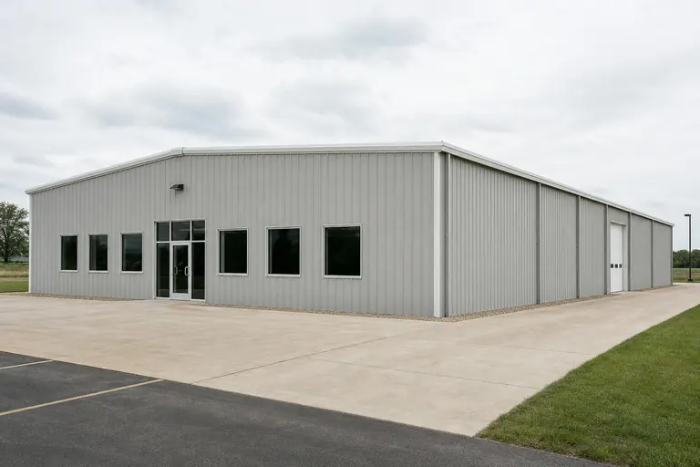 Ag Storage and ProcessingBuildings scoped for potatoes, barley, hay, or peppermint oil, with commodity-specific storage, ventilation, floor drainage, and handling needs that a generic warehouse brief doesn't address.Light Industrial / DistributionClear-span working bays with loading access and truck court space, often serving rural or low-density sites well outside a metro core.Retail or Office FrontA finished front section attached to a working bay, found in Idaho's metro corridors alongside working-bay space.
Example Configuration — for planning purposes only.
Footprint
Sizes That Suit Common Idaho Commercial Briefs
A reasonable starting range before a site-specific plan is drawn.
40′ × 60′
2,400 sq ft
A single working bay with a small office corner.
60′ × 100′
6,000 sq ft
Room for a working bay plus a retail or showroom front.
80′ × 150′
12,000 sq ft
Larger ag-storage or multi-bay light-industrial footprints.
Example Configuration — for planning purposes only.
Footprint pages carry layout detail; confirm code and permit specifics with your local building department, and size any truck court or loading apron against the trailers your operation actually uses.
Questions
Idaho Commercial Steel Building Questions
Questions answered honestly at the state level, with the rest routed to the party that owns them.
Idaho's 2022 Census of Agriculture ranks the state 19th nationally in products sold, and #1 nationally in barley, potatoes, and peppermint oil production. That production base drives steady demand for storage, processing, and distribution buildings.
It can. The Idaho Geological Survey identifies Basin and Range, volcanic Snake River Plain, and batholith mountain terrain as distinct zones, each with different drainage and access considerations. Confirm sitework scope with your contractor before finalizing a budget.
Use FEMA's National Risk Index (hazards.fema.gov), which scores Idaho by county and tract across 18 hazard types. There is no single statewide hazard label that applies evenly to every site.
Not always. With roughly 19 persons per square mile statewide, many commercial parcels sit outside municipal service areas, which can mean budgeting for on-site well or septic infrastructure as well as a longer utility-extension conversation with the local provider.
There's no official typical size; use varies by industry. Many enquiries fall between 40x60 and 80x150 depending on whether the building serves ag storage, light-industrial, or retail/office use.
No. NOAA's 1991-2020 normal for the Boise Air Terminal station reflects the Treasure Valley's semi-arid conditions specifically. Idaho's mountain and northern regions see different snowfall and precipitation patterns, so confirm site-specific structural design criteria with your county building department and engineer rather than relying on a single station's data.
Sources for the Idaho facts on this page
This page states no code requirement, wind speed, snow load, permit rule, price or supplier claim. The state-specific facts it does use are listed with their publisher below.
Idaho's 2022 Census of Agriculture market value of products sold totaled about $10.9 billion, ranking Idaho 19th of 50 states in agricultural sales.
USDA NASS · 2022 · Tier 1
https://www.nass.usda.gov/Publications/AgCensus/2022/Online_Resources/County_Profiles/Idaho/cp99016.pdfThe Idaho State Department of Agriculture's Idaho Agricultural Statistics report ranks Idaho 1st in the nation for barley, potatoes, and peppermint oil production, and 1st for hay/alfalfa hay by share of U.S. output (9.5%).
Idaho State Department of Agriculture · 2023 statistics bulletin · Tier 2
https://agri.idaho.gov/wp-content/uploads/2024/11/2023-Idaho-Ag-Stats_Draft.pdfThe Idaho Geological Survey's statewide Geologic Map of Idaho documents the state's varied terrain, spanning Basin and Range structures in the south, the volcanic Snake River Plain, and the mountainous central Idaho batholith terrain to the north.
Idaho Geological Survey, University of Idaho · 2012 · Tier 2
https://idahogeology.org/pub/Maps/Geologic_Map_of_ID_booklet_3.pdfIdaho's total land area was measured at 82,643.12 square miles as of the 2010 Census, the 11th largest of any U.S. state, with a population density of only about 19.0 persons per square mile.
U.S. Census Bureau · 2010 Census · Tier 1
https://www.census.gov/geographies/reference-files/2010/geo/state-local-geo-guides-2010/idaho.htmlFEMA's National Risk Index platform (hazards.fema.gov) is the authoritative county/tract-level source for Idaho natural hazard exposure scores across 18 hazard types, including hazard categories such as wildfire, landslide, and earthquake that are tracked for Idaho specifically.
Federal Emergency Management Agency (FEMA) · Current NRI dataset · Tier 1
https://www.fema.gov/flood-maps/products-tools/national-risk-indexBoise's 1991-2020 annual climate normal precipitation is about 11.5 inches with roughly 17.6 inches of annual snowfall, reflecting the semi-arid Treasure Valley climate.
NOAA National Centers for Environmental Information (NCEI) · 1991-2020 · Tier 1
https://www.ncei.noaa.gov/access/services/data/v1?dataset=normals-monthly-1991-2020&dataTypes=MLY-PRCP-NORMAL,MLY-SNOW-NORMAL&format=csv&stations=USW00024131NWS Boise publishes a 'Local Climate of the Treasure Valley and Boise, Idaho' reference page and ongoing climatology data describing the region's climate patterns and local climate divides.
National Weather Service (NOAA), Boise ID office · Ongoing NWS climatology reference · Tier 1
https://www.weather.gov/boi/climatesummary