
Carport · IL
Carports in Illinois
Illinois asks two different questions of a carport depending on where you're standing. Near Lake Michigan, the Chicago Midway station normal runs roughly 36-38 inches of annual precipitation with lake-effect-influenced snow, which pushes toward a steeper roof pitch and tighter attention to drift. Out on the Till Plains and the state's other physiographic sections, the same structure is more often judged on how well it stands up to open, unbroken wind across flat farmland with no windbreak. With 71,123 farms averaging 370 acres apiece, a carport in downstate Illinois is as likely to shelter a tractor or grain truck as a car. This guide separates those two planning contexts instead of flattening them into one 'Illinois' answer.
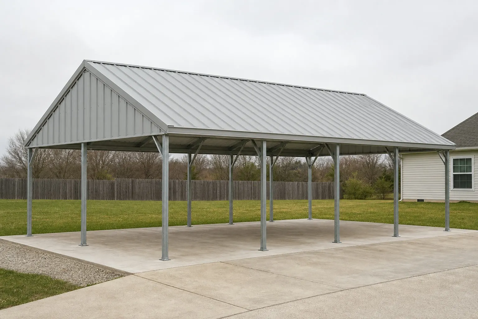
One State, Two Very Different Carport Sites
Illinois covers 55,518.9 square miles across a dozen named physiographic sections, from the Chicago Lake Plain in the northeast down through the Till Plains, Springfield Plain, and the Shawnee Hills near the southern tip. A carport plan that works in one of these sections doesn't automatically transfer to another. Buyers near Chicago are dealing with lake-influenced precipitation patterns; buyers on the state's dominant Till Plains are dealing with flat, open exposure and, in many cases, an actual working farm. Before picking a roof style or anchor type, it's worth being honest about which Illinois you're building in.
Climate Context
Reading the Chicago Normal Without Assuming It Applies Statewide
The most detailed Illinois climate data comes from a single Chicago-area station, and it should be treated as representative of that corridor, not the whole state.
NOAA NCEI's 1991-2020 climate normal for Chicago Midway Airport puts annual precipitation at roughly 36-38 inches, with snowfall totals that reflect lake-effect influence off Lake Michigan. That's a genuinely useful number if you're siting a carport in Cook County or nearby collar counties, where roof pitch and drift clearance benefit from planning around sustained winter accumulation. NOAA also separately publishes a narrative description of Illinois as having a continental climate with cold winters, warm summers, and frequent short-term weather fluctuations, which is a statewide characterization but not a load figure.
Move away from the lakeshore and the picture changes. The Illinois State Climatologist Office, run through the University of Illinois's Prairie Research Institute, maintains separate normals for Chicago O'Hare going back to 1981-2010, underscoring that even within the same metro area, station-level detail matters more than a single 'Illinois average.' Downstate, in sections like the Springfield Plain or Galesburg Plain, buyers won't find an equivalent single-station normal cited here, and that's a genuine gap worth declaring rather than papering over with an assumed number.
Data Reference
Illinois Reference Points for Carport Planning
These sourced figures frame the siting and structural questions worth asking before ordering an Illinois carport.
| Measure | Value | Source |
|---|---|---|
| Land Area | 55,518.9 sq mi | U.S. Census Bureau (2010) |
| Chicago Midway Precipitation Normal | ~36-38 in/yr | NOAA NCEI (1991-2020) |
| Farms in Illinois (2022) | 71,123 | USDA NASS |
| Land in Farms | 26,292,041 acres | USDA NASS |
| Average Farm Size | 370 acres | USDA NASS |
| New Housing Units Authorized (2024) | 20,326 | U.S. Census Bureau |
Land Area
- Value
- 55,518.9 sq mi
- Source
- U.S. Census Bureau (2010)
Chicago Midway Precipitation Normal
- Value
- ~36-38 in/yr
- Source
- NOAA NCEI (1991-2020)
Farms in Illinois (2022)
- Value
- 71,123
- Source
- USDA NASS
Land in Farms
- Value
- 26,292,041 acres
- Source
- USDA NASS
Average Farm Size
- Value
- 370 acres
- Source
- USDA NASS
New Housing Units Authorized (2024)
- Value
- 20,326
- Source
- U.S. Census Bureau
Plan a Carport for Your Part of Illinois
Whether you're near the lake or out on open farmland, tell us your location and we'll help match you with an Illinois-appropriate carport option.
Site Planning
Siting a Carport on Illinois's 370-Acre Average Farm
On working Illinois farmland, a carport's location is usually dictated by equipment flow, not curb appeal.
USDA's 2022 Census of Agriculture counted 71,123 farms in Illinois covering 26,292,041 acres, for an average size of 370 acres — a modest 2% decline in farm count since 2017, but still a landscape where a carport frequently sits alongside a grain bin, machine shed, or long gravel lane rather than a suburban driveway. On a parcel that size, the carport's job often shifts from 'protect the car' to 'protect equipment between uses' — a pickup, a UTV, or overflow implement storage that doesn't justify a fully enclosed building.
That changes the geometry question. A carport built for a two-car residential driveway in a Chicago suburb needs a different clear height and post spacing than one meant to shelter a farm truck with an attached hitch or a piece of equipment with raised implements. Because the Till Plains and similar physiographic sections offer little natural windbreak, an open-sided structure on a large parcel is also more exposed to sustained crosswinds than a comparably sized carport tucked between other buildings in town — worth factoring into anchor choice regardless of the specific load number, which should come from your local building department rather than a generic online chart.
- Match clear height to actual equipment
- Confirm the tallest vehicle or implement that will park under the roof before finalizing post height, not just a standard passenger car.
- Plan for open-fetch wind exposure
- On flat, unbroken Till Plains or Springfield Plain terrain, anchoring should assume longer wind fetch than a sheltered suburban lot.
- Position along existing access lanes
- On multi-building farm parcels, siting the carport along the lane already used by equipment avoids creating a new traffic pattern.
Hazard Awareness
Why 'Illinois Risk' Isn't a Single Number
FEMA's own hazard tool is built around counties and tracts, not a statewide Illinois ranking, so verification has to happen locally.
FEMA's National Risk Index covers 18 natural hazards and is explicitly built as a county- and tract-level interactive tool. FEMA does not publish a single statewide 'top hazard' narrative for Illinois on fema.gov, which means any claim about 'Illinois's biggest carport risk' being one specific hazard is not something FEMA itself asserts. The honest approach is to pull the NRI report for your specific county — whether that's Cook County near the lake or a rural county in the state's southern Shawnee Hills — before deciding how much structural reinforcement makes sense for your carport.
This matters for Illinois specifically because the state's hazard exposure genuinely varies by geography: proximity to Lake Michigan changes moisture and wind patterns, while flat interior sections change wind exposure and drainage behavior. Rather than guessing, treat the NRI lookup as a required step in carport planning, the same way you'd check local zoning before ordering a footprint.
Questions
Illinois Carport Questions
Straight answers for buyers planning a carport somewhere in Illinois's varied geography.
Not directly. The Chicago Midway climate normal reflects lake-effect-influenced precipitation specific to that corridor. Downstate Illinois sections like the Till Plains or Springfield Plain don't share that same lake influence, so treat the Chicago figures as regional context, not a statewide design number.
That depends entirely on your local jurisdiction; Illinois doesn't set one statewide accessory-structure threshold in the evidence used here. Confirm square footage, setback, and permit requirements with your county or municipal building department before ordering.
Base the clear height and post spacing on the tallest equipment or vehicle you'll actually park underneath, not a generic residential carport size. On the state's average 370-acre farm, that's often a truck or implement rather than a passenger car.
Sustained, unobstructed wind exposure is a reasonable concern on the state's flatter physiographic sections, since there's often little natural windbreak. Confirm anchoring specifications with a local supplier or engineer rather than assuming a fixed wind rating for the whole state.
FEMA doesn't publish a single top-hazard ranking for Illinois as a whole; its National Risk Index is a county/tract tool. Look up your specific county's NRI report rather than relying on a generalized statewide hazard claim.
A confirmed statewide frost-depth figure wasn't available from the sources used for this guide, so this is a genuine local question — ask your building department or a local contractor for the frost line in your specific county before setting footing depth.
Sources for the Illinois facts on this page
This page states no code requirement, wind speed, snow load, permit rule, price or supplier claim. The state-specific facts it does use are listed with their publisher below.
Chicago Midway Airport's 1991-2020 annual climate normal is roughly 36-38 inches of precipitation with substantial lake-effect-influenced snowfall totals published by NOAA NCEI for the official station.
NOAA National Centers for Environmental Information (NCEI) · 1991-2020 · Tier 1
https://www.ncei.noaa.gov/access/services/data/v1?dataset=normals-annualseasonal-1991-2020&startDate=0001-01-01&endDate=9996-12-31&stations=USW00014819&format=pdfNOAA NCEI publishes a narrative 'Climate of Illinois' describing the state's location midway between the Continental Divide and the Atlantic Ocean and its continental climate of cold winters, warm summers, and frequent short-term fluctuations in weather.
NOAA National Centers for Environmental Information (NCEI) · Historical narrative (NCEI climate normals series) · Tier 1
https://www.ncei.noaa.gov/data/climate-normals-deprecated/access/clim60/states/Clim_IL_01.pdfThe Illinois State Geological Survey maps the state into named physiographic divisions including the Till Plains, Wisconsin Driftless Section, Rock River Hill Country, Green River Lowland, Great Lake Section (Chicago Lake Plain), Kankakee Plain, Springfield Plain, Galesburg Plain, Bloomington Ridged Plain, Mt. Vernon Hill Country, Shawnee Hills Section, and Lincoln Hills.
Illinois State Geological Survey, University of Illinois · ISGS reference map, 1993 (revised 1998), originally based on Leighton et al. 1948 · Tier 2
https://clearinghouse.isgs.illinois.edu/data/geology/physiographic-divisionsIllinois's total land area was measured at 55,518.9 square miles as of the 2010 Census.
U.S. Census Bureau · 2010 Census · Tier 1
https://www.census.gov/geographies/reference-files/2010/geo/state-local-geo-guides-2010/illinois.htmlIllinois had 71,123 farms in 2022, a decrease of 2% since 2017.
USDA National Agricultural Statistics Service (NASS) · 2022 · Tier 1
https://www.nass.usda.gov/Publications/AgCensus/2022/Online_Resources/County_Profiles/Illinois/cp99017.pdfIllinois had 26,292,041 acres of land in farms in 2022, an average farm size of 370 acres.
USDA NASS · 2022 · Tier 1
https://www.nass.usda.gov/Publications/AgCensus/2022/Online_Resources/County_Profiles/Illinois/cp99017.pdfFEMA's National Risk Index is an interactive county/tract-level tool covering 18 natural hazards (including tornado, hail, riverine flooding, and severe winter weather relevant to the Midwest); FEMA does not publish a single-number statewide 'top hazard' ranking narrative for Illinois on fema.gov, so county/tract-level NRI queries are the citable source.
Federal Emergency Management Agency (FEMA) · Current NRI release · Tier 1
https://www.fema.gov/flood-maps/products-tools/national-risk-indexIllinois had a total of 16,863 new privately-owned housing units authorized by building permits in 2023, rising to 20,326 units in 2024 (a 20.5% increase).
U.S. Census Bureau · 2023-2024 · Tier 1
https://www.census.gov/construction/bps/pdf/2024annualhighlights.pdf