
Barndominium · AK
Barndominiums in Alaska
A barndominium in Alaska is decided at the ground, not at the floor plan. USGS's reference Permafrost Map of Alaska and its newer 30-meter modeled probability layer both document that continuous or discontinuous permafrost is a real possibility across large stretches of the state, and whether a specific parcel sits on frozen or unfrozen ground changes the foundation system before any interior layout gets drawn. Layer onto that a state so large — 570,641 square miles by the 2010 Census, the biggest in the country — that a builder's typical delivery radius from Anchorage or Fairbanks may not reach a given site at all, and the planning sequence for an Alaska barndominium runs foundation and logistics first, aesthetics second. This page works through what that actually means for siting, ordering and phasing the build.
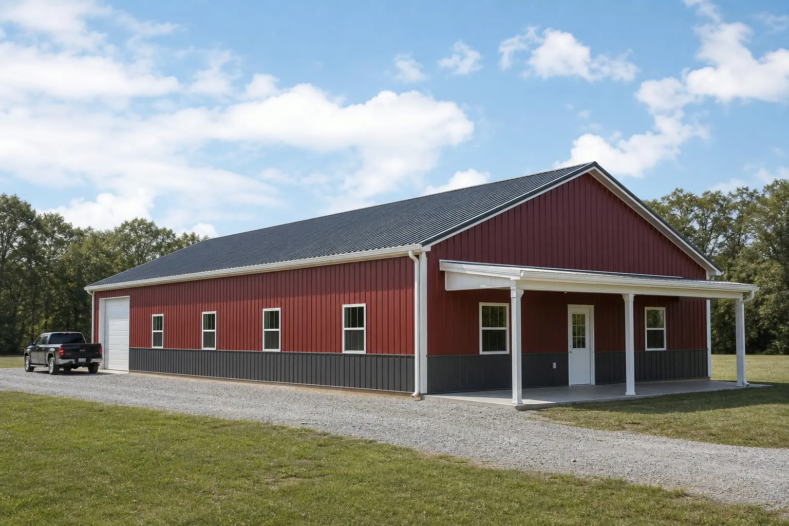
The intersection
Why Alaska starts the barndominium conversation at the ground
Foundation design is the first Alaska-specific decision, and it happens before layout because the ground itself is the variable.
USGS's reference Permafrost Map of Alaska, originally published in 1965 and still cited by the agency, documents continuous and discontinuous permafrost across wide portions of the state. That single fact reorders the usual barndominium planning sequence: instead of picking a floor plan and then an appropriate slab, an Alaska project typically needs a site-specific ground read before a foundation type is even proposed.
USGS's EROS Center has since built a modeled probabilistic map of near-surface permafrost — within one meter of the surface — at 30-meter resolution, which gives planners a more current starting reference than the 1965 map alone. Neither map substitutes for a site visit or a geotechnical boring, but both make clear that 'permafrost or not' is a real question for a specific Alaska parcel rather than a rare edge case.
On unfrozen, well-drained ground, an Alaska barndominium foundation can look much like it would elsewhere. On ground where permafrost is likely, insulated or elevated foundation systems designed to avoid thawing the permafrost beneath the structure are the kind of engineering conversation that needs to happen before a builder quotes a package, not after.
Site planning
What the USGS permafrost references suggest for siting
A comparison of what the two USGS resources indicate and what each means for next steps.
| USGS resource | What it documents | What to do with it |
|---|---|---|
| Reference Permafrost Map of Alaska (1965, IMAP 445) | Broad continuous and discontinuous permafrost zones statewide | Use as a first screening reference, not a site-specific answer |
| Modeled near-surface permafrost probability map (30 m) | Probabilistic near-surface (within 1 m) permafrost likelihood | Narrow the screening before commissioning a geotechnical boring |
| On-site geotechnical investigation | Ground truth for the specific parcel | Required before foundation type is finalized |
Reference Permafrost Map of Alaska (1965, IMAP 445)
- What it documents
- Broad continuous and discontinuous permafrost zones statewide
- What to do with it
- Use as a first screening reference, not a site-specific answer
Modeled near-surface permafrost probability map (30 m)
- What it documents
- Probabilistic near-surface (within 1 m) permafrost likelihood
- What to do with it
- Narrow the screening before commissioning a geotechnical boring
On-site geotechnical investigation
- What it documents
- Ground truth for the specific parcel
- What to do with it
- Required before foundation type is finalized
Delivery & scale
The largest state by land area changes how a build gets there
Alaska's sheer size means delivery routing and crew travel are a planning input, not an afterthought.
The U.S. Census Bureau measured Alaska's total land area at 570,641.0 square miles as of the 2010 Census — the largest of any state by a wide margin. That scale means a builder's normal service radius, calibrated for Lower-48 distances, may simply not reach a given Alaska site, and confirming the actual delivery route and season is worth doing before a schedule is promised.
USDA's 2022 Census of Agriculture recorded 1,173 Alaska farms averaging 742 acres each, up 18% in farm count since 2017 even as average acreage moved with the addition of newer, smaller operations. That mix argues against assuming any single acreage figure for a working parcel — the right approach is measuring the buyer's actual equipment and access needs on the specific property rather than applying a statewide average to shop-bay sizing.
Because delivery distance and route (road, barge, or air, depending on the site) are project-specific, the ordering sequence for materials often needs to work backward from a seasonal shipping window rather than forward from a target move-in date.
- Confirm the real delivery route early
- Road access, barge scheduling or air freight each carry different lead times; find out which applies to the parcel before ordering.
- Don't size the shop off a statewide acreage average
- USDA's 742-acre average spans a wide range of operation sizes; measure the buyer's actual equipment instead.
- Build in a schedule buffer
- Remote sites and seasonal shipping windows argue for a buffer beyond the builder's stated lead time.
Get Alaska barndominium quotes
Tell suppliers your site's ground condition (or that it needs screening), your delivery route, and the shop-half equipment it needs to hold. We route it with the Alaska and barndominium context already attached.
Permitting climate
A thin and shifting statewide permit baseline
Residential permit volume statewide has moved sharply year over year, which is a reason to confirm process locally rather than assume continuity.
Statewide trend
The Census Bureau recorded 937 total housing units authorized by building permits in Alaska in 2023, up 62.1% from 578 units in 2022 — a swing that signals a permitting environment still settling rather than a stable annual baseline.
Borough and municipal offices
Given that volatility, a project's actual permit timeline and requirements should come directly from the specific borough or municipal building department rather than from a statewide assumption.
Unorganized borough areas
Large portions of the state fall outside organized boroughs, where permitting authority and process can differ meaningfully from an incorporated municipality; confirm which jurisdiction actually governs the parcel.
Preparation
Before requesting an Alaska barndominium quote
Five items resolved up front keep an Alaska barndominium project from stalling once ground condition or logistics surface mid-design.
- Screen the parcel against USGS permafrost resourcesCheck both the reference permafrost map and the newer 30-meter modeled probability layer before assuming a standard foundation.
- Commission a site-specific geotechnical investigationNeither USGS map substitutes for ground-truthing on the actual parcel; budget for a boring before foundation design is finalized.
- Confirm the delivery route and seasonRoad, barge or air access each carry different lead times; get this from the builder and carrier, not assumed from typical distances.
- Check the FEMA National Risk Index for your borough or census areaUse the official NRI tool for a citable hazard picture covering earthquake, avalanche and winter weather rather than a general statewide claim.
- Confirm permitting requirements with the specific jurisdictionPermit volume swung 62.1% year over year statewide in 2023-2022 Census Bureau data; get current requirements from your borough or municipal office directly.
Questions
Alaska barndominium questions
Honest state-level answers, with anything jurisdiction-, engineer- or lender-specific routed to who actually owns it.
Not every site, but it is a real possibility across large parts of the state. USGS's reference permafrost map and its modeled 30-meter near-surface probability layer both document continuous and discontinuous permafrost zones, so a site-specific geotechnical check is the right first step before foundation design.
Alaska's 570,641 square miles of land area, the largest of any state per the 2010 Census, means delivery routes vary enormously by location. Confirm whether your site is reached by road, barge or air, and plan the material order around that route's season rather than a fixed target date.
Size it from the buyer's actual equipment list. USDA's 2022 Census of Agriculture recorded Alaska farms averaging 742 acres, but that average spans a wide range of operation types, so it should not substitute for measuring specific equipment clearances.
No. Census Bureau data shows statewide authorized housing units rose 62.1% from 2022 to 2023, suggesting a permitting environment that varies meaningfully by year and jurisdiction. Confirm current requirements directly with the borough or municipal building department covering the parcel.
FEMA's National Risk Index scores earthquake, avalanche, winter weather and other hazards at the borough and census-area level. Use FEMA's own NRI tool for a citable, location-specific figure rather than a general statewide hazard claim.
Sources for the Alaska facts on this page
This page states no code requirement, wind speed, snow load, permit rule, price or supplier claim. The state-specific facts it does use are listed with their publisher below.
USGS's Permafrost Map of Alaska (Ferrians, 1965, IMAP 445) documents the widespread distribution of continuous and discontinuous permafrost across the state, a longstanding reference still cited by USGS.
U.S. Geological Survey (USGS) · Originally published 1965; USGS reference · Tier 1
https://www.usgs.gov/maps/permafrost-map-alaskaUSGS's Earth Resources Observation and Science (EROS) Center maintains a modeled probabilistic map of near-surface (within 1 meter) permafrost distribution across Alaska at 30-meter resolution.
U.S. Geological Survey (USGS), EROS Center · USGS EROS reference dataset · Tier 1
https://www.usgs.gov/media/images/modeled-probabilistic-map-near-surface-permafrost-within-alaskaAlaska's total land area was measured at 570,641.0 square miles as of the 2010 Census, the largest of any US state.
U.S. Census Bureau · 2010 Census · Tier 1
https://www.census.gov/geographies/reference-files/2010/geo/state-local-geo-guides-2010/alaska.htmlAlaska had 937 total housing units authorized by building permits in 2023, up 62.1% from 578 in 2022.
U.S. Census Bureau · 2023 (annual) · Tier 1
https://www.census.gov/construction/bps/pdf/2023annualhighlights.pdfAlaska had 869,852 acres of land in farms in 2022, an average farm size of 742 acres, down 14% from 2017.
USDA NASS · 2022 · Tier 1
https://www.nass.usda.gov/Publications/AgCensus/2022/Online_Resources/County_Profiles/Alaska/cp99002.pdfFEMA's National Risk Index is an interactive county/tract-level tool covering 18 natural hazards, including earthquake, avalanche, and winter weather, that can be queried for Alaska's boroughs and census areas.
Federal Emergency Management Agency (FEMA) · Current NRI release · Tier 1
https://www.fema.gov/flood-maps/products-tools/national-risk-index