
Shed · UT
Sheds in Utah
A shed is often the least-reviewed structure a property owner ever puts up, which is exactly why the first Utah-specific question is not about the shed at all: is the ground it's going on actually yours to build on? A CRS federal land ownership dataset shows federal acreage dominating Utah's land base, and Utah's Trust Lands Administration (SITLA) separately manages state trust land granted by Congress for school and institution funding — land that can sit right at the edge of a private parcel without the property owner realizing it. Once that's settled, Utah's own elevation range, from 2,350 feet at Beaver Dam Wash to 13,528 feet at Kings Peak, and its three climate zones — desert, steppe and highland — shape which foundation and snow-shed approach actually fits the site. This page works through both questions in order, then covers footprint.
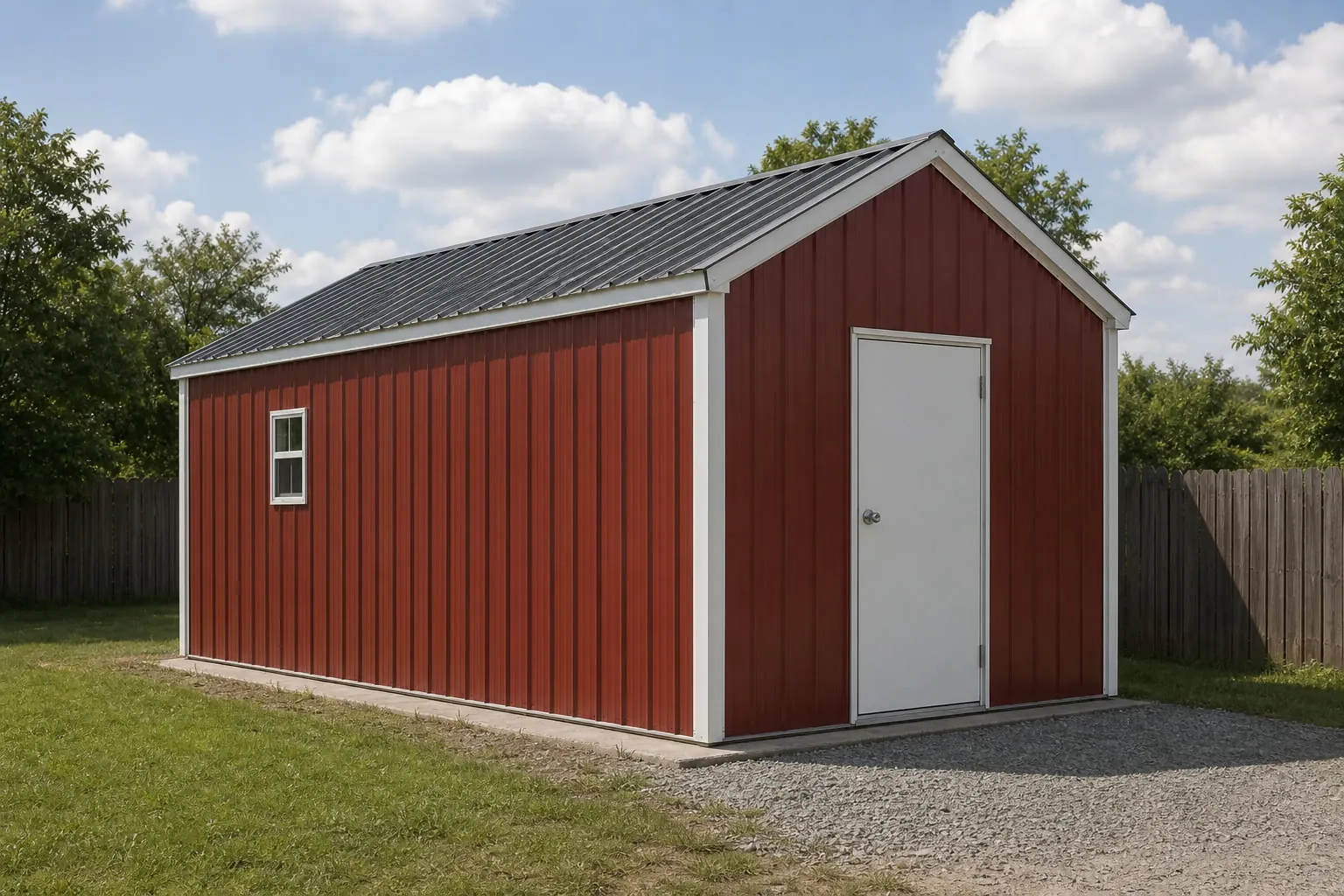
Check the Ground Before You Choose a Footprint
A shed is small enough, and cheap enough, that buyers routinely skip the one check that matters most in Utah: is this parcel unambiguously private land? Federal acreage dominates Utah's total land base per a CRS dataset, and SITLA-managed state trust land runs alongside private parcels in places a casual look wouldn't reveal. Confirm that first. A shed sited a few feet onto the wrong side of a boundary is a genuinely hard problem to fix after the fact, in a way that choosing the wrong footprint size simply isn't.
Land Status
Confirm This Before You Pick a Spot
These checks matter more in Utah than in a state with a smaller share of federal and trust land.
Step 1
Confirm the parcel boundary against county records
Given how much of Utah's land base is federal per CRS data, don't assume adjoining open land is part of your lot.
Step 2
Ask whether your parcel borders SITLA trust land
Trust lands fund Utah schools and institutions and are administered separately from private parcels; a boundary check avoids a costly mistake.
Step 3
Check your local accessory-structure rules before ordering
Setback and footprint thresholds for a shed are set locally, not by a single statewide figure.
Step 4
Confirm delivery access across your specific parcel
Especially relevant on rural land among Utah's 17,386 farms, where an unpaved approach may not support a delivery truck without preparation.
Zone
Which Utah Zone Is Your Shed Actually In?
Utah's desert, steppe and highland/mountain zones call for different foundation and orientation choices, and the state's elevation range makes the difference concrete rather than academic.
Desert zone (about a third of the state)
Dry, low-elevation ground closer to the state's low point near Beaver Dam Wash; heat and dust management for stored contents matter more here than snow.
Steppe zone (the largest share of the state)
A wider seasonal swing between hot summers and colder winters than the desert zone; a foundation approach that tolerates that swing without excessive movement is the practical goal.
Highland/mountain zone (about a quarter of the state)
Ground toward the state's high point near Kings Peak's 13,528 feet, where a shed's roof-snow shedding and door orientation deserve more deliberate planning than in the other two zones.
Foundation
An Unheated Building Follows the Ground It Sits On
A shed keeps no warmth in the soil beneath it, so whichever Utah zone it sits in, the ground responds to that zone's own freeze-thaw pattern, not a single statewide default.
A shed's slab or pad choice is a smaller decision than a garage's or a shop's, but it's not a free one. On the ground surrounding Beaver Dam Wash, a well-drained gravel pad is often adequate for light storage. Closer to the state's higher elevations near Kings Peak, a foundation that tolerates seasonal ground movement without racking the frame becomes worth the extra thought, since that ground freezes and thaws through a longer season than the desert floor does.
None of that is a substitute for a local answer. Frost depth and any permit threshold for a shed's footprint are confirmed by the local building department, and this page does not publish a statewide figure for either because none is sourced with confidence at that level of specificity.
Get shed quotes for your Utah parcel
Confirm your land status and zone first, then tell suppliers your footprint and intended use. Those answers make Utah shed quotes comparable.
Footprints
Shed Footprints That Work Once Land and Zone Are Confirmed
Utah shed buyers span suburban tool storage to rural equipment storage, so footprint follows use once the land and zone questions above are settled.
10′ × 12′
120 sq ft
A basic garden and tool-storage footprint suited to a confirmed suburban lot.
12′ × 20′
240 sq ft
Room for a mower and seasonal equipment, a common choice once delivery access is confirmed.
16′ × 24′
384 sq ft
A rural-parcel utility shed with bench space, suited to a larger confirmed holding among Utah's working farms.
Example Configuration — for planning purposes only.
Confirm your local accessory-structure threshold before selecting a footprint.
Terrain
Province, Not Just Zone, Decides What's Under the Pad
Utah's climate zones decide heat, dust and snow exposure above ground; its three physiographic provinces decide what the excavator actually finds below it.
Utah Division of State History places the state at the convergence of the Rocky Mountain Province, the Colorado Plateau, and the Basin and Range. A shed pad near the Wasatch or Uinta foothills, in the Rocky Mountain Province, can sit on sloped or variable ground even at a modest elevation. A shed on the Colorado Plateau may need to work around exposed bedrock rather than a simple graded pad. A shed in the Basin and Range's broad valley floors more often faces a drainage question across flat ground than a slope question.
This is a separate check from the climate-zone question above: two sheds at similar elevation can sit in different provinces and need different pad approaches, and a buyer who only checks their climate zone can still miss the province-specific ground condition their excavator finds on delivery day.
Rural Sheds
Rural Utah Sheds and Shrinking Farm Acreage
A shed sited on working land should account for the fact that Utah's farmland base is contracting slightly, not assume open acreage stays available indefinitely.
- Confirm the site plan now rather than deferring itTotal land in farms across Utah fell to 10,494,923 acres in the 2022 Census, down about 3% from 2017, so open acreage on a working parcel isn't guaranteed to stay open.
- Check the parcel's physiographic province before excavationRocky Mountain, Colorado Plateau and Basin and Range terrain each present different ground conditions for a shed pad, independent of climate zone.
- Coordinate shed siting with other planned outbuildingsOn a working farm among Utah's 17,386 recorded operations, a shed sited without regard to future barns or equipment storage can force an awkward layout later.
Questions
Utah Shed Questions
The Utah-specific questions a general shed page can't answer.
Federal acreage dominates Utah's land base per CRS data, and SITLA-managed state trust land runs alongside many private parcels. A boundary check before siting a shed avoids a mistake that's far harder to fix than choosing the wrong footprint size.
Yes. Utah's desert, steppe and highland/mountain zones differ enough in heat, dust and snow exposure that a foundation and orientation suited to one zone can under-serve a site in another.
Often, especially in the desert zone on well-drained ground. Closer to the state's higher elevations, a foundation that tolerates more seasonal ground movement is worth discussing with your local department.
It depends on your local jurisdiction's accessory-structure thresholds for footprint, height and setback. There's no single statewide answer we publish; ask your local building department about your specific shed.
Utah recorded 17,386 farms in the 2022 Census of Agriculture, so many sheds are rural. Confirm delivery access across your specific parcel, since an unpaved approach may need preparation before a delivery truck can reach the site.
Pricing is handled by the cost silo. The Utah-variable elements are foundation choice by zone, site access preparation, and any local permit requirements.
Sources for the Utah facts on this page
This page states no code requirement, wind speed, snow load, permit rule, price or supplier claim. The state-specific facts it does use are listed with their publisher below.
CRS's federal land ownership dataset lists Utah federal acreage at roughly 33.3 million acres (2013 data) against total state acreage of approximately 33.6 million acres.
Congressional Research Service · data as of FY2013, report dated March 3, 2017 · Tier 1
https://www.everycrsreport.com/files/20170303_R42346_95ce191e74ed8e08054bb5476971544bc55823f2.htmlUtah's School and Institutional Trust Lands Administration (SITLA/Trust Lands Administration) manages state trust land granted by Congress to benefit Utah schools and institutions.
Utah Trust Lands Administration (SITLA) · current, accessed 2024 · Tier 2
https://trustlands.utah.gov/Utah's highest point is Kings Peak at 13,528 feet and its lowest point is Beaver Dam Wash at 2,350 feet, illustrating the mountain-versus-valley elevation and climate contrast used in state education materials.
Utah Agriculture in the Classroom (agclassroom.org, hosted via Utah State University Extension network) · current reference sheet · Tier 3
https://cdn.agclassroom.org/ut/lessons/cc/ut_elevation_precip_maps.pdfUtah has three distinct climate zones: desert (33% of the state), steppe (43%), and highland/mountain (24%), reflecting the valley-to-mountain precipitation and snowfall contrast.
Utah Agriculture in the Classroom · current reference sheet · Tier 3
https://cdn.agclassroom.org/ut/lessons/cc/ut_elevation_precip_maps.pdfThe 2022 Census of Agriculture counted 17,386 farms in Utah (down about 6% from 2017).
USDA NASS · 2022 · Tier 1
https://www.nass.usda.gov/Publications/AgCensus/2022/Online_Resources/County_Profiles/Utah/cp99049.pdfUtah lies at the convergence of three physiographic provinces: the Rocky Mountain Province (Uinta and Wasatch mountains) in the northeast, the Colorado Plateau in the east/southeast, and the Basin and Range in the west.
Utah Division of State History (History to Go) · current reference page · Tier 2
https://historytogo.utah.gov/unique-setting/Land in farms in Utah totaled 10,494,923 acres in the 2022 Census, down about 3% from 2017.
USDA NASS · 2022 · Tier 1
https://www.nass.usda.gov/Publications/AgCensus/2022/Online_Resources/County_Profiles/Utah/cp99049.pdf