
Carport · AR
Carports in Arkansas
Arkansas is really two landscapes stitched into one state, and that matters more to a carport buyer than any single weather figure does. East of Little Rock, the Arkansas Delta sits inside the Mississippi Alluvial Plain — flat, low-lying ground with a documented history of flooding. West and north of that line, the Ozark Plateau and Ouachita Mountains rise into hillier, better-drained terrain. A carport foundation, a pad's drainage slope, and even where you'd want the open bay to face can look different depending on which side of that line a property sits. Layer in that Arkansas's 37,756 farms average 363 acres each, and a carport here is as often a covered bay for a truck, trailer, or grain cart as it is a spot for the family sedan.
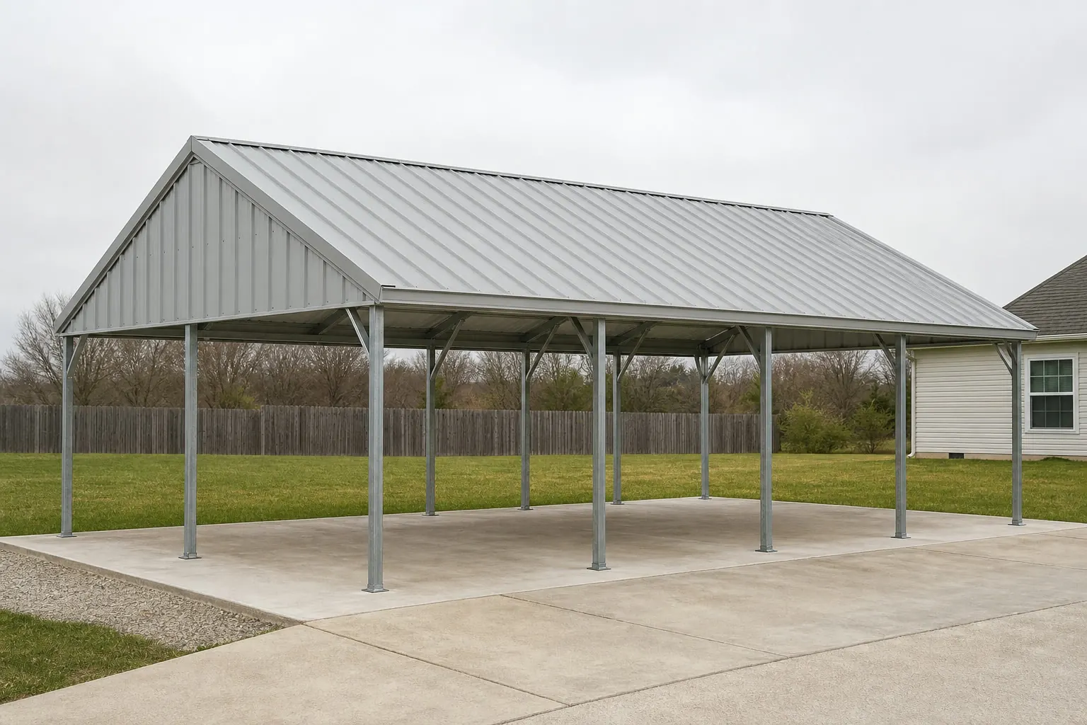
Terrain Split
One State, Two Very Different Building Sites
Arkansas divides into a flat eastern floodplain and a hillier western highland, and that line matters more to carport siting than a single climate number.
USGS physiographic reference material places the Arkansas Delta, in the eastern part of the state, within the Mississippi Alluvial Plain — a low, flat region with a documented history of flooding. West and north of the Delta, the land rises into the Ozark Plateau and the Ouachita Mountains, terrain that drains differently and sits at higher elevation. Neither description applies statewide, which is exactly the point: a carport plan drafted for one side of Arkansas may need real adjustment on the other.
For a Delta-area property, that can mean paying closer attention to pad elevation and drainage away from the structure, and asking the local floodplain administrator whether the parcel carries any flood-zone designation before finalizing a footing plan. For an Ozark or Ouachita property, the more common questions are about slope grading and how a hillside site changes access for delivery and installation. Neither question has a statewide answer — both route to the local building department.
State Reference
Arkansas Figures Behind This Page
Sourced figures only; none of these implies a specific design value.
| Metric | Value | Source |
|---|---|---|
| Farms (2022) | 37,756 (-11% since 2017) | USDA NASS |
| Average farm size (2022) | 363 acres (+12% land in farms since 2017) | USDA NASS |
| Total land area | 52,035.5 sq mi | U.S. Census Bureau, 2010 |
| Counties covered by FEMA NRI | 75 | FEMA National Risk Index |
| Reference climate station | Little Rock AP Adams Field, 1991-2020 normals | NOAA NCEI |
Farms (2022)
- Value
- 37,756 (-11% since 2017)
- Source
- USDA NASS
Average farm size (2022)
- Value
- 363 acres (+12% land in farms since 2017)
- Source
- USDA NASS
Total land area
- Value
- 52,035.5 sq mi
- Source
- U.S. Census Bureau, 2010
Counties covered by FEMA NRI
- Value
- 75
- Source
- FEMA National Risk Index
Reference climate station
- Value
- Little Rock AP Adams Field, 1991-2020 normals
- Source
- NOAA NCEI
Sizing
Why Farm Scale Changes the Sizing Conversation
With average farms at 363 acres and total land in farms up 12% since 2017, an Arkansas carport is frequently sized around equipment, not just a car.
Arkansas's 2022 Census of Agriculture shows fewer farms than in 2017 — 37,756, an 11% drop — but more land in farms overall, up 12% to 13,722,525 acres, meaning the average operation grew to 363 acres. That trend toward fewer, larger farms is a reasonable signal that covered storage on Arkansas farmland increasingly needs to fit a grain truck, a round baler, or a flatbed trailer rather than only a passenger vehicle.
That doesn't mean every Arkansas carport buyer is a farmer — plenty are homeowners in Little Rock, Fayetteville, or Fort Smith looking for basic vehicle cover. But it does mean a builder quoting an Arkansas project should ask early what's actually being parked underneath, since eave height and bay depth for farm equipment differ meaningfully from a residential two-car footprint.
- Ask what's being covered
- A pickup, a boat, and a grain truck need different clearance heights — specify before sizing.
- Check flood-zone status in Delta counties
- Low-lying eastern parcels may carry floodplain rules; confirm with the local floodplain administrator.
- Confirm hillside access in Ozark/Ouachita counties
- Slope and access can affect installation cost more than the structure itself.
Regional Notes
Three Arkansas Regions, Three Siting Notes
A brief, honest note for each broad region — none of these are design values.
Arkansas Delta (East)
Flat Mississippi Alluvial Plain terrain with a documented flood history; confirm floodplain status and drainage grading with the local authority before foundation work.
Ozark Plateau (North/Northwest)
Higher, hillier ground where site access and grading — not floor area — often drive installation cost.
Ouachita Mountains & Central Arkansas (South-Central)
Mixed terrain near Little Rock, where the state's most-cited climate station (Little Rock AP Adams Field) sits; still confirm local conditions rather than assume that station represents your specific site.
Plan Your Arkansas Carport
Tell us whether your site sits in the Delta or the highlands, and what you're covering, and we'll route the right siting questions to you.
Configurations
Carport Configurations Common to Arkansas Sites
Three configurations that respond to the terrain split and farm-scale context above.
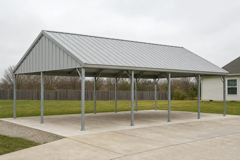 Delta Utility CarportA straightforward open-bay design with attention to pad elevation and drainage on flat, low-lying ground.Highland Residential CarportA standard footprint adapted for sloped or hillside Ozark/Ouachita access.Farm Equipment CarportTaller eaves and a longer bay sized for trucks, trailers, or implements on larger operations.
Example Configuration — for planning purposes only.
Footprint
Common Arkansas Carport Footprints
A starting range before a site-specific plan accounts for your terrain and use.
18′ × 20′
360 sq ft
A compact single-vehicle carport for a residential lot.
20′ × 30′
600 sq ft
Room for a vehicle plus general storage on a standard rural parcel.
24′ × 40′
960 sq ft
A longer bay suited to trucks, trailers, or farm implements.
Example Configuration — for planning purposes only.
Confirm any local flood-zone, drainage, or load requirement with your building department before finalizing a size.
Preparation
Four Checks Before You Finalize an Arkansas Carport Plan
These checks translate the Delta/highland split and farm-scale context above into concrete pre-build steps.
- Pull your specific NOAA station normalsThe Little Rock AP Adams Field 1991-2020 normals are a useful central reference, but a carport elsewhere in the state should confirm conditions against its own nearest NOAA station rather than assuming the Little Rock figures apply.
- Confirm construction permit history isn't assumedThe Census Bureau's Building Permits Survey publishes an annual Arkansas total, but this page does not cite a specific figure since one was not directly confirmed; ask your local building department about current review volume instead.
- Orient the open bay with drainage in mindOn Delta ground, face the open bay away from the low side of the pad so runoff has somewhere to go besides the vehicle bay.
- Ask about post spacing before orderingFarm-equipment carports with taller eaves and longer bays often need different post spacing than a residential design; confirm this with your builder before finalizing dimensions.
Questions
Arkansas Carport Questions
Honest answers, with technical or local specifics routed to the right office.
It can. USGS reference material places the Delta within the historically flood-prone Mississippi Alluvial Plain. Confirm floodplain status and any elevation or setback requirement with your county's floodplain administrator before finalizing a foundation plan.
Not necessarily. The most citable Arkansas climate normal comes from the Little Rock Adams Field station, a single central location. Delta and Ozark/Ouachita sites can differ; confirm local conditions with your building department.
There's no official typical size, but with the state's average farm now at 363 acres, many working carports run longer and taller than a residential model to fit trucks, trailers, or implements. Confirm eave height against your specific equipment.
Use FEMA's National Risk Index (hazards.fema.gov), which scores all 75 Arkansas counties across 18 hazard categories including tornado and riverine flooding, rather than relying on a general statewide claim.
Slope and access can add site-prep cost on hillside terrain, though the exact cost depends on the specific property. Ask your installer to walk the site before quoting.
Sources for the Arkansas facts on this page
This page states no code requirement, wind speed, snow load, permit rule, price or supplier claim. The state-specific facts it does use are listed with their publisher below.
The Arkansas Delta in the eastern part of the state lies within the Mississippi Alluvial Plain, a low, flat, historically flood-prone floodplain region distinct from the higher Ozark Plateau and Ouachita Mountains to the west.
U.S. Geological Survey (USGS) · Originally published 1923; USGS reference · Tier 1
https://pubs.usgs.gov/bul/0730d/report.pdfArkansas had 37,756 farms in 2022, down 11% from 2017.
USDA National Agricultural Statistics Service (NASS) · 2022 · Tier 1
https://www.nass.usda.gov/Publications/AgCensus/2022/Online_Resources/County_Profiles/Arkansas/cp99005.pdfArkansas had 13,722,525 acres of land in farms in 2022, an average farm size of 363 acres, up 12% from 2017.
USDA NASS · 2022 · Tier 1
https://www.nass.usda.gov/Publications/AgCensus/2022/Online_Resources/County_Profiles/Arkansas/cp99005.pdfFEMA's National Risk Index is an interactive county/tract-level tool covering 18 natural hazards, including tornado, riverine flooding, and earthquake, that can be queried for Arkansas's 75 counties.
Federal Emergency Management Agency (FEMA) · Current NRI release · Tier 1
https://www.fema.gov/flood-maps/products-tools/national-risk-indexArkansas's total land area was measured at 52,035.5 square miles as of the 2010 Census.
U.S. Census Bureau · 2010 Census · Tier 1
https://www.census.gov/geographies/reference-files/2010/geo/state-local-geo-guides-2010/arkansas.htmlNOAA NCEI's 1991-2020 climate normals for Little Rock Adams Field list station-level monthly and annual temperature, precipitation, and degree-day data for the Little Rock area.
NOAA National Centers for Environmental Information (NCEI) · 1991-2020 · Tier 1
https://www.ncei.noaa.gov/access/services/data/v1?dataset=normals-monthly-1991-2020&endDate=9996-12-31&format=pdf&startDate=0001-01-01&stations=USW00013963