
Carport · AK
Carports in Alaska
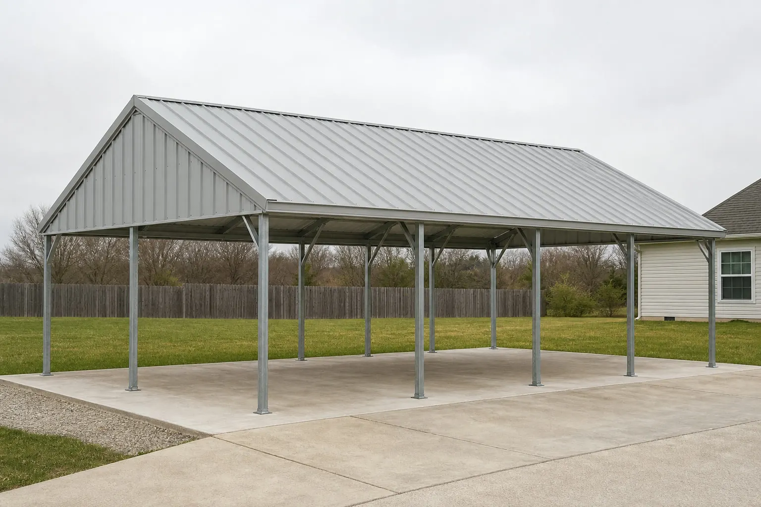
An open-sided carport has less structure to absorb a bad winter than an enclosed building, so in Alaska two things get decided before a size or color: roof geometry and what the footings sit on. The National Weather Service's Anchorage office issues monthly climate reports that compare current conditions against the official 1991-2020 normal period and against the full 1952-present record, a reporting structure that itself signals a climate that moves noticeably from year to year rather than repeating a fixed pattern. And because USGS mapping documents continuous and discontinuous permafrost across wide parts of the state, the footing detail under a simple carport post is not automatically the same detail that works in a Lower-48 climate. This page works through both before getting to layout.
The intersection
Why an Alaska carport is planned around variability, not an average
The way NWS Anchorage reports its own climate data is itself the signal that a single seasonal assumption is the wrong starting point.
The National Weather Service's Anchorage office issues a monthly Climatological Report that measures the current month against two separate baselines: the official 1991-2020 normal period and the full period of record back to 1952. Reporting against both, rather than just the newest normal, points to a climate that shifts meaningfully year over year — exactly the kind of variability an open-sided structure like a carport is more exposed to than an enclosed building, because it has less structure to buffer an unusual load event.
NOAA NCEI's underlying 1991-2020 normals are published at the individual weather station level — Anchorage Merrill Field is one example — rather than as a single statewide figure. A carport site outside that immediate area should be checked against its own nearest comparable station rather than assuming the Anchorage-area normal travels statewide.
None of this substitutes for a stamped structural design from the local building department's required snow-load figure, which this page does not attempt to state. The practical takeaway is that roof pitch and connection detailing for an Alaska carport deserve a real look at the nearest station's reporting pattern, not a generic template pulled from a milder climate.
Structure
What changes on an Alaska carport versus a milder-climate build
A quick comparison of the two structural questions this page focuses on.
| Consideration | What Alaska evidence shows | What to confirm before ordering |
|---|---|---|
| Roof geometry | NWS Anchorage tracks conditions against both a 1991-2020 normal and a 1952-present record, implying real year-to-year variability | Local snow-load requirement from the building department, applied to roof pitch and panel spec |
| Footing depth | USGS documents continuous/discontinuous permafrost zones statewide | Site-specific geotechnical screening before footing depth is fixed |
| Site screening | USGS EROS 30-meter modeled near-surface permafrost probability map is available statewide | Use as a first screen, not a substitute for an on-site boring |
Roof geometry
- What Alaska evidence shows
- NWS Anchorage tracks conditions against both a 1991-2020 normal and a 1952-present record, implying real year-to-year variability
- What to confirm before ordering
- Local snow-load requirement from the building department, applied to roof pitch and panel spec
Footing depth
- What Alaska evidence shows
- USGS documents continuous/discontinuous permafrost zones statewide
- What to confirm before ordering
- Site-specific geotechnical screening before footing depth is fixed
Site screening
- What Alaska evidence shows
- USGS EROS 30-meter modeled near-surface permafrost probability map is available statewide
- What to confirm before ordering
- Use as a first screen, not a substitute for an on-site boring
Foundation
Ground condition decides the footing before the frame does
A carport's posts carry less total load than a fully enclosed building, but the footing still has to reach stable, non-frost-susceptible ground.
USGS's reference Permafrost Map of Alaska, still cited by the agency as a statewide resource, documents both continuous and discontinuous permafrost zones. On a site within one of those zones, a standard shallow post footing risks frost heave or settlement as the active layer freezes and thaws seasonally, which is a structural problem for a lightweight carport frame just as much as for a heavier building.
USGS's EROS Center now maintains a modeled probabilistic map of near-surface permafrost — within one meter of the surface — at 30-meter resolution, giving a buyer a way to screen a specific site before paying for a geotechnical boring. That screening step is worth doing early, since it can change whether a helical pier, an insulated footing, or a standard concrete footing is the right call.
None of this is a substitute for a licensed geotechnical engineer's site-specific recommendation, but starting the footing conversation with the USGS resources in hand, rather than starting from a generic footing spec, tends to save a redesign later in the process.
- Screen before you design
- Check both USGS permafrost resources for the parcel before a footing type is proposed.
- Treat footing depth as engineered, not standard
- A frost-susceptible site can call for a different footing system than a standard concrete pier.
- Confirm with a geotechnical engineer, not a map alone
- USGS mapping is a screening tool; a site-specific boring is the actual design input.
Get Alaska carport quotes
Tell suppliers your nearest weather station, whether your site needs permafrost screening, and your actual delivery route. We route it with the Alaska and carport context already attached.
Hazard & access
Hazard exposure and delivery access vary by borough
Both natural-hazard exposure and how a carport kit reaches the site depend on the specific borough or census area, not a single statewide figure.
Hazard scoring
FEMA's National Risk Index tracks 18 hazards, including winter weather and avalanche exposure, at the borough and census-area level; query the tool directly for the parcel's actual exposure rather than assuming a statewide level.
Road-connected boroughs
Sites with direct road access to a supply hub typically see more conventional delivery timelines for a carport kit than sites reached only seasonally.
Remote and unorganized areas
Sites without year-round road access may depend on barge or air freight scheduling, which argues for ordering well ahead of the intended install window.
Preparation
Before ordering an Alaska carport
These steps keep an Alaska carport project from hitting a footing or delivery surprise after the kit is already ordered.
- Check the nearest station's climate reportingUse the NWS Anchorage office's monthly reports, or the nearest comparable NOAA station, as your starting reference rather than a generic seasonal assumption.
- Get the local snow-load requirement in writingYour building department's stated figure, not a station normal, is the actual design input for roof pitch and panel spec.
- Screen the site against both USGS permafrost resourcesUse the reference map and the 30-meter modeled probability layer before assuming a standard footing.
- Confirm footing design with a geotechnical engineer if the screen flags riskA frost-susceptible site needs an engineered footing, not a standard concrete pier.
- Confirm the actual delivery route and seasonRoad, barge or air access varies by borough; order with the real timeline in mind, not a Lower-48 default.
Questions
Alaska carport questions
Honest state-level answers, with anything jurisdiction- or engineer-specific routed to who actually owns it.
NWS Anchorage's monthly reports compare current conditions to both the 1991-2020 normal period and the 1952-present record, a structure that reflects real year-to-year variability. That variability is a reason to confirm your local snow-load requirement directly with the building department rather than assume a single seasonal pattern.
It's worth checking. USGS's reference permafrost map and its 30-meter modeled near-surface probability layer both document permafrost zones across parts of the state, and even a lightweight post-and-footing carport can need a frost-stable footing on affected ground.
Start with USGS's reference Permafrost Map of Alaska and the newer modeled near-surface probability map from USGS's EROS Center, then confirm with a licensed geotechnical engineer before finalizing footing design.
No. NOAA's 1991-2020 normals are published at the individual station level, such as Anchorage Merrill Field, and a single statewide precipitation or snowfall figure was not identified given the state's coastal, interior and arctic variation. Use your nearest station's normal or ask your local NWS office.
Delivery depends on whether the site has year-round road access or relies on barge or air freight. Confirm the actual route and season with the supplier and carrier, and order ahead of the intended install window if the site isn't road-connected.
Sources for the Alaska facts on this page
This page states no code requirement, wind speed, snow load, permit rule, price or supplier claim. The state-specific facts it does use are listed with their publisher below.
NWS Anchorage issues monthly climate reports comparing observed conditions to the official 1991-2020 climate normal period and the 1952-present period of record for the Anchorage station.
National Weather Service (NOAA), Anchorage AK office · Normal period 1991-2020; record 1952-present · Tier 1
https://forecast.weather.gov/product.php?issuedby=ANC&product=CLM&site=NWSNOAA NCEI's 1991-2020 climate normals for Anchorage Merrill Field list station-level monthly temperature, precipitation, and degree-day normals for the Anchorage area.
NOAA National Centers for Environmental Information (NCEI) · 1991-2020 · Tier 1
https://www.ncei.noaa.gov/access/services/data/v1?dataset=normals-monthly-1991-2020&stations=USW00026409&format=pdf&dataTypes=MLY-TMAX-NORMALUSGS's Permafrost Map of Alaska (Ferrians, 1965, IMAP 445) documents the widespread distribution of continuous and discontinuous permafrost across the state, a longstanding reference still cited by USGS.
U.S. Geological Survey (USGS) · Originally published 1965; USGS reference · Tier 1
https://www.usgs.gov/maps/permafrost-map-alaskaUSGS's Earth Resources Observation and Science (EROS) Center maintains a modeled probabilistic map of near-surface (within 1 meter) permafrost distribution across Alaska at 30-meter resolution.
U.S. Geological Survey (USGS), EROS Center · USGS EROS reference dataset · Tier 1
https://www.usgs.gov/media/images/modeled-probabilistic-map-near-surface-permafrost-within-alaskaFEMA's National Risk Index is an interactive county/tract-level tool covering 18 natural hazards, including earthquake, avalanche, and winter weather, that can be queried for Alaska's boroughs and census areas.
Federal Emergency Management Agency (FEMA) · Current NRI release · Tier 1
https://www.fema.gov/flood-maps/products-tools/national-risk-index