
Aircraft hangar · ID
Aircraft Hangars in Idaho
Idaho has a genuine backcountry flying culture, and the terrain that makes it famous for that is the same terrain that complicates hangar planning. The Idaho Geological Survey maps three distinct zones across the state's 82,643 square miles — southern Basin and Range structure, the volcanic Snake River Plain, and the mountainous central batholith — and a hangar sited on a farm strip in one region can face a completely different foundation and access story than one sited in another. With farms averaging 505 acres and population density near 19 people per square mile, private airstrips are a practical reality on much of Idaho's open land, but the state's most-cited climate figures come from a single Boise Valley station that does not describe mountain flying conditions.
Aviation Culture
A State Built for Backcountry Flying — and Its Foundation Complications
Idaho's private aviation opportunity comes from open land and varied terrain, and that terrain is exactly what a hangar's foundation plan has to account for.
Idaho's low population density — about 19 persons per square mile across 82,643.12 square miles — and average farm size of 505 acres (USDA NASS 2022) give many landowners enough open ground to consider a private turf or gravel strip with an adjacent hangar. That combination of land and terrain is part of what makes Idaho a well-known backcountry flying destination, but the same varied terrain complicates the build.
The Idaho Geological Survey's statewide geologic map documents Basin and Range structure in the south, the volcanic Snake River Plain, and the mountainous central batholith. A hangar sited on a Snake River Plain strip meets different substrate conditions than one built in Basin and Range valley country or up against batholith mountain terrain, and each of those settings has a different story for foundation depth, grading, and vehicle or aircraft access.
Access matters as much as terrain type once a strip is chosen. FEMA's National Risk Index scores wildfire and other exposure at the county and tract level rather than as a single statewide Idaho figure, so a hangar sited near a backcountry strip in one county can carry a meaningfully different wildfire exposure than a valley hangar an hour away. Pulling the NRI report for the exact parcel, rather than assuming a uniform risk picture for Idaho aviation in general, is worth doing before a hangar's siting and defensible-space plan is finalized.
Engineering
Why the Boise Climate Normal Isn't Your Design Number
Idaho's most commonly cited weather figures come from one valley station, and its volcanic terrain adds a foundation wrinkle few buyers expect.
NOAA's 1991-2020 normal for Boise Air Terminal shows about 11.5 inches of annual precipitation and 17.6 inches of snowfall — a real number, but drawn from a single low-elevation station. Idaho's elevation range means a mountain or high-desert airstrip can see very different snow accumulation, and no single official statewide NOAA normal exists to substitute for a local reading. A hangar buyer building away from the Treasure Valley should treat any snow-load design number as a question for their structural engineer and local building department, not something to infer from the Boise figure.
Foundation planning carries a similar local dependency. Hangars require heavy, reinforced concrete pads to support the weight of aircraft and the torque of large door systems. On the Snake River Plain, USGS research ties the terrain's volcanic geology to the Yellowstone hotspot track, and basalt-influenced soils there can behave differently under a slab than the alluvial or sedimentary ground found elsewhere in the state. A geotechnical check before pouring is worth the cost on this terrain.
- Confirm Snow Load Locally
- Don't extend the Boise Valley normal to a mountain or high-desert strip.
- Check Substrate Before Pouring
- Snake River Plain basalt soils may call for different footing depth than sedimentary ground elsewhere in Idaho.
- Plan Access, Not Just Footprint
- In batholith mountain terrain, road grading to the strip can be a bigger cost driver than the hangar itself.
Site Selection
Where in Idaho You Build Changes the Hangar Brief
Idaho's three broad terrain zones each carry a different siting story for a private hangar.
Snake River Plain (South)
Broad volcanic terrain across southern Idaho; basalt-influenced soils are worth a geotechnical review before a slab is finalized.
Southern Basin and Range
Valley-and-range topography where a strip's approach path should account for the surrounding relief, not just flat runway length.
Central Idaho Batholith (North/Central Mountains)
Granite mountain terrain typical of backcountry strips; access road grading often outweighs the hangar structure itself as a cost driver, and the Boise climate normal is least representative here.
Plan Your Idaho Hangar
Tell us your terrain type and strip location, and we'll route the right foundation and access questions with your Idaho context attached.
Application
Hangar Configurations for Idaho Aviation
Configurations suited to Idaho's mix of backcountry, agricultural, and valley flying.
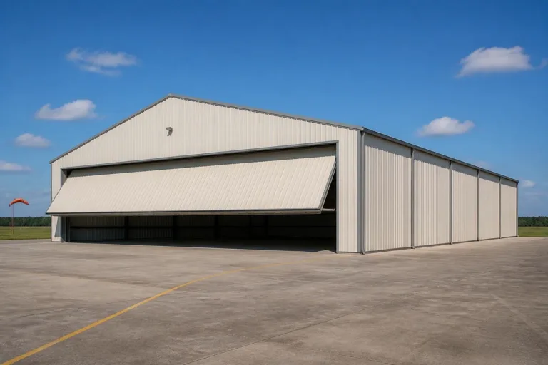 Backcountry Box HangarA compact structure for a single light aircraft on a remote mountain or high-desert strip.Ag-Aviation HangarStorage for crop-dusters or ag survey aircraft, sized for Idaho's farm-based operations.Valley Private HangarA larger hangar on Snake River Plain or Basin and Range ground with a poured concrete pad and standard access.
Example Configuration — for planning purposes only.
Scale
Footprints for Idaho Aviation
A starting range that reflects recreational and working aircraft use on Idaho strips.
40′ × 40′
1,600 sq ft
A compact box hangar for a single light aircraft on a backcountry strip.
50′ × 50′
2,500 sq ft
Room for one aircraft plus a small workshop or tool storage.
60′ × 60′
3,600 sq ft
A larger hangar for twin-engine aircraft or multiple light planes on a valley strip.
Example Configuration — for planning purposes only.
Ensure your door opening clears your aircraft's wingspan by at least 5-10 feet; confirm foundation specifics with a local contractor familiar with your terrain. Because Idaho's terrain varies so much by region, treat these figures as a planning starting point rather than a fixed spec.
Questions
Idaho Aircraft Hangar Questions
Honest answers, with technical and regulatory questions routed to the authority that owns them.
Many Idaho landowners have the acreage for it — the state's farms average 505 acres — but private airstrip rules fall under FAA and local jurisdiction. Confirm requirements with the FAA and your county before committing to a site.
No. The commonly cited Boise snowfall figure (about 17.6 inches annually) comes from one low-elevation station. A mountain or high-desert strip can see very different snow loads, so confirm with your structural engineer and local building department.
Yes, qualitatively. The Idaho Geological Survey documents Basin and Range, Snake River Plain, and batholith terrain across the state. Snake River Plain basalt soils in particular are worth a geotechnical check before pouring a hangar's reinforced concrete pad.
Use FEMA's National Risk Index (hazards.fema.gov), which scores Idaho by county and tract across 18 hazard types including wildfire and landslide. There is no single statewide hazard figure that applies evenly across the state.
There's no official typical size, but a 40x40 to 60x60 range covers most single- and twin-engine private hangars on Idaho strips. Confirm your door opening against your aircraft's wingspan before finalizing.
Sources for the Idaho facts on this page
This page states no code requirement, wind speed, snow load, permit rule, price or supplier claim. The state-specific facts it does use are listed with their publisher below.
The Idaho Geological Survey's statewide Geologic Map of Idaho documents the state's varied terrain, spanning Basin and Range structures in the south, the volcanic Snake River Plain, and the mountainous central Idaho batholith terrain to the north.
Idaho Geological Survey, University of Idaho · 2012 · Tier 2
https://idahogeology.org/pub/Maps/Geologic_Map_of_ID_booklet_3.pdfIdaho's total land area was measured at 82,643.12 square miles as of the 2010 Census, the 11th largest of any U.S. state, with a population density of only about 19.0 persons per square mile.
U.S. Census Bureau · 2010 Census · Tier 1
https://www.census.gov/geographies/reference-files/2010/geo/state-local-geo-guides-2010/idaho.htmlIdaho had 22,877 farms in 2022, down 8% from 2017, covering 11,547,963 acres of land in farms (down 1%), with an average farm size of 505 acres (up 8%).
USDA National Agricultural Statistics Service (NASS) · 2022 · Tier 1
https://www.nass.usda.gov/Publications/AgCensus/2022/Online_Resources/County_Profiles/Idaho/cp99016.pdfBoise's 1991-2020 annual climate normal precipitation is about 11.5 inches with roughly 17.6 inches of annual snowfall, reflecting the semi-arid Treasure Valley climate.
NOAA National Centers for Environmental Information (NCEI) · 1991-2020 · Tier 1
https://www.ncei.noaa.gov/access/services/data/v1?dataset=normals-monthly-1991-2020&dataTypes=MLY-PRCP-NORMAL,MLY-SNOW-NORMAL&format=csv&stations=USW00024131FEMA's National Risk Index platform (hazards.fema.gov) is the authoritative county/tract-level source for Idaho natural hazard exposure scores across 18 hazard types, including hazard categories such as wildfire, landslide, and earthquake that are tracked for Idaho specifically.
Federal Emergency Management Agency (FEMA) · Current NRI dataset · Tier 1
https://www.fema.gov/flood-maps/products-tools/national-risk-index