
Aircraft hangar · CO
Aircraft Hangars in Colorado
Two figures set the frame for a Colorado hangar project before a single building decision gets made. Colorado has the highest mean elevation of any U.S. state, with 54 peaks above 14,000 feet and Mount Elbert topping out at 14,440 feet — yet the eastern two-fifths of the state is flat plains. A hangar parcel a hundred miles apart can sit at wildly different elevations, and Colorado has no single statewide building code agency governing private construction, so the office that actually reviews a hangar application changes with the county. Add a landscape where roughly 23.8 million acres carry federal ownership per Congressional Research Service data, and site selection becomes the first real design decision, not an afterthought.
Permitting Reality
Why Colorado Hangar Buyers Should Start With the County, Not the State
Colorado has no single statewide building code authority for private construction, so the review path for a hangar is set locally.
The Colorado Office of the State Architect's authority is limited to state-owned and state-lease-purchased buildings — it does not review a privately owned hangar. Everything else, per the Department of Local Affairs' Division of Housing and the state's Planning for Hazards program, is subject to local adoption. That means the code edition in force, the drawings a plan reviewer expects, and the inspection sequence for a hangar can differ from one Colorado county to the next.
The Division of Housing's own resolutions reinforce this pattern: they apply only where a local jurisdiction has not already adopted its own standard. In practice, a hangar buyer's first call should go to the county or municipal building department for the parcel in question, not to a state office expecting a single Colorado-wide answer.
This is a genuinely different structure than states with a single statewide adopted code, and it changes the order of operations for a hangar project. Confirming the reviewing authority before finalizing a floor plan or door package avoids a rework cycle later in permitting.
Terrain
One State, Two Elevation Stories
Colorado holds the highest mean elevation of any U.S. state, but its eastern plains are flat — and that split matters for hangar siting.
Colorado's high point, Mount Elbert, reaches 14,440 feet, and the state has 54 peaks above 14,000 feet, giving it the highest mean elevation of any state. At the same time, the eastern two-fifths of Colorado are flat plains. A hangar parcel in the high country and one on the eastern plains are not the same siting problem: approach terrain, wind exposure at altitude, and access road grading diverge sharply between the two.
The Colorado Geological Survey's physiographic map formalizes this contrast with four named provinces: the Southern Rocky Mountains, the Great Plains (itself split into High Plains, Colorado Piedmont, and Raton Basin subprovinces), the Wyoming Basin, and the Colorado Plateau. Knowing which province a hangar site sits in gives a buyer a concrete term to bring into a conversation with a structural engineer or grading contractor, rather than describing the land only as 'mountainous' or 'flat.'
- Identify Your Province
- Use the Colorado Geological Survey's four-province map to name your parcel's terrain type before design begins.
- Don't Generalize Elevation
- A design assumption from a Front Range foothill site will not transfer to an eastern-plains parcel or a high-mountain strip.
- Route Load Numbers Locally
- Snow and wind design figures are a structural-engineer and local-code question, not a statewide constant.
Land Access
Federal Land Is a Real Factor in Colorado Site Selection
A large share of Colorado's acreage is federally owned, which affects which parcels are even available for a private hangar and strip.
The Congressional Research Service's federal land ownership table lists roughly 23.8 million acres of federal land in Colorado against approximately 23.6 million total acres reported in the same 2013-based dataset. The CRS report notes that western-state totals in that table were affected by year-to-year BLM and Department of Defense adjustments, so the figures should be read as an order-of-magnitude picture rather than a precise current share.
Even with that caveat, the takeaway for a hangar buyer is straightforward: federal land is not a marginal factor in Colorado, it is a structural one. Verifying that a candidate parcel carries clean private title and legal access — rather than assuming open land is automatically buildable — is worth doing before any hangar design work starts.
Plan Your Colorado Hangar
Tell us your province, elevation, and county, and we'll route the right permitting and foundation questions with your Colorado context attached.
Site Selection
What Each Colorado Province Means for a Hangar Site
The state's four mapped physiographic provinces carry different siting implications.
Southern Rocky Mountains
High-elevation, high-relief terrain where access road grading and altitude-driven design questions should be raised with a local engineer early.
Great Plains (High Plains, Piedmont, Raton Basin)
Flatter eastern terrain that simplifies grading, but still requires a local code and hazard check rather than a statewide assumption.
Wyoming Basin
A transitional northern province where terrain and jurisdiction should both be confirmed before committing to a strip location.
Colorado Plateau
Western tableland terrain distinct from the Front Range corridor; local building department contact is the right first step here too.
Application
Hangar Configurations Suited to Colorado Sites
Configurations that map to Colorado's elevation and jurisdiction spread.
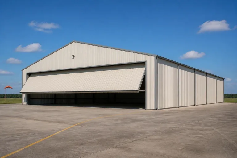 High-Country Box HangarA compact single-aircraft hangar sized for a mountain or foothill strip in the Southern Rocky Mountains province.Plains Private HangarA larger hangar on flatter Great Plains ground, where grading is simpler but local permitting still applies.Plateau or Basin HangarA hangar sited on Colorado Plateau or Wyoming Basin terrain, with access and title verified ahead of design.
Example Configuration — for planning purposes only.
Scale
Starting Footprints for a Colorado Hangar
A planning range, not a fixed spec — confirm door clearance and pad design locally.
40′ × 40′
1,600 sq ft
A single-aircraft box hangar suited to a high-country or Front Range foothill strip.
50′ × 50′
2,500 sq ft
Room for one aircraft with a workshop bay, workable on plains or plateau ground.
60′ × 60′
3,600 sq ft
A larger hangar for twin-engine aircraft or multiple planes on flatter eastern terrain.
Example Configuration — for planning purposes only.
Confirm your door opening against your aircraft's wingspan with at least 5-10 feet of clearance, and verify foundation and snow-load specifics with your local building department, since Colorado has no single statewide code to reference.
Questions
Colorado Aircraft Hangar Questions
Direct answers, with regulatory and technical specifics routed to the office that actually owns them.
There is no single statewide building code authority for private construction in Colorado — the Office of the State Architect's authority covers only state-owned buildings. Your county or municipal building department is the reviewing authority for a private hangar.
Elevation and terrain vary enormously across the state, from 14,440-foot peaks to flat eastern plains, so there is no single statewide load figure. Confirm your specific design loads with a local structural engineer and your building department.
Roughly 23.8 million acres of Colorado is federally owned per CRS data, so verifying clean private title and legal access to your parcel before design work begins is essential rather than optional.
Yes, qualitatively. The Colorado Geological Survey maps four distinct provinces — Southern Rocky Mountains, Great Plains, Wyoming Basin, and Colorado Plateau — and each carries different grading and access considerations worth raising with your engineer.
A specific statewide FEMA hazard enumeration for Colorado was not confirmed in our research, so pull FEMA National Risk Index data directly for your parcel's county and tract rather than relying on a general statewide assumption.
There's no official standard size, but a 40x40 to 60x60 range covers most single- and twin-engine private hangars. Confirm door clearance against your aircraft's wingspan and check local pad requirements before finalizing.
Sources for the Colorado facts on this page
This page states no code requirement, wind speed, snow load, permit rule, price or supplier claim. The state-specific facts it does use are listed with their publisher below.
Colorado's highest point, Mount Elbert, reaches 14,440 feet elevation (NAVD 88), reflecting the extreme high-mountain-to-plains elevation range relevant to mountain snow load versus valley/plains conditions.
Wikipedia (cross-referencing USGS elevation data) · current · Tier 1
https://en.wikipedia.org/wiki/Mount_ElbertColorado is described as having the highest mean elevation of any U.S. state and contains 54 peaks above 14,000 feet, with the eastern two-fifths of the state being flat plains, underscoring the mountain-vs-plains contrast for snow and wind exposure.
NETSTATE.com (general geography reference) · current reference page · Tier 2
https://www.netstate.com/states/geography/co_geography.htmCRS's federal land ownership dataset lists Colorado federal acreage at roughly 23.8 million acres (2013 data) against total state acreage of approximately 23.6 million acres reported in the same table (figures should be read alongside the report's narrative, as western-state totals were affected by year-to-year BLM/DOD adjustments).
Congressional Research Service · data as of FY2013, report dated March 3, 2017 · Tier 1
https://www.everycrsreport.com/files/20170303_R42346_95ce191e74ed8e08054bb5476971544bc55823f2.htmlThe Colorado Geological Survey's physiographic map divides the state into the Southern Rocky Mountains, the Great Plains (with High Plains, Colorado Piedmont, and Raton Basin subprovinces), the Wyoming Basin, and the Colorado Plateau.
Colorado Geological Survey · current reference map · Tier 2
https://coloradogeologicalsurvey.org/wp-content/uploads/ON-010-09-04.pdfColorado has no single statewide building code agency for general construction; the state's Office of the State Architect only sets minimum codes for state-owned/state-lease-purchased buildings, while other construction is subject to local adoption per the Division of Housing and Colorado's Planning for Hazards program.
Colorado Office of the State Architect; Colorado Department of Local Affairs, Division of Housing · current, accessed 2024/2025 · Tier 2
https://osa.colorado.gov/building-codesColorado's Division of Housing (Department of Local Affairs) issues state housing board resolutions (e.g., on-site construction/safety codes for manufactured and multi-family housing) that apply only where local standards do not otherwise exist, illustrating the state's default-to-local code structure.
Colorado Secretary of State / Department of Local Affairs, Division of Housing · current codified rule · Tier 2
https://www.sos.state.co.us/CCR/GenerateRulePdf.do?fileName=8+CCR+1302-8&ruleVersionId=7589