
Aircraft hangar · AK
Aircraft Hangars in Alaska
In much of Alaska, a hangar isn't a hobby structure sitting next to a paved runway — it's tied to a working airstrip that may be a community's main connection to the outside world. That reality changes the planning brief. USGS's permafrost mapping shows continuous and discontinuous permafrost across wide stretches of the state, and a slab poured on frozen ground behaves nothing like one poured on the gravel benches near Anchorage. At 570,641 square miles, Alaska is the largest state in the country, and the NOAA and NWS climate figures most people cite are read from a single Anchorage station — useful for that specific airport, not a stand-in for conditions at a strip hundreds of miles north or west of it.
Foundation Planning
Start With the Ground, Not the Floor Plan
Before laying out a hangar footprint in Alaska, find out whether the parcel sits on permafrost, because that answer changes the foundation type.
USGS's reference Permafrost Map of Alaska, originally compiled by Ferrians and still cited as a baseline USGS reference, documents continuous permafrost across the state's north and discontinuous permafrost across large stretches further south. A hangar built on continuous permafrost typically needs a foundation designed to keep the ground frozen and stable — often elevated on piles or insulated to prevent the heat of the building (and any heated hangar space) from thawing the ground beneath the slab and causing uneven settling.
For a specific parcel, USGS EROS also maintains a modeled, 30-meter-resolution probability layer estimating the likelihood of near-surface permafrost within one meter of the ground. That resolution is fine enough to give a buyer an informed starting question for a site visit, though it's a modeled estimate, not a substitute for a geotechnical boring at the actual hangar location.
None of this is uniform across the state. A hangar planned for a gravel bench near Anchorage, well outside the continuous permafrost zone, faces a far more conventional foundation problem than one planned for an interior or arctic strip. Treating 'Alaska foundation design' as one statewide answer risks a foundation scoped to the wrong ground condition, since the same evidence shows permafrost status swings from continuous to absent within a few hundred miles.
Climate Data
One Anchorage Station Isn't a Statewide Climate Number
The most frequently cited Alaska climate figures come from a single Anchorage station and a single normal period; a strip elsewhere in the state needs its own record.
NOAA NCEI publishes 1991-2020 climate normals for the Anchorage Merrill Field station (USW00026409), and NWS Anchorage issues monthly Climatological Reports comparing current conditions against that same 1991-2020 normal period and against the station's 1952-present period of record. Both are genuinely useful, tier-1 datasets — for Anchorage.
Alaska's coastal, interior, and arctic climate zones differ enough that no single official statewide NOAA precipitation or snowfall normal is meaningful as a design number. A hangar door system, roof snow-shedding design, and heating capacity should be sized against the climate record for the nearest reporting station to the actual strip, confirmed with a structural engineer, rather than borrowed from Anchorage data because it's the easiest figure to find.
- Pull the Local Station Record
- Use NWS or NOAA data for the station nearest your strip, not the most commonly published Anchorage figure.
- Ask About Heat and Thaw Together
- A heated hangar on permafrost ground needs a foundation plan that accounts for the building's own heat load, not just outdoor temperature.
- Confirm Snow-Shedding Roof Design Locally
- Roof pitch and door header strength should be checked against the specific site's snow accumulation pattern.
Logistics
Scale Changes the Build Before It Changes the Design
At 570,641 square miles, Alaska's size means getting steel components to site can be a bigger planning question than the hangar's engineering.
Alaska's 2010 Census land area of 570,641.0 square miles makes it the largest state, but road access does not reach every airstrip. Materials for a remote-site hangar may travel by barge on a seasonal shipping schedule or by air freight, either of which changes lead-time planning far more than anything about the structure's engineering. Confirming a delivery window with the supplier before setting a build schedule is worth doing early, not after design is finalized.
Census Bureau data shows Alaska had 937 total housing units authorized by building permits in 2023, up 62.1% from 578 in 2022 — a small, volatile base compared with Lower 48 states, and a reminder that local permitting offices in Alaska may see far fewer building projects per year than their counterparts elsewhere, which can affect how quickly a hangar permit application moves. Confirm timelines directly with the local building department rather than assuming a national-average pace.
Plan Your Alaska Hangar
Tell us your region and site conditions, and we'll route the right foundation, climate, and logistics questions with your Alaska context attached.
Site Selection
What Region Changes About the Hangar Brief
Alaska's zones carry distinct foundation, climate-data, and access implications for a hangar project.
South-Central (Anchorage Basin)
Largely outside continuous permafrost; the region's own NOAA station data is directly usable here, unlike further north.
Interior (Fairbanks and Beyond)
Discontinuous permafrost is common; a site-specific geotechnical check before foundation design is strongly advised.
Arctic and Remote Coastal
Continuous permafrost zones and barge- or air-only freight access typically drive both foundation type and project timeline.
Application
Hangar Configurations Suited to Alaska Aviation
Configurations reflecting Alaska's mix of community, agricultural, and private aviation use.
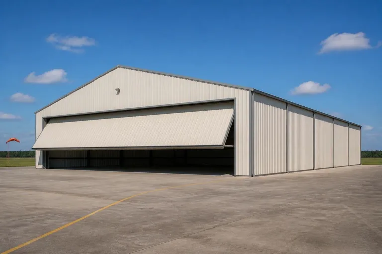 Community Strip HangarA working hangar sized for aircraft that serve as a village or community's primary transport link.Permafrost-Site HangarA pile-supported or insulated-foundation hangar designed for continuous or discontinuous permafrost ground.Farm and Homestead HangarA smaller hangar paired with a private strip on Alaska's larger agricultural parcels.
Example Configuration — for planning purposes only.
Scale
Footprints for Alaska Aviation Use
A starting range reflecting both private and community-linked aircraft use across the state.
40′ × 40′
1,600 sq ft
A compact hangar for a single light aircraft on a private or homestead strip.
50′ × 50′
2,500 sq ft
Space for one aircraft plus tools, fuel storage, or cold-weather maintenance equipment.
60′ × 60′
3,600 sq ft
A larger hangar suited to community-strip or working aviation use with multiple aircraft.
Example Configuration — for planning purposes only.
Confirm foundation type against your parcel's permafrost status before finalizing a footprint; door clearance should exceed your aircraft's wingspan by at least 5-10 feet.
Questions
Alaska Aircraft Hangar Questions
Direct answers, with regulatory and site-specific technical questions routed to the office that owns them.
It depends on where the parcel sits. USGS mapping shows continuous permafrost in northern Alaska and discontinuous permafrost across much of the rest of the state. A geotechnical check, informed by USGS's modeled near-surface permafrost probability layer, should come before foundation design.
No. NOAA's Anchorage Merrill Field normals and NWS Anchorage climate reports describe that station specifically. A strip in the interior, arctic, or a different coastal zone needs its own local climate record for roof and door design.
This varies by location and season; barge and air freight schedules can add lead time a road-accessible site never faces. Confirm delivery windows directly with your supplier before setting a build schedule.
Use FEMA's National Risk Index, which scores Alaska boroughs and census areas across 18 hazard categories including avalanche and winter weather. There is no single statewide figure that applies evenly to every site.
Alaska had 1,173 farms in 2022 averaging 742 acres, so some landowners have the acreage for it, but private airstrip approval falls under FAA and local jurisdiction rules. Confirm with the FAA and your local building department before committing to a site.
There's no fixed standard, but a 40x40 to 60x60 range covers most single- and multi-aircraft hangars on private or community strips. Confirm door clearance against your aircraft's wingspan and your site's foundation plan first.
Sources for the Alaska facts on this page
This page states no code requirement, wind speed, snow load, permit rule, price or supplier claim. The state-specific facts it does use are listed with their publisher below.
Alaska's total land area was measured at 570,641.0 square miles as of the 2010 Census, the largest of any US state.
U.S. Census Bureau · 2010 Census · Tier 1
https://www.census.gov/geographies/reference-files/2010/geo/state-local-geo-guides-2010/alaska.htmlUSGS's Permafrost Map of Alaska (Ferrians, 1965, IMAP 445) documents the widespread distribution of continuous and discontinuous permafrost across the state, a longstanding reference still cited by USGS.
U.S. Geological Survey (USGS) · Originally published 1965; USGS reference · Tier 1
https://www.usgs.gov/maps/permafrost-map-alaskaUSGS's Earth Resources Observation and Science (EROS) Center maintains a modeled probabilistic map of near-surface (within 1 meter) permafrost distribution across Alaska at 30-meter resolution.
U.S. Geological Survey (USGS), EROS Center · USGS EROS reference dataset · Tier 1
https://www.usgs.gov/media/images/modeled-probabilistic-map-near-surface-permafrost-within-alaskaNOAA NCEI's 1991-2020 climate normals for Anchorage Merrill Field list station-level monthly temperature, precipitation, and degree-day normals for the Anchorage area.
NOAA National Centers for Environmental Information (NCEI) · 1991-2020 · Tier 1
https://www.ncei.noaa.gov/access/services/data/v1?dataset=normals-monthly-1991-2020&stations=USW00026409&format=pdf&dataTypes=MLY-TMAX-NORMALFEMA's National Risk Index is an interactive county/tract-level tool covering 18 natural hazards, including earthquake, avalanche, and winter weather, that can be queried for Alaska's boroughs and census areas.
Federal Emergency Management Agency (FEMA) · Current NRI release · Tier 1
https://www.fema.gov/flood-maps/products-tools/national-risk-index