
Steel home · CO
Steel Homes in Colorado
A residential steel build in Colorado starts by placing the parcel on the Colorado Geological Survey's own physiographic map, which divides the state into the Southern Rocky Mountains, the Great Plains (with High Plains, Colorado Piedmont and Raton Basin subprovinces), the Wyoming Basin, and the Colorado Plateau. Those regions are not interchangeable for a residential build: NETSTATE's geography reference describes Colorado as having the highest mean elevation of any U.S. state, with 54 peaks over 14,000 feet, while the eastern two-fifths is flat plains. Once the region is settled, the second question is who actually reviews the plans, and the Colorado Office of the State Architect answers it plainly: its own code-setting authority reaches only state-owned or state-lease-purchased buildings, so a private steel home's permit path is set by whichever city or county covers the land, coordinated loosely through the Department of Local Affairs' Division of Housing.
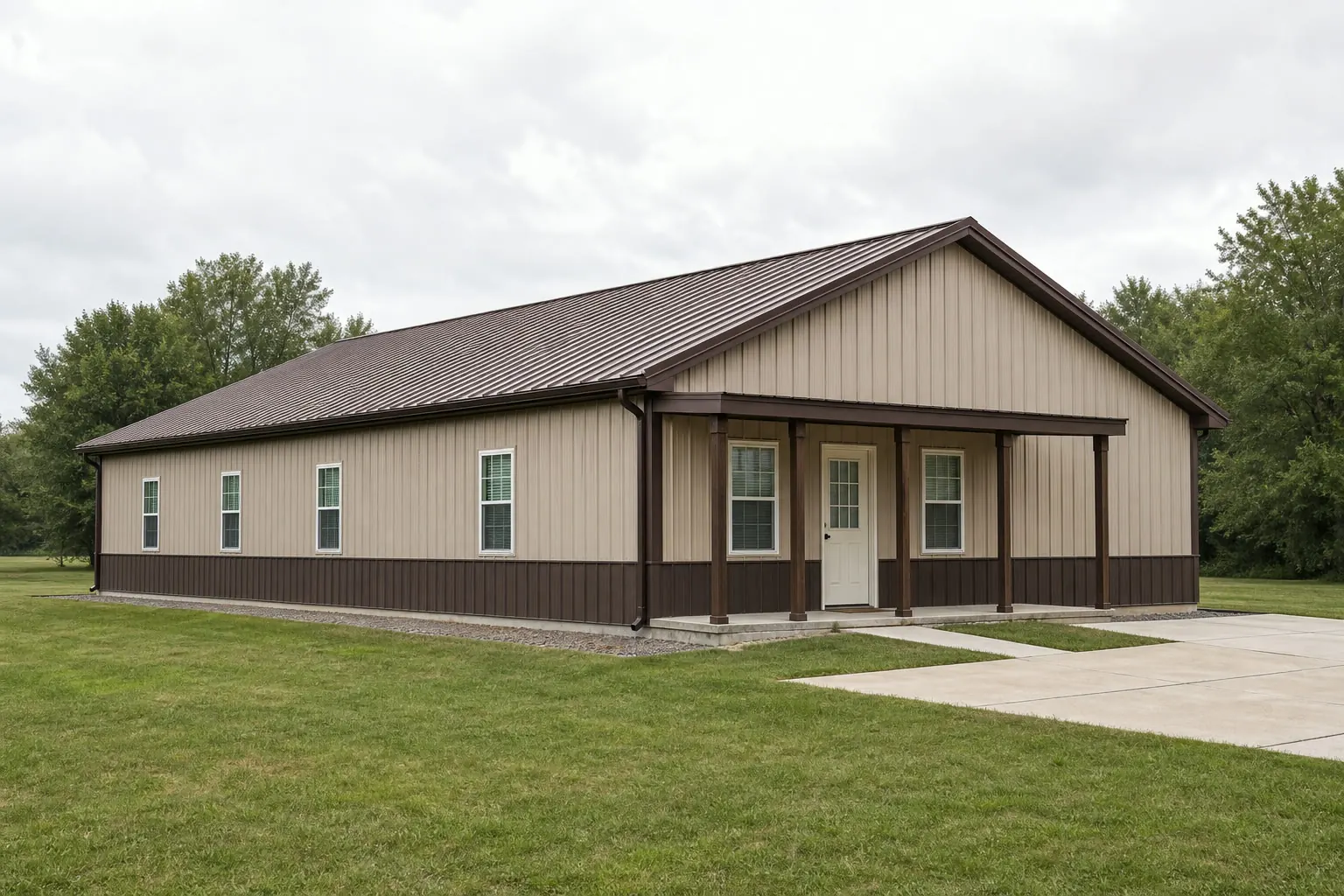
Start here
Place the parcel on the region map before anything else
The Colorado Geological Survey's physiographic map is a better starting point for a residential steel build than a city name alone.
The Colorado Geological Survey divides the state into the Southern Rocky Mountains, the Great Plains (with High Plains, Colorado Piedmont and Raton Basin subprovinces), the Wyoming Basin, and the Colorado Plateau. Each of those regions carries a genuinely different terrain, access and grading conversation for a residential build, and knowing which one a parcel sits in is a more useful early step than assuming a single statewide answer applies.
The scale of Colorado's elevation range makes this concrete. NETSTATE's geography reference describes Colorado as having the highest mean elevation of any U.S. state, with 54 peaks above 14,000 feet, and Mount Elbert alone reaches 14,440 feet (NAVD 88). The same reference notes the eastern two-fifths of the state is flat plains. A residential lot in the mountain corridor and one on the eastern plains are not the same planning context, even though both sit within Colorado's borders.
This page does not assign a snow load, wind speed or seismic value to any specific region — those come from your local building department and engineer of record based on the exact parcel. What is fair to state is that the region question should be answered before layout and roof-shape decisions, not after.
Process
How the planning conversation differs by Colorado region
Terrain and elevation change the starting point depending on which physiographic region the parcel sits in.
| Planning question | Mountain-corridor / high-elevation site | Plains / lower-elevation site |
|---|---|---|
| Who to contact first | County building department, plus a terrain and access conversation with your builder | City or county building department for standard residential review |
| Access | Confirm road grade, seasonal access and delivery logistics early | Typically more straightforward road and delivery access |
| Site grading | Slope and drainage often drive foundation planning more than on flatter ground | Grading is usually a smaller share of the site-prep conversation |
| Design conversation | Ask your engineer of record about roof shape and structural detailing for the specific elevation | Same local-review path, generally with fewer terrain-driven variables |
Who to contact first
- Mountain-corridor / high-elevation site
- County building department, plus a terrain and access conversation with your builder
- Plains / lower-elevation site
- City or county building department for standard residential review
Access
- Mountain-corridor / high-elevation site
- Confirm road grade, seasonal access and delivery logistics early
- Plains / lower-elevation site
- Typically more straightforward road and delivery access
Site grading
- Mountain-corridor / high-elevation site
- Slope and drainage often drive foundation planning more than on flatter ground
- Plains / lower-elevation site
- Grading is usually a smaller share of the site-prep conversation
Design conversation
- Mountain-corridor / high-elevation site
- Ask your engineer of record about roof shape and structural detailing for the specific elevation
- Plains / lower-elevation site
- Same local-review path, generally with fewer terrain-driven variables
Land
Colorado's land base adds a jurisdiction layer for some sites
A meaningful share of Colorado's acreage sits under federal management, which is worth checking for parcels near that boundary.
Federal land-adjacent parcels
CRS data lists roughly 23.8 million federal acres in Colorado (2013 figures); a residential parcel bordering federally managed land is worth an access and boundary check early in planning.
Established suburban and metro parcels
The most straightforward siting case: standard city or county permit review with no adjacent federal-land question to resolve first.
Mountain-corridor rural parcels
Terrain, seasonal access and delivery logistics often shape the schedule more than the building specification itself.
Eastern-plains rural parcels
Flatter access and grading conditions generally, with the local building department still the source for permit specifics.
Get Colorado steel home quotes
Tell us your region, whether the parcel borders federally managed land, and the living area you have in mind. We pass the Colorado context through with the enquiry.
Jurisdiction
Colorado defaults residential permitting to the local level
No single state agency reviews private residential construction; the review path is set by the covering city or county.
The Colorado Office of the State Architect confirms its authority to set minimum codes is limited to state-owned or state-lease-purchased buildings — it does not cover private residential construction like a steel home. General construction permitting is left to local jurisdictions, loosely coordinated through the Department of Local Affairs' Division of Housing and its Planning for Hazards program.
The Division of Housing's own codified rule (8 CCR 1302-8) states its resolutions apply only where a local standard does not already exist, confirming that Colorado's structure defaults to local control by design. For a residential steel-home buyer, that means the applicable code edition, plan review process and inspection sequence come from the specific city or county covering the parcel, not from a single statewide document.
- Confirm your specific jurisdiction's process
- Your city or county building department is the reliable source for residential steel-home requirements.
- Don't assume a state office reviews your plans
- The Office of the State Architect's authority covers state-owned buildings only.
- Ask whether a local standard already governs your parcel
- Division of Housing resolutions apply only in its absence, per 8 CCR 1302-8.
Footprint
Footprints that suit a Colorado residential brief
Single-level living with an efficient footprint is a common driver across Colorado's mountain and plains sites alike.
30′ × 60′
1,800 sq ft
A common single-level layout with room for three defined zones along the length.
40′ × 60′
2,400 sq ft
Adds width for a genuinely open central living area rather than a corridor plan.
30′ × 70′
2,100 sq ft
Length instead of width where the site favors a long, narrow building footprint.
40′ × 80′
3,200 sq ft
Where the brief includes an attached shop or garage bay under the same roofline.
Example Configuration — for planning purposes only.
Each footprint page carries layout detail; this page only explains why a Colorado brief lands in this range.
Sequence
The order to do things in Colorado
Getting the region and jurisdiction questions settled first avoids re-quoting later.
Step 1
Identify your physiographic region
Southern Rocky Mountains, Great Plains, Wyoming Basin or Colorado Plateau — each carries a different terrain conversation.
Step 2
Confirm your city or county's code adoption and process
Colorado has no single statewide building-code agency for private construction; the applicable path is local.
Step 3
Check land status if near federally managed acreage
Roughly 23.8 million acres of Colorado are federally owned per CRS data; confirm access near that boundary.
Step 4
Ask your engineer of record about elevation-specific structural detail
This page does not assign a snow load or wind value; that comes from a licensed engineer working your specific parcel.
Step 5
Decide house versus shop-house before drawings
A steel home and a combined living-and-workshop building diverge early; choosing late is the expensive version.
Questions
Colorado steel home questions
What we can answer at state level, and where the rest properly belongs.
No single statewide agency reviews private residential construction. The Colorado Office of the State Architect's code-setting authority is limited to state-owned or state-lease-purchased buildings; residential permitting is handled by the covering city or county.
Yes, for terrain and access planning. The Colorado Geological Survey's own map separates the Southern Rocky Mountains, Great Plains, Wyoming Basin and Colorado Plateau, and NETSTATE's reference notes the eastern two-fifths of the state is flat plains against a mountain corridor with 54 peaks above 14,000 feet.
Mount Elbert reaches 14,440 feet (NAVD 88). We do not assign a specific structural design value here — that's your engineer of record's job for your exact parcel — but it's a fair reason to have that conversation early if you're building at higher elevation.
It can be, but confirm access first. CRS data lists roughly 23.8 million federal acres in Colorado; parcels bordering that land should verify access and boundary status before finalizing site plans.
We do not publish state-level home prices. A steel home's cost depends heavily on interior finish level and site conditions, which is why a statewide number would mislead. Our cost pages explain the drivers; a quote reflects your specification.
Not quite. A barndominium brief usually combines living space with a working shop or storage area under one roof. If that describes your project, the barndominium pages are the better starting point.
Sources for the Colorado facts on this page
This page states no code requirement, wind speed, snow load, permit rule, price or supplier claim. The state-specific facts it does use are listed with their publisher below.
The Colorado Geological Survey's physiographic map divides the state into the Southern Rocky Mountains, the Great Plains (with High Plains, Colorado Piedmont, and Raton Basin subprovinces), the Wyoming Basin, and the Colorado Plateau.
Colorado Geological Survey · current reference map · Tier 2
https://coloradogeologicalsurvey.org/wp-content/uploads/ON-010-09-04.pdfColorado is described as having the highest mean elevation of any U.S. state and contains 54 peaks above 14,000 feet, with the eastern two-fifths of the state being flat plains, underscoring the mountain-vs-plains contrast for snow and wind exposure.
NETSTATE.com (general geography reference) · current reference page · Tier 2
https://www.netstate.com/states/geography/co_geography.htmColorado's highest point, Mount Elbert, reaches 14,440 feet elevation (NAVD 88), reflecting the extreme high-mountain-to-plains elevation range relevant to mountain snow load versus valley/plains conditions.
Wikipedia (cross-referencing USGS elevation data) · current · Tier 1
https://en.wikipedia.org/wiki/Mount_ElbertColorado has no single statewide building code agency for general construction; the state's Office of the State Architect only sets minimum codes for state-owned/state-lease-purchased buildings, while other construction is subject to local adoption per the Division of Housing and Colorado's Planning for Hazards program.
Colorado Office of the State Architect; Colorado Department of Local Affairs, Division of Housing · current, accessed 2024/2025 · Tier 2
https://osa.colorado.gov/building-codesColorado has no single statewide building code agency for general construction; the state's Office of the State Architect only sets minimum codes for state-owned/state-lease-purchased buildings, while other construction is subject to local adoption per the Division of Housing and Colorado's Planning for Hazards program.
Colorado Office of the State Architect; Colorado Department of Local Affairs, Division of Housing · current, accessed 2024/2025 · Tier 2
https://osa.colorado.gov/building-codesCRS's federal land ownership dataset lists Colorado federal acreage at roughly 23.8 million acres (2013 data) against total state acreage of approximately 23.6 million acres reported in the same table (figures should be read alongside the report's narrative, as western-state totals were affected by year-to-year BLM/DOD adjustments).
Congressional Research Service · data as of FY2013, report dated March 3, 2017 · Tier 1
https://www.everycrsreport.com/files/20170303_R42346_95ce191e74ed8e08054bb5476971544bc55823f2.html